
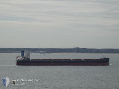
GOLDEN FURIOUS
Cargo
Current Trip
PORT KAMSAR
| Time Travelled | 2 days |
|---|---|
| Remaining Time | --- |
| Distance Travelled | 631.13 nm |
| Remaining Distance | --- |
| AVG Speed | 10.5 Knots |
| MAX Speed | 12.3 Knots |
| AVG Wind | 12.6 knots |
| MAX Wind | 18.9 knots |
| MIN Temp | 20.6°C / 69.08°F |
| MAX Temp | 25.4°C / 77.72°F |
| Draught | 8 m |
| Position Received | 7 d ago |
Current Position
| Longitude | --- |
|---|---|
| Latitude | --- |
| Status | Under way using engine |
| Speed | 14.3 Knots |
| Course | 219° |
| Area | North Atlantic Ocean |
| Station | T-AIS |
| Position Received | 7 d ago |
Information
The current position of GOLDEN FURIOUS is in North Atlantic Ocean with coordinates 26.60254° / -14.91597° as reported on 2025-02-15 14:00 by AIS to our vessel tracker app. The vessel's current speed is 14.3 Knots
The vessel GOLDEN FURIOUS (IMO: 9860128, MMSI: 538009294) is a Cargo It's sailing under the flag of [MH] Marshall Is.
In this page you can find informations about the vessels current position, last detected port calls, and current voyage information. If the vessels is not in coverage by AIS you will find the latest position.
The current position of GOLDEN FURIOUS is detected by our AIS receivers and we are not responsible for the reliability of the data. The last position was recorded while the vessel was in Coverage by the Ais receivers of our vessel tracking app.
The current draught of GOLDEN FURIOUS as reported by AIS is 8 meters
Weather
| Temperature | 21.6°C / 70.88°F |
|---|---|
| Wind Speed | 18 knots |
| Direction | 56° NE |
| Pressure | 1016.7 hPa |
| Humidity | 73.4 % |
| Cloud Coverage | --- |
Featured Company
Last Port Calls
| Port | Arrival | Departure | Time In Port |
|---|---|---|---|
| 2025-02-19 11:23 | 2025-02-21 00:35 | 1 d | |
| 2025-02-04 11:46 | 2025-02-08 19:17 | 4 d | |
| 2025-01-19 14:33 | 2025-01-21 03:55 | 1 d | |
| 2025-01-10 02:09 | 2025-01-13 23:10 | 3 d | |
| 2024-12-04 21:43 | 2024-12-06 23:10 | 2 d |
Last Trips
| Origin | Departure | Destination | Arrival | Distance | |
|---|---|---|---|---|---|
| 2025-02-08 20:17 | 2025-02-19 11:23 | 2778.27 nm | |||
| 2025-01-20 22:55 | 2025-02-04 12:46 | 3703.13 nm | |||
| 2025-01-13 18:10 | 2025-01-19 09:33 | 325.45 nm | |||
| 2024-12-06 23:10 | 2025-01-09 21:09 | 4027.72 nm | |||
| 2024-11-11 09:36 | 2024-12-04 21:43 | 4088.89 nm |
Events
| Time | Event | Details | Position / Dest | Info |
|---|---|---|---|---|
| 2025-02-21 00:35 | PORT DEPARTURE |
|
10.62627 / -14.63610
PORT KAMSAR
|
Speed: 4.4 kn Course: 198° |
| 2025-02-21 00:29 | START Moving |
10.63430 / -14.63332
[GN] KAMSAR
|
Speed: 4.4 kn Course: 198° |
|
| 2025-02-19 11:23 | STOP Moving |
10.64212 / -14.62918
[GN] KAMSAR
|
Speed: 0.3 kn Course: 197° |
|
| 2025-02-19 11:23 | PORT ARRIVAL |
|
10.64212 / -14.62918
[GN] KAMSAR
|
Speed: 0.8 kn Course: 194° |
| 2025-02-19 07:52 | START Moving | 13.81 nm, South West of KAMSAR |
10.44674 / -14.76135
PORT KAMSAR
|
Speed: 3.3 kn Course: 14° |
| 2025-02-19 04:30 | STOP Moving | 13.97 nm, South West of KAMSAR |
10.44312 / -14.76074
PORT KAMSAR
|
Speed: 0.3 kn Course: 357° |
| 2025-02-15 14:04 | Status Changed | Default Under way using engine |
26.58832 / -14.92832
PORT KAMSAR
|
Speed: 14.3 kn Course: 219° |
| 2025-02-15 14:00 | Status Changed | Under way using engine Default |
26.60254 / -14.91597
PORT KAMSAR
|
Speed: 14.1 kn Course: 218° |
| 2025-02-15 14:00 | IN Coverage |
26.60254 / -14.91597
North Atlantic Ocean
PORT KAMSAR
|
Speed: 14.3 kn Course: 219° |
|
| 2025-02-15 14:00 | OUT of Coverage |
26.60254 / -14.91597
North Atlantic Ocean
PORT KAMSAR
|
Speed: 14.3 kn Course: 219° |