
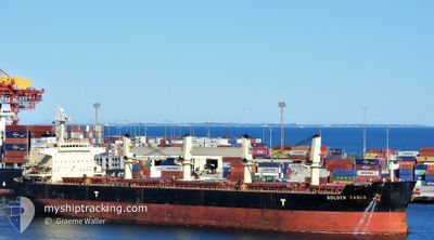
GOLDEN EAGLE
Bulk Carrier
Current Trip
| Time Travelled | 13 days |
|---|---|
| Remaining Time | --- |
| Distance Travelled | 1865.88 nm |
| Remaining Distance | --- |
| AVG Speed | 12.1 Knots |
| MAX Speed | 14.8 Knots |
| AVG Wind | 12.9 knots |
| MAX Wind | 31.9 knots |
| MIN Temp | 9.6°C / 49.28°F |
| MAX Temp | 28.2°C / 82.76°F |
| Draught | 7 m |
| Position Received | 1 m ago |
Current Position
| Longitude | -76.16579° |
|---|---|
| Latitude | 37.19248° |
| Status | At anchor |
| Speed | 0.2 Knots |
| Course | 251° |
| Area | North Atlantic Ocean |
| Station | T-AIS |
| Position Received | 1 m ago |
Info
Information
The current position of GOLDEN EAGLE is in North Atlantic Ocean with coordinates 37.19248° / -76.16579° as reported on 2024-05-01 04:33 by AIS to our vessel tracker app. The vessel's current speed is 0.2 Knots
The vessel GOLDEN EAGLE (IMO: 9418731, MMSI: 538003794) is a Bulk Carrier that was built in 2010 ( 14 years old ). It's sailing under the flag of [MH] Marshall Is.
In this page you can find informations about the vessels current position, last detected port calls, and current voyage information. If the vessels is not in coverage by AIS you will find the latest position.
The current position of GOLDEN EAGLE is detected by our AIS receivers and we are not responsible for the reliability of the data. The last position was recorded while the vessel was in Coverage by the Ais receivers of our vessel tracking app.
The current draught of GOLDEN EAGLE as reported by AIS is 7 meters
Weather
| Temperature | 20.3°C / 68.54°F |
|---|---|
| Wind Speed | 10 knots |
| Direction | 222° SW |
| Pressure | 1012.9 hPa |
| Humidity | 74.3 % |
| Cloud Coverage | 100 % |
Featured Company
Last Port Calls
| Port | Arrival | Departure | Time In Port |
|---|---|---|---|
| 2024-04-16 07:41 | 2024-04-17 12:15 | 1 d | |
| 2024-04-10 13:20 | 2024-04-12 02:16 | 1 d |
Most Visited Ports (Last year)
| Port | Arrivals | |
|---|---|---|
| 3 | ||
| 2 | ||
| 2 | ||
| 2 | ||
| 2 | ||
| 1 |
Last Trips
| Origin | Departure | Destination | Arrival | Distance | |
|---|---|---|---|---|---|
| 2024-04-11 21:16 | 2024-04-16 01:41 | 554.52 nm |
Events
| Time | Event | Details | Position / Dest | Info |
|---|---|---|---|---|
| 2024-05-01 00:09 | ETA Changed | 2025/04/23 15:00 2024/04/23 15:00 |
37.19112 / -76.16493
US ORF
|
Speed: Course: 291° |
| 2024-04-30 19:51 | Status Changed | At anchor Default |
37.19373 / -76.16663
US ORF
|
Speed: Course: 195° |
| 2024-04-30 19:48 | Status Changed | Default At anchor |
37.19368 / -76.16666
US ORF
|
Speed: Course: 193° |
| 2024-04-30 18:21 | Status Changed | At anchor Default |
37.19370 / -76.16662
US ORF
|
Speed: Course: 182° |
| 2024-04-30 18:06 | Status Changed | Default At anchor |
37.19322 / -76.16547
US ORF
|
Speed: 0.4 kn Course: 272° |
| 2024-04-30 14:27 | Status Changed | At anchor Default |
37.19025 / -76.16555
US ORF
|
Speed: Course: 319° |
| 2024-04-30 14:24 | Status Changed | Default At anchor |
37.19024 / -76.16558
US ORF
|
Speed: Course: 321° |
| 2024-04-30 11:15 | Status Changed | At anchor Default |
37.19221 / -76.16430
US ORF
|
Speed: 0.1 kn Course: 258° |
| 2024-04-30 11:12 | Status Changed | Default At anchor |
37.19225 / -76.16433
US ORF
|
Speed: Course: 253° |
| 2024-04-30 05:15 | Status Changed | At anchor Default |
37.19358 / -76.16721
US ORF
|
Speed: Course: 180° |