
GLOBAL UNITY
Cargo
Current Trip
| Time Travelled | 3 days |
|---|---|
| Remaining Time | --- |
| Distance Travelled | 304.01 nm |
| Remaining Distance | --- |
| AVG Speed | 9.6 Knots |
| MAX Speed | 12.2 Knots |
| AVG Wind | 5 knots |
| MAX Wind | 14 knots |
| MIN Temp | 7.5°C / 45.5°F |
| MAX Temp | 13.9°C / 57.02°F |
| Draught | 11.5 m |
| Position Received | 2 m ago |
Current Position
| Longitude | --- |
|---|---|
| Latitude | --- |
| Status | Under way using engine |
| Speed | 12.1 Knots |
| Course | 225.9° |
| Area | Sea of Marmara |
| Station | T-AIS |
| Position Received | 2 m ago |
Info
Information
The current position of GLOBAL UNITY is in Sea of Marmara with coordinates 40.09362° / 26.32234° as reported on 2025-12-20 20:47 by AIS to our vessel tracker app. The vessel's current speed is 12.1 Knots and is heading at the port of DAMIETTA. The estimated time of arrival as calculated by MyShipTracking vessel tracking app is 2025-12-23 11:00 LT
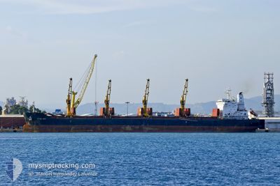
The vessel GLOBAL UNITY (IMO: 9665542, MMSI: 538005566) is a Cargo It's sailing under the flag of [MH] Marshall Is.
In this page you can find informations about the vessels current position, last detected port calls, and current voyage information. If the vessels is not in coverage by AIS you will find the latest position.
The current position of GLOBAL UNITY is detected by our AIS receivers and we are not responsible for the reliability of the data. The last position was recorded while the vessel was in Coverage by the Ais receivers of our vessel tracking app.
The current draught of GLOBAL UNITY as reported by AIS is 11.5 meters
Weather
| Temperature | 10.8°C / 51.44°F |
|---|---|
| Wind Speed | 9 knots |
| Direction | 42° NE |
| Pressure | 1016.8 hPa |
| Humidity | 80.8 % |
| Cloud Coverage | 100 % |
Featured Company
Last Port Calls
| Port | Arrival | Departure | Time In Port |
|---|---|---|---|
| 2025-12-09 22:45 | 2025-12-17 21:03 | 7 d | |
| 2025-11-22 11:25 | 2025-11-29 20:39 | 7 d | |
| 2025-11-20 11:52 | 2025-11-20 21:23 | 9 h | |
| 2025-11-03 01:59 | 2025-11-07 22:28 | 4 d | |
| 2025-10-08 06:48 | 2025-10-08 15:33 | 8 h | |
| 2025-10-02 14:56 |
Most Visited Ports (Last year)
| Port | Arrivals | |
|---|---|---|
| 3 | ||
| 2 | ||
| 2 | ||
| 1 | ||
| 1 | ||
| 1 |
Last Trips
| Origin | Departure | Destination | Arrival | Distance | |
|---|---|---|---|---|---|
| 2025-11-29 20:39 | 2025-12-09 22:45 | 1198.17 nm | |||
| 2025-11-07 22:28 | 2025-11-22 11:25 | 3553.26 nm | |||
| 2025-11-07 22:28 | 2025-11-20 11:52 | 3085.47 nm | |||
| 2025-10-02 14:56 | 2025-11-03 01:59 | 4849.55 nm | |||
| 2025-10-02 14:56 | 2025-10-08 06:48 | 1028.43 nm |
Events
| Time | Event | Details | Position / Dest | Info |
|---|---|---|---|---|
| 2025-12-20 20:07 | ETA Changed | 2025/12/23 09:00 2025/12/23 04:00 |
40.19936 / 26.38314
EGDAM
|
Speed: 10.9 kn Course: 217° |
| 2025-12-20 18:44 | Status Changed | Under way using engine Default |
40.36380 / 26.65241
EGDAM
|
Speed: 10.4 kn Course: 213° |
| 2025-12-20 18:29 | IN Coverage |
40.36245 / 26.65122
Sea of Marmara
EGDAM
|
Speed: 11.7 kn Course: 213.9° |
|
| 2025-12-20 15:24 | START Moving | 4.64 nm, South West of SARKOY |
40.54715 / 27.04977
EGDAM
|
Speed: 7.1 kn Course: 244° |
| 2025-12-20 15:16 | STOP Moving | 3.6 nm, South West of SARKOY |
40.55605 / 27.07344
EGDAM
|
Speed: Course: 0° |
| 2025-12-20 12:50 | Status Changed | Default Under way using engine |
40.72656 / 27.52045
EGDAM
|
Speed: 11.9 kn Course: 240.9° |
| 2025-12-20 12:46 | OUT of Coverage |
40.73321 / 27.53630
Sea of Marmara
EGDAM
|
Speed: 11.9 kn Course: 240.9° |
|
| 2025-12-20 07:18 | START Moving | 1.26 nm, South West of BAKIRKOY |
40.95504 / 28.86509
EGDAM
|
Speed: 3.3 kn Course: 326° |
| 2025-12-20 07:12 | Status Changed | Under way using engine At anchor |
40.95239 / 28.86414
EGDAM
|
Speed: 0.2 kn Course: 27° |
| 2025-12-20 06:52 | Destination Changed | EGDAM TURKELI |
40.95251 / 28.86279
EGDAM
|
Speed: 0.2 kn Course: 50° |