
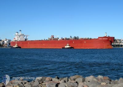
GLOBAL COMMANDER
Cargo
Current Trip
| Trip Time | 20 days |
|---|---|
| Trip Distance | 3904.84 nm |
| AVG Speed | 9.8 Knots |
| MAX Speed | 15.2 Knots |
| Draught | 16 m |
| AVG Wind | 13.1 knots |
| MAX Wind | 36 knots |
| MIN Temp | 5.5°C / 41.9°F |
| MAX Temp | 30.4°C / 86.72°F |
| Position Received | 2 d ago |
Current Position
| Longitude | --- |
|---|---|
| Latitude | --- |
| Status | Under way using engine |
| Speed | 11.7 Knots |
| Course | 241.1° |
| Area | Inland Sea |
| Station | T-AIS |
| Position Received | 2 d ago |
Info
Information
The current position of GLOBAL COMMANDER is in Inland Sea with coordinates 34.43626° / 134.03138° as reported on 2024-12-21 01:44 by AIS to our vessel tracker app. The vessel's current speed is 11.7 Knots and is currently inside the port of FUKUYAMA.
The vessel GLOBAL COMMANDER (IMO: 9531844, MMSI: 311039100) is a Cargo It's sailing under the flag of [BS] Bahamas.
In this page you can find informations about the vessels current position, last detected port calls, and current voyage information. If the vessels is not in coverage by AIS you will find the latest position.
The current position of GLOBAL COMMANDER is detected by our AIS receivers and we are not responsible for the reliability of the data. The last position was recorded while the vessel was in Coverage by the Ais receivers of our vessel tracking app.
The current draught of GLOBAL COMMANDER as reported by AIS is 16 meters
Weather
| Temperature | 9.8°C / 49.64°F |
|---|---|
| Wind Speed | 10 knots |
| Direction | 258° WSW |
| Pressure | 1020.5 hPa |
| Humidity | 41.8 % |
| Cloud Coverage | 29 % |
Featured Company
Last Port Calls
| Port | Arrival | Departure | Time In Port |
|---|---|---|---|
| 2024-12-22 04:36 | |||
| 2024-11-29 05:12 | 2024-12-02 03:38 | 2 d | |
| 2024-11-15 02:32 | 2024-11-17 00:38 | 1 d | |
| 2024-11-09 22:08 | 2024-11-12 03:56 | 2 d | |
| 2024-10-22 07:13 | 2024-10-25 19:09 | 3 d | |
| 2024-10-01 23:49 | 2024-10-04 07:44 | 2 d |
Most Visited Ports (Last year)
| Port | Arrivals | |
|---|---|---|
| 5 | ||
| 4 | ||
| 2 | ||
| 2 | ||
| 2 | ||
| 1 |
Last Trips
| Origin | Departure | Destination | Arrival | Distance | |
|---|---|---|---|---|---|
| 2024-12-02 11:38 | 2024-12-22 13:36 | 3904.84 nm | |||
| 2024-11-17 09:38 | 2024-11-29 13:12 | 3553.21 nm | |||
| 2024-11-12 12:56 | 2024-11-15 11:32 | 388.34 nm | |||
| 2024-10-26 03:09 | 2024-11-10 07:08 | 3421.77 nm | |||
| 2024-10-04 15:44 | 2024-10-22 15:13 | 3859.42 nm | |||
| 2024-09-11 13:22 | 2024-10-02 07:49 | 3816.79 nm |
Events
| Time | Event | Details | Position / Dest | Info |
|---|---|---|---|---|
| 2024-12-22 05:13 | STOP Moving |
34.45854 / 133.44658
[JP] FUKUYAMA
|
Speed: 0.3 kn Course: 4° |
|
| 2024-12-22 04:36 | PORT ARRIVAL |
|
34.43006 / 133.44737
[JP] FUKUYAMA
|
Speed: 6.8 kn Course: 1° |
| 2024-12-22 04:13 | START Moving | 2.62 nm, South of FUKUYAMA |
34.38495 / 133.44485
JP FKY
|
Speed: 6.2 kn Course: 12° |
| 2024-12-21 06:11 | STOP Moving | 3.1 nm, East of TOMONOURA |
34.37297 / 133.44199
JP FKY
|
Speed: 0.2 kn Course: 247° |
| 2024-12-21 01:49 | Status Changed | Default Under way using engine |
34.42802 / 134.01312
JP FKY
|
Speed: 11.7 kn Course: 241.1° |
| 2024-12-21 01:44 | OUT of Coverage |
34.43626 / 134.03138
Inland Sea
|
Speed: 11.7 kn Course: 241.1° |
|
| 2024-12-21 01:43 | Status Changed | Under way using engine Default |
34.43750 / 134.03423
JP FKY
|
Speed: 11.5 kn Course: 242° |
| 2024-12-21 01:09 | Status Changed | Default Under way using engine |
34.42484 / 134.16594
JP FKY
|
Speed: 12 kn Course: 294.2° |
| 2024-12-21 00:49 | Status Changed | Under way using engine Default |
34.40359 / 134.24078
JP FKY
|
Speed: 12.8 kn Course: 269° |
| 2024-12-21 00:37 | Status Changed | Default Under way using engine |
34.40445 / 134.29349
JP FKY
|
Speed: 11.9 kn Course: 267.8° |