
GLEN GRANT
Cargo
Current Trip
| Time Travelled | 36 days |
|---|---|
| Remaining Time | 2 days |
| Distance Travelled | 8945.12 nm |
| Remaining Distance | 1288.41 nm |
| AVG Speed | 11.1 Knots |
| MAX Speed | 14.6 Knots |
| AVG Wind | 13.1 knots |
| MAX Wind | 24.9 knots |
| MIN Temp | 15.9°C / 60.62°F |
| MAX Temp | 30.8°C / 87.44°F |
| Draught | 8.5 m |
| Position Received | 2 d ago |
Current Position
| Longitude | 104.33853° |
|---|---|
| Latitude | 1.29483° |
| Status | Under way using engine |
| Speed | 11.6 Knots |
| Course | 55.4° |
| Area | Singapore Strait |
| Station | T-AIS |
| Position Received | 2 d ago |
Info
Information
The current position of GLEN GRANT is in Singapore Strait with coordinates 1.29483° / 104.33853° as reported on 2024-06-01 12:40 by AIS to our vessel tracker app. The vessel's current speed is 11.6 Knots and is heading at the port of ZHANJIANG. The estimated time of arrival as calculated by MyShipTracking vessel tracking app is 2024-06-06 03:48 LT
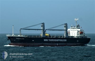
The vessel GLEN GRANT (IMO: 9699957, MMSI: 636021034) is a Cargo It's sailing under the flag of [LR] Liberia.
In this page you can find informations about the vessels current position, last detected port calls, and current voyage information. If the vessels is not in coverage by AIS you will find the latest position.
The current position of GLEN GRANT is detected by our AIS receivers and we are not responsible for the reliability of the data. The last position was recorded while the vessel was in Coverage by the Ais receivers of our vessel tracking app.
The current draught of GLEN GRANT as reported by AIS is 8.5 meters
Weather
| Temperature | 30.5°C / 86.9°F |
|---|---|
| Wind Speed | 15 knots |
| Direction | 223° SW |
| Pressure | 1008.2 hPa |
| Humidity | 76 % |
| Cloud Coverage | 100 % |
Featured Company
Last Port Calls
| Port | Arrival | Departure | Time In Port |
|---|---|---|---|
| 2024-04-24 23:09 | 2024-04-28 12:29 | 3 d | |
| 2024-04-13 08:50 | 2024-04-17 15:58 | 4 d | |
| 2024-04-02 19:07 | 2024-04-05 12:07 | 2 d |
Most Visited Ports (Last year)
| Port | Arrivals | |
|---|---|---|
| 2 | ||
| 1 | ||
| 1 | ||
| 1 | ||
| 1 | ||
| 1 |
Last Trips
| Origin | Departure | Destination | Arrival | Distance | |
|---|---|---|---|---|---|
| 2024-04-17 12:58 | 2024-04-24 20:09 | 1304.70 nm | |||
| 2024-04-05 09:07 | 2024-04-13 05:50 | 1926.75 nm | |||
| 2024-02-15 20:51 | 2024-04-02 16:07 | 8237.56 nm |
Events
| Time | Event | Details | Position / Dest | Info |
|---|---|---|---|---|
| 2024-06-01 12:46 | Status Changed | Default Under way using engine |
1.30730 / 104.35204
CN ZHA
|
Speed: 11.6 kn Course: 55.4° |
| 2024-06-01 12:40 | OUT of Coverage |
1.29483 / 104.33853
Singapore Strait
CN ZHA
|
Speed: 11.6 kn Course: 55.4° |
|
| 2024-06-01 11:41 | Change Sea Area | Malaysian part of the Singapore Strait Indonesian part of the Singapore Strait |
1.25945 / 104.14982
Singapore Strait
CN ZHA
|
Speed: 11.9 kn Course: 81° |
| 2024-06-01 10:26 | Draught Changed | 8.5 7.8 |
1.21562 / 103.91964
CN ZHA
|
Speed: 9.5 kn Course: 71.7° |
| 2024-06-01 10:26 | Destination Changed | CN ZHA SG SIN |
1.21562 / 103.91964
CN ZHA
|
Speed: 9.5 kn Course: 71.7° |
| 2024-06-01 10:26 | ETA Changed | 2024/06/06 22:00 2024/06/01 03:30 |
1.21562 / 103.91964
CN ZHA
|
Speed: 9.5 kn Course: 71.7° |
| 2024-06-01 10:20 | Change Sea Area | Indonesian part of the Singapore Strait Singaporean part of the Singapore Strait |
1.21374 / 103.90481
Singapore Strait
|
Speed: 8.9 kn Course: 116.2° |
| 2024-06-01 09:46 | START Moving | 2.13 nm, North East of SINGAPORE |
1.27371 / 103.88627
SG SIN
|
Speed: 3.1 kn Course: 172° |
| 2024-05-31 20:36 | STOP Moving | 2.23 nm, North East of SINGAPORE |
1.27556 / 103.88717
SG SIN
|
Speed: 0.3 kn Course: 226° |
| 2024-05-31 19:54 | START Moving | 5.32 nm, South West of TANAH MERAH |
1.25745 / 103.94806
SG SIN
|
Speed: 3.3 kn Course: 278° |