
GISELE A
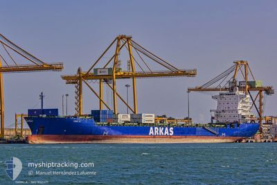
Container Ship
Current Trip
| Time Travelled | 16 h, 20 mins |
|---|---|
| Remaining Time | --- |
| Distance Travelled | 57.88 nm |
| Remaining Distance | --- |
| AVG Speed | 8.1 Knots |
| MAX Speed | 12.6 Knots |
| AVG Wind | 11.6 knots |
| MAX Wind | 27.7 knots |
| MIN Temp | 8.9°C / 48.02°F |
| MAX Temp | 12°C / 53.6°F |
| Draught | 9.3 m |
| Position Received | 1 m ago |
Current Position
| Longitude | --- |
|---|---|
| Latitude | --- |
| Status | Under way using engine |
| Speed | 0.3 Knots |
| Course | 40° |
| Area | Sea of Marmara |
| Station | T-AIS |
| Position Received | 1 m ago |
Info
Information
The current position of GISELE A is in Sea of Marmara with coordinates 40.74995° / 28.99126° as reported on 2024-11-22 06:46 by AIS to our vessel tracker app. The vessel's current speed is 0.3 Knots
The vessel GISELE A (IMO: 9321471, MMSI: 256475000) is a Container Ship that was built in 2006 ( 18 years old ). It's sailing under the flag of [MT] Malta.
In this page you can find informations about the vessels current position, last detected port calls, and current voyage information. If the vessels is not in coverage by AIS you will find the latest position.
The current position of GISELE A is detected by our AIS receivers and we are not responsible for the reliability of the data. The last position was recorded while the vessel was in Coverage by the Ais receivers of our vessel tracking app.
The current draught of GISELE A as reported by AIS is 9.3 meters
Weather
| Temperature | 11.7°C / 53.06°F |
|---|---|
| Wind Speed | 2 knots |
| Direction | 117° ESE |
| Pressure | 1013.6 hPa |
| Humidity | 68.8 % |
| Cloud Coverage | 11 % |
Featured Company
Last Port Calls
| Port | Arrival | Departure | Time In Port |
|---|---|---|---|
| 2024-11-21 01:10 | 2024-11-21 14:27 | 13 h | |
| 2024-11-18 09:42 | 2024-11-19 13:35 | 1 d | |
| 2024-11-14 18:04 | 2024-11-15 02:01 | 7 h | |
| 2024-11-11 13:02 | 2024-11-12 18:57 | 1 d | |
| 2024-11-03 12:24 | 2024-11-04 07:19 | 18 h | |
| 2024-11-02 19:16 | 2024-11-03 08:19 | 13 h | |
| 2024-11-02 01:00 | 2024-11-02 19:06 | 18 h | |
| 2024-10-29 15:36 | 2024-10-30 04:40 | 13 h | |
| 2024-10-27 18:25 | 2024-10-29 06:48 | 1 d | |
| 2024-10-17 08:26 | 2024-10-17 22:44 | 14 h |
Last Trips
| Origin | Departure | Destination | Arrival | Distance | |
|---|---|---|---|---|---|
| 2024-11-19 15:35 | 2024-11-21 04:10 | 374.14 nm | |||
| 2024-11-15 03:01 | 2024-11-18 11:42 | 1186.28 nm | |||
| 2024-11-12 19:57 | 2024-11-14 19:04 | 724.20 nm | |||
| 2024-11-04 10:19 | 2024-11-11 14:02 | 2067.96 nm | |||
| 2024-11-03 11:19 | 2024-11-03 15:24 | 45.62 nm | |||
| 2024-11-02 22:06 | 2024-11-02 22:16 | 0.39 nm | |||
| 2024-10-30 06:40 | 2024-11-02 04:00 | 233.97 nm | |||
| 2024-10-29 08:48 | 2024-10-29 17:36 | 134.42 nm | |||
| 2024-10-18 01:44 | 2024-10-27 20:25 | 314.16 nm | |||
| 2024-10-17 07:23 | 2024-10-17 11:26 | 16.14 nm |
Events
| Time | Event | Details | Position / Dest | Info |
|---|---|---|---|---|
| 2024-11-22 06:06 | STOP Moving | 11.98 nm, South West of MALTEPE |
40.74553 / 28.99017
TRYAR
|
Speed: 0.3 kn Course: 53° |
| 2024-11-21 16:46 | Status Changed | Under way using engine Default |
40.54274 / 28.72765
TRYAR
|
Speed: 9.5 kn Course: 23° |
| 2024-11-21 16:44 | Status Changed | Default Under way using engine |
40.53945 / 28.72574
TRYAR
|
Speed: 8.7 kn Course: 12.4° |
| 2024-11-21 16:35 | Status Changed | Under way using engine Default |
40.51622 / 28.71848
TRYAR
|
Speed: 7.9 kn Course: 6° |
| 2024-11-21 16:26 | Status Changed | Default Under way using engine |
40.49733 / 28.71488
TRYAR
|
Speed: 8 kn Course: 343.4° |
| 2024-11-21 16:20 | Status Changed | Under way using engine Default |
40.48520 / 28.71874
TRYAR
|
Speed: 9.4 kn Course: 312° |
| 2024-11-21 15:57 | Status Changed | Default Under way using engine |
40.45042 / 28.78986
TRYAR
|
Speed: 10 kn Course: 285.7° |
| 2024-11-21 15:50 | Status Changed | Under way using engine Default |
40.44251 / 28.81265
TRYAR
|
Speed: 10.2 kn Course: 279° |
| 2024-11-21 15:44 | Status Changed | Default Under way using engine |
40.43995 / 28.83145
TRYAR
|
Speed: 10 kn Course: 278.7° |
| 2024-11-21 15:33 | Status Changed | Under way using engine Default |
40.43482 / 28.87190
TRYAR
|
Speed: 9.9 kn Course: 279° |