

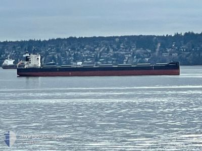
GIRASOLE RIVER
Cargo

Current Trip
| Time Travelled | 8 days |
|---|---|
| Remaining Time | --- |
| Distance Travelled | 1594.61 nm |
| Remaining Distance | --- |
| AVG Speed | 9 Knots |
| MAX Speed | 13.2 Knots |
| AVG Wind | 15.8 knots |
| MAX Wind | 27.2 knots |
| MIN Temp | 12.3°C / 54.14°F |
| MAX Temp | 24.8°C / 76.64°F |
| Draught | 13 m |
| Position Received | 1 d ago |
Current Position
| Longitude | --- |
|---|---|
| Latitude | --- |
| Status | Under way using engine |
| Speed | 10 Knots |
| Course | 21.7° |
| Area | North Atlantic Ocean |
| Station | T-AIS |
| Position Received | 1 d ago |
Information
The current position of GIRASOLE RIVER is in North Atlantic Ocean with coordinates 28.66996° / -14.98913° as reported on 2025-03-28 01:21 by AIS to our vessel tracker app. The vessel's current speed is 10 Knots and is heading at the port of SAN CIPRIAN. The estimated time of arrival as calculated by MyShipTracking vessel tracking app is 2025-04-01 09:00 LT
The vessel GIRASOLE RIVER (IMO: 9882322, MMSI: 356066000) is a Cargo It's sailing under the flag of [PA] Panama.
In this page you can find informations about the vessels current position, last detected port calls, and current voyage information. If the vessels is not in coverage by AIS you will find the latest position.
The current position of GIRASOLE RIVER is detected by our AIS receivers and we are not responsible for the reliability of the data. The last position was recorded while the vessel was in Coverage by the Ais receivers of our vessel tracking app.
The current draught of GIRASOLE RIVER as reported by AIS is 13 meters
Weather
| Temperature | 17.3°C / 63.14°F |
|---|---|
| Wind Speed | 26 knots |
| Direction | 74° ENE |
| Pressure | 1014.6 hPa |
| Humidity | 78.4 % |
| Cloud Coverage | 1 % |


Featured Company
Most Visited Ports (Last year)
| Port | Arrivals | |
|---|---|---|
| 2 | ||
| 2 | ||
| 2 | ||
| 1 | ||
| 1 | ||
| 1 |
Events
| Time | Event | Details | Position / Dest | Info |
|---|---|---|---|---|
| 2025-03-28 01:30 | Status Changed | Default Under way using engine |
28.69362 / -14.97788
ES SCI
|
Speed: 10 kn Course: 21.7° |
| 2025-03-28 01:21 | OUT of Coverage |
28.66996 / -14.98913
North Atlantic Ocean
ES SCI
|
Speed: 10 kn Course: 21.7° |
|
| 2025-03-27 21:29 | Destination Changed | ES SCI ES LPA |
28.10468 / -15.34302
ES SCI
|
Speed: 9.4 kn Course: 46.8° |
| 2025-03-27 21:29 | ETA Changed | 2025/04/01 07:00 2025/03/26 16:00 |
28.10468 / -15.34302
ES SCI
|
Speed: 9.4 kn Course: 46.8° |
| 2025-03-27 21:14 | START Moving | 3.52 nm, South East of LAS PALMAS |
28.08291 / -15.37182
ES LPA
|
Speed: 4.4 kn Course: 50° |
| 2025-03-27 20:58 | Status Changed | Under way using engine Default |
28.07994 / -15.37603
ES LPA
|
Speed: Course: 0° |
| 2025-03-27 20:57 | Status Changed | Default Under way using engine |
28.07990 / -15.37613
ES LPA
|
Speed: 0.3 kn Course: 30° |
| 2025-03-27 20:49 | Status Changed | Under way using engine Default |
28.07932 / -15.37672
ES LPA
|
Speed: 0.4 kn Course: 24° |
| 2025-03-27 20:48 | Status Changed | Default Under way using engine |
28.07920 / -15.37672
ES LPA
|
Speed: 0.4 kn Course: 24° |
| 2025-03-27 20:47 | Status Changed | Under way using engine Default |
28.07916 / -15.37673
ES LPA
|
Speed: 0.3 kn Course: 13° |