

GHINAH
Tanker

Current Trip
JRT KSA
| Time Travelled | 32 days |
|---|---|
| Remaining Time | --- |
| Distance Travelled | 6546.33 nm |
| Remaining Distance | --- |
| AVG Speed | 10.9 Knots |
| MAX Speed | 16 Knots |
| AVG Wind | 10.4 knots |
| MAX Wind | 25 knots |
| MIN Temp | 16.7°C / 62.06°F |
| MAX Temp | 29.7°C / 85.46°F |
| Draught | 10.8 m |
| Position Received | 2 d ago |
Current Position
| Longitude | --- |
|---|---|
| Latitude | --- |
| Status | Under way using engine |
| Speed | 12 Knots |
| Course | 303.7° |
| Area | Laccadive Sea |
| Station | T-AIS |
| Position Received | 2 d ago |
Information
The current position of GHINAH is in Laccadive Sea with coordinates 7.37366° / 76.29029° as reported on 2025-02-17 21:57 by AIS to our vessel tracker app. The vessel's current speed is 12 Knots
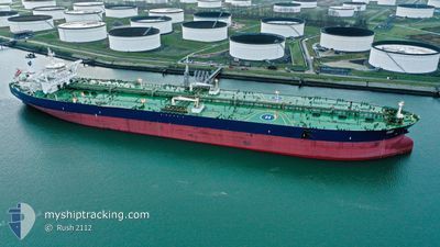
The vessel GHINAH (IMO: 9484728, MMSI: 403638000) is a Tanker It's sailing under the flag of [SA] Saudi Arabia.
In this page you can find informations about the vessels current position, last detected port calls, and current voyage information. If the vessels is not in coverage by AIS you will find the latest position.
The current position of GHINAH is detected by our AIS receivers and we are not responsible for the reliability of the data. The last position was recorded while the vessel was in Coverage by the Ais receivers of our vessel tracking app.
The current draught of GHINAH as reported by AIS is 10.8 meters
Weather
| Temperature | 26.4°C / 79.52°F |
|---|---|
| Wind Speed | 11 knots |
| Direction | 48° NE |
| Pressure | 1014.7 hPa |
| Humidity | 67.9 % |
| Cloud Coverage | 1 % |


Featured Company
Last Port Calls
| Port | Arrival | Departure | Time In Port |
|---|---|---|---|
| 2025-01-18 14:40 | 2025-01-19 12:26 | 21 h |
Most Visited Ports (Last year)
| Port | Arrivals | |
|---|---|---|
| 3 | ||
| 1 | ||
| 1 |
Last Trips
| Origin | Departure | Destination | Arrival | Distance | |
|---|---|---|---|---|---|
| 2024-11-05 10:00 | 2025-01-18 17:40 | 4020.62 nm |
Events
| Time | Event | Details | Position / Dest | Info |
|---|---|---|---|---|
| 2025-02-17 22:07 | Status Changed | Default Under way using engine |
7.38782 / 76.26029
JRT KSA
|
Speed: 12 kn Course: 303.7° |
| 2025-02-17 21:57 | OUT of Coverage |
7.37366 / 76.29029
Laccadive Sea
JRT KSA
|
Speed: 12 kn Course: 303.7° |
|
| 2025-02-17 21:26 | Status Changed | Under way using engine Default |
7.30060 / 76.36683
JRT KSA
|
Speed: 12.1 kn Course: 305° |
| 2025-02-17 21:09 | Status Changed | Default Under way using engine |
7.26612 / 76.41232
JRT KSA
|
Speed: 12.2 kn Course: 305.7° |
| 2025-02-17 21:02 | Status Changed | Under way using engine Default |
7.25294 / 76.43035
JRT KSA
|
Speed: 11.8 kn Course: 298° |
| 2025-02-17 20:37 | Status Changed | Default Under way using engine |
7.21096 / 76.50265
JRT KSA
|
Speed: 11.8 kn Course: 297.3° |
| 2025-02-17 13:49 | Status Changed | Under way using engine Default |
6.58964 / 77.68444
JRT KSA
|
Speed: 11.4 kn Course: 297° |
| 2025-02-17 13:38 | Status Changed | Default Under way using engine |
6.57265 / 77.71664
JRT KSA
|
Speed: 11.4 kn Course: 296.4° |
| 2025-02-17 13:36 | Detected in Sea | Indian part of the Laccadive Sea |
6.57001 / 77.72169
Laccadive Sea
JRT KSA
|
Speed: 11.4 kn Course: 296.4° |
| 2025-02-17 13:35 | Status Changed | Under way using engine Default |
6.56851 / 77.72454
JRT KSA
|
Speed: 11.3 kn Course: 299° |