

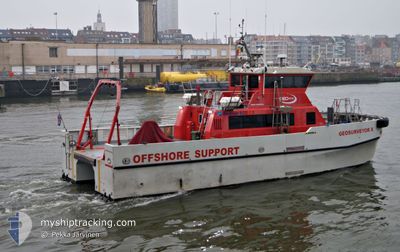
GEOSURVEYOR X
High speed craft

Current Trip
KERTEMINDE
| Time Travelled | 1 day |
|---|---|
| Remaining Time | --- |
| Distance Travelled | 149.59 nm |
| Remaining Distance | --- |
| AVG Speed | 8.9 Knots |
| MAX Speed | 16 Knots |
| AVG Wind | 7.1 knots |
| MAX Wind | 10.7 knots |
| MIN Temp | 5.7°C / 42.26°F |
| MAX Temp | 16.2°C / 61.16°F |
| Draught | 1.5 m |
| Position Received | 3 m ago |
Current Position
| Longitude | --- |
|---|---|
| Latitude | --- |
| Status | Moored |
| Speed | |
| Course | 78° |
| Area | Kattegat |
| Station | T-AIS |
| Position Received | 3 m ago |
Information
The current position of GEOSURVEYOR X is in Kattegat with coordinates 55.45005° / 10.66473° as reported on 2025-03-09 22:22 by AIS to our vessel tracker app. The vessel's current speed is 0 Knots
The vessel GEOSURVEYOR X (MMSI: 253113000) is a High speed craft It's sailing under the flag of [LU] Luxembourg.
In this page you can find informations about the vessels current position, last detected port calls, and current voyage information. If the vessels is not in coverage by AIS you will find the latest position.
The current position of GEOSURVEYOR X is detected by our AIS receivers and we are not responsible for the reliability of the data. The last position was recorded while the vessel was in Coverage by the Ais receivers of our vessel tracking app.
The current draught of GEOSURVEYOR X as reported by AIS is 1.5 meters
Weather
| Temperature | 5.4°C / 41.72°F |
|---|---|
| Wind Speed | 10 knots |
| Direction | 51° NE |
| Pressure | 1005.6 hPa |
| Humidity | 81.4 % |
| Cloud Coverage | 78 % |


Featured Company
Last Port Calls
| Port | Arrival | Departure | Time In Port |
|---|---|---|---|
| 2025-03-08 04:34 | 2025-03-08 07:32 | 2 h | |
| 2025-02-12 18:14 | 2025-03-07 06:22 | 22 d | |
| 2025-02-12 07:19 | 2025-02-12 11:36 | 4 h |
Most Visited Ports (Last year)
| Port | Arrivals | |
|---|---|---|
| 43 | ||
| 2 | ||
| 1 | ||
| 1 | ||
| 1 |
Last Trips
| Origin | Departure | Destination | Arrival | Distance | |
|---|---|---|---|---|---|
| 2025-03-07 07:22 | 2025-03-08 05:34 | 296.86 nm | |||
| 2025-02-12 12:36 | 2025-02-12 19:14 | 81.63 nm | |||
| 2024-12-14 14:07 | 2025-02-12 08:19 | 0.83 nm |
Events
| Time | Event | Details | Position / Dest | Info |
|---|---|---|---|---|
| 2025-03-09 17:34 | Status Changed | Moored Default |
55.45004 / 10.66476
KERTEMINDE
|
Speed: Course: 81° |
| 2025-03-09 17:31 | Status Changed | Default Moored |
55.45003 / 10.66475
KERTEMINDE
|
Speed: Course: 81° |
| 2025-03-09 11:01 | Status Changed | Moored Default |
55.45004 / 10.66474
KERTEMINDE
|
Speed: Course: 80° |
| 2025-03-09 10:55 | Status Changed | Default Moored |
55.45005 / 10.66474
KERTEMINDE
|
Speed: Course: 80° |
| 2025-03-09 07:10 | Status Changed | Moored Default |
55.45001 / 10.66474
KERTEMINDE
|
Speed: Course: 78° |
| 2025-03-09 07:07 | Status Changed | Default Moored |
55.45004 / 10.66475
KERTEMINDE
|
Speed: Course: 78° |
| 2025-03-09 00:37 | Status Changed | Moored Under way using engine |
55.45005 / 10.66474
KERTEMINDE
|
Speed: Course: 79° |
| 2025-03-09 00:21 | STOP Moving | 4.62 nm, East of LINDOE |
55.45012 / 10.66471
KERTEMINDE
|
Speed: 0.2 kn Course: 130° |
| 2025-03-08 20:52 | Change Sea Area | Danish part of the Kattegat Danish part of the Baltic Sea |
54.73842 / 10.76479
Kattegat
|
Speed: 14.4 kn Course: 5.8° |
| 2025-03-08 20:01 | Change Sea Area | Danish part of the Baltic Sea German part of the Baltic Sea |
54.59281 / 10.52256
Baltic Sea
|
Speed: 15.1 kn Course: 46.6° |