
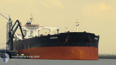
GEORGIOS
Crude Oil Tanker
Current Trip
| Time Travelled | --- |
|---|---|
| Remaining Time | 1 day |
| Distance Travelled | 5136.17 nm |
| Remaining Distance | 744.75 nm |
| AVG Speed | 10.6 Knots |
| MAX Speed | 16.4 Knots |
| AVG Wind | 7.8 knots |
| MAX Wind | 27 knots |
| MIN Temp | 15.4°C / 59.72°F |
| MAX Temp | 32.2°C / 89.96°F |
| Draught | 11 m |
| Position Received | 2 d ago |
Current Position
| Longitude | --- |
|---|---|
| Latitude | --- |
| Status | Under way using engine |
| Speed | 14.5 Knots |
| Course | 312.8° |
| Area | Laccadive Sea |
| Station | T-AIS |
| Position Received | 2 d ago |
Info
Information
The current position of GEORGIOS is in Laccadive Sea with coordinates 8.02496° / 75.83719° as reported on 2025-02-27 14:04 by AIS to our vessel tracker app. The vessel's current speed is 14.5 Knots and is heading at the port of FUJAIRAH. The estimated time of arrival as calculated by MyShipTracking vessel tracking app is 2025-03-04 03:43 LT
The vessel GEORGIOS (IMO: 9389033, MMSI: 636013383) is a Crude Oil Tanker that was built in 2009 ( 16 years old ). It's sailing under the flag of [LR] Liberia.
In this page you can find informations about the vessels current position, last detected port calls, and current voyage information. If the vessels is not in coverage by AIS you will find the latest position.
The current position of GEORGIOS is detected by our AIS receivers and we are not responsible for the reliability of the data. The last position was recorded while the vessel was in Coverage by the Ais receivers of our vessel tracking app.
The current draught of GEORGIOS as reported by AIS is 11 meters
Weather
| Temperature | 25.8°C / 78.44°F |
|---|---|
| Wind Speed | 10 knots |
| Direction | 15° NNE |
| Pressure | 1012.4 hPa |
| Humidity | 63.6 % |
| Cloud Coverage | 95 % |
Featured Company
Last Port Calls
Most Visited Ports (Last year)
| Port | Arrivals | |
|---|---|---|
| 1 | ||
| 1 | ||
| 1 |
Last Trips
| Origin | Departure | Destination | Arrival | Distance |
|---|
Events
| Time | Event | Details | Position / Dest | Info |
|---|---|---|---|---|
| 2025-02-27 14:09 | Status Changed | Default Under way using engine |
8.03847 / 75.82266
AEFJR
|
Speed: 14.5 kn Course: 312.8° |
| 2025-02-27 14:04 | OUT of Coverage |
8.02496 / 75.83719
Laccadive Sea
AEFJR
|
Speed: 14.5 kn Course: 312.8° |
|
| 2025-02-27 14:01 | Detected in Sea | Indian part of the Laccadive Sea |
8.01627 / 75.84682
Laccadive Sea
AEFJR
|
Speed: 14.5 kn Course: 311.1° |
| 2025-02-27 14:00 | Status Changed | Under way using engine Default |
8.01254 / 75.85111
AEFJR
|
Speed: 14.7 kn Course: 312° |
| 2025-02-27 13:54 | IN Coverage |
8.01627 / 75.84682
Laccadive Sea
AEFJR
|
Speed: 14.5 kn Course: 311.1° |
|
| 2025-02-22 05:33 | Status Changed | Default Under way using engine |
1.27288 / 103.36652
AEFJR
|
Speed: 14.9 kn Course: 307.3° |
| 2025-02-22 05:26 | OUT of Coverage |
1.25520 / 103.38993
Malacca Strait
AEFJR
|
Speed: 14.9 kn Course: 307.3° |
|
| 2025-02-22 05:23 | Status Changed | Under way using engine Default |
1.24838 / 103.39920
AEFJR
|
Speed: 14.8 kn Course: 290° |
| 2025-02-22 05:17 | Status Changed | Default Under way using engine |
1.23927 / 103.42115
AEFJR
|
Speed: 14.5 kn Course: 282.6° |
| 2025-02-22 05:07 | Change Sea Area | Malaysian part of the Malacca Strait Malaysian part of the Singapore Strait |
1.22890 / 103.46350
Malacca Strait
AEFJR
|
Speed: 14.4 kn Course: 282.1° |