
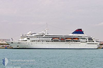
GEMINI
Passengers Ship
Current Trip
GRPIR
| Time Travelled | 91 days |
|---|---|
| Remaining Time | --- |
| Distance Travelled | 18.57 nm |
| Remaining Distance | --- |
| AVG Speed | --- |
| MAX Speed | --- |
| AVG Wind | 7.3 knots |
| MAX Wind | 22 knots |
| MIN Temp | 12.8°C / 55.04°F |
| MAX Temp | 22.4°C / 72.32°F |
| Draught | 5.9 m |
| Position Received | Now |
Current Position
| Longitude | --- |
|---|---|
| Latitude | --- |
| Status | Moored |
| Speed | |
| Course | 96° |
| Area | Aegean Sea |
| Station | T-AIS |
| Position Received | Now |
Info
Information
The current position of GEMINI is in Aegean Sea with coordinates 37.95466° / 23.55089° as reported on 2025-12-07 11:27 by AIS to our vessel tracker app. The vessel's current speed is 0 Knots
The vessel GEMINI (IMO: 9000687, MMSI: 311000160) is a Passengers Ship that was built in 1992 ( 33 years old ). It's sailing under the flag of [BS] Bahamas.
In this page you can find informations about the vessels current position, last detected port calls, and current voyage information. If the vessels is not in coverage by AIS you will find the latest position.
The current position of GEMINI is detected by our AIS receivers and we are not responsible for the reliability of the data. The last position was recorded while the vessel was in Coverage by the Ais receivers of our vessel tracking app.
The current draught of GEMINI as reported by AIS is 5.9 meters
Weather
| Temperature | 13.9°C / 57.02°F |
|---|---|
| Wind Speed | 9 knots |
| Direction | 2° N |
| Pressure | 1010 hPa |
| Humidity | 78.1 % |
| Cloud Coverage | 72 % |
Featured Company
Last Port Calls
Last Trips
| Origin | Departure | Destination | Arrival | Distance |
|---|
Events
| Time | Event | Details | Position / Dest | Info |
|---|---|---|---|---|
| 2025-12-07 04:18 | ETA Changed | 2026/09/05 04:30 2026/01/01 04:30 |
37.95449 / 23.55207
GRPIR
|
Speed: Course: 95° |
| 2025-12-07 03:12 | ETA Changed | 2026/01/01 04:30 2026/09/05 04:30 |
37.95450 / 23.55207
GRPIR
|
Speed: Course: 95° |
| 2025-12-07 01:48 | ETA Changed | 2026/09/05 04:30 2026/01/01 04:30 |
37.95448 / 23.55205
GRPIR
|
Speed: 0.1 kn Course: 95° |
| 2025-12-07 01:42 | ETA Changed | 2026/01/01 04:30 2026/09/05 04:30 |
37.95452 / 23.55207
GRPIR
|
Speed: 0.1 kn Course: 95° |
| 2025-12-07 00:36 | ETA Changed | 2026/09/05 04:30 2026/01/01 04:30 |
37.95448 / 23.55207
GRPIR
|
Speed: Course: 95° |
| 2025-12-07 00:30 | ETA Changed | 2026/01/01 04:30 2026/09/05 04:30 |
37.95450 / 23.55207
GRPIR
|
Speed: 0.1 kn Course: 95° |
| 2025-12-07 00:12 | ETA Changed | 2026/09/05 04:30 2026/01/01 04:30 |
37.95433 / 23.55265
GRPIR
|
Speed: Course: 95° |
| 2025-12-07 00:06 | ETA Changed | 2026/01/01 04:30 2026/09/05 04:30 |
37.95436 / 23.55263
GRPIR
|
Speed: Course: 94° |
| 2025-12-06 22:24 | ETA Changed | 2026/09/05 04:30 2026/01/01 04:30 |
37.95460 / 23.55197
GRPIR
|
Speed: Course: 95° |
| 2025-12-06 22:18 | ETA Changed | 2026/01/01 04:30 2026/09/05 04:30 |
37.95452 / 23.55208
GRPIR
|
Speed: Course: 94° |