
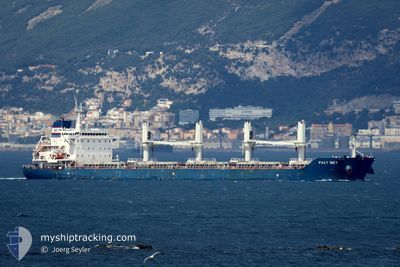
FUAT BEY
Cargo
Current Trip
| Time Travelled | 11 days |
|---|---|
| Remaining Time | --- |
| Distance Travelled | 2041.16 nm |
| Remaining Distance | --- |
| AVG Speed | 10.9 Knots |
| MAX Speed | 10.9 Knots |
| AVG Wind | 11.6 knots |
| MAX Wind | 26.3 knots |
| MIN Temp | 11.8°C / 53.24°F |
| MAX Temp | 33.9°C / 93.02°F |
| Draught | 6 m |
| Position Received | 1 d ago |
Current Position
| Longitude | 26.93447° |
|---|---|
| Latitude | 40.45488° |
| Status | Under way using engine |
| Speed | 1.4 Knots |
| Course | 332° |
| Area | Sea of Marmara |
| Station | T-AIS |
| Position Received | 1 d ago |
Info
Information
The current position of FUAT BEY is in Sea of Marmara with coordinates 40.45488° / 26.93447° as reported on 2024-05-14 12:00 by AIS to our vessel tracker app. The vessel's current speed is 1.4 Knots and is heading at the port of CANAKKALE. The estimated time of arrival as calculated by MyShipTracking vessel tracking app is 2024-05-11 22:53 LT
The vessel FUAT BEY (IMO: 9663817, MMSI: 538009101) is a Cargo It's sailing under the flag of [MH] Marshall Is.
In this page you can find informations about the vessels current position, last detected port calls, and current voyage information. If the vessels is not in coverage by AIS you will find the latest position.
The current position of FUAT BEY is detected by our AIS receivers and we are not responsible for the reliability of the data. The last position was recorded while the vessel was in Coverage by the Ais receivers of our vessel tracking app.
The current draught of FUAT BEY as reported by AIS is 6 meters
Weather
| Temperature | 14.6°C / 58.28°F |
|---|---|
| Wind Speed | 15 knots |
| Direction | 76° ENE |
| Pressure | 1020.1 hPa |
| Humidity | 72 % |
| Cloud Coverage | 100 % |
Featured Company
Last Port Calls
| Port | Arrival | Departure | Time In Port |
|---|---|---|---|
| 2024-05-09 04:33 | 2024-05-09 13:49 | 9 h | |
| 2024-04-28 13:39 | 2024-05-04 13:16 | 5 d | |
| 2024-04-24 11:08 | 2024-04-24 15:00 | 3 h | |
| 2024-04-15 06:18 | 2024-04-15 14:49 | 8 h | |
| 2024-04-14 14:21 | 2024-04-15 00:46 | 10 h | |
| 2024-04-06 07:11 | 2024-04-06 16:57 | 9 h | |
| 2024-04-06 06:41 | |||
| 2024-03-26 10:40 |
Most Visited Ports (Last year)
| Port | Arrivals | |
|---|---|---|
| 5 | ||
| 2 | ||
| 2 | ||
| 2 | ||
| 2 | ||
| 1 |
Last Trips
| Origin | Departure | Destination | Arrival | Distance | |
|---|---|---|---|---|---|
| 2024-05-04 13:16 | 2024-05-09 04:33 | 1092.69 nm | |||
| 2024-04-24 15:00 | 2024-04-28 13:39 | 258.79 nm | |||
| 2024-04-15 00:46 | 2024-04-24 11:08 | 1420.79 nm | |||
| 2024-04-15 00:46 | 2024-04-15 06:18 | 21.38 nm | |||
| 2024-04-06 16:57 | 2024-04-14 14:21 | 1358.18 nm | |||
| 2024-04-06 06:41 | 2024-04-06 07:11 | 2.76 nm |
Events
| Time | Event | Details | Position / Dest | Info |
|---|---|---|---|---|
| 2024-05-15 19:52 | START Moving | 4.4 nm, West of KEMER |
40.41818 / 26.95510
CANAKKALE
|
Speed: 3.8 kn Course: 61° |
| 2024-05-15 16:58 | STOP Moving | 3.3 nm, West of KEMER |
40.43500 / 26.98333
CANAKKALE
|
Speed: Course: -1° |
| 2024-05-15 05:47 | START Moving | 6.18 nm, West of KEMER |
40.44009 / 26.91987
CANAKKALE
|
Speed: 4.3 kn Course: 74° |
| 2024-05-14 22:25 | STOP Moving | 4.07 nm, North West of KEMER |
40.46167 / 26.98500
CANAKKALE
|
Speed: Course: -1° |
| 2024-05-14 12:04 | Status Changed | Default Under way using engine |
40.45484 / 26.93241
CANAKKALE
|
Speed: 1.4 kn Course: 332° |
| 2024-05-14 12:00 | Status Changed | Under way using engine Default |
40.45488 / 26.93447
CANAKKALE
|
Speed: 1.4 kn Course: 328° |
| 2024-05-14 12:00 | OUT of Coverage |
40.45488 / 26.93447
Sea of Marmara
|
Speed: 1.4 kn Course: 268.2° |
|
| 2024-05-14 11:49 | IN Coverage |
40.45488 / 26.93447
Sea of Marmara
|
Speed: 1.4 kn Course: 268.2° |
|
| 2024-05-14 04:46 | START Moving | 7.22 nm, West of KEMER |
40.44559 / 26.89826
CANAKKALE
|
Speed: 3.8 kn Course: 78° |
| 2024-05-13 22:40 | STOP Moving | 3.44 nm, North West of KEMER |
40.43833 / 26.98167
CANAKKALE
|
Speed: Course: -1° |