
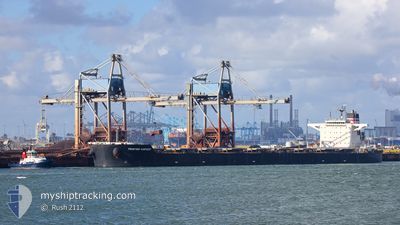
FRONTIER HARVEST
Bulk Carrier
Current Trip
| Time Travelled | 3 days |
|---|---|
| Remaining Time | --- |
| Distance Travelled | 258.95 nm |
| Remaining Distance | --- |
| AVG Speed | 8.7 Knots |
| MAX Speed | 13.8 Knots |
| AVG Wind | 7.9 knots |
| MAX Wind | 16.9 knots |
| MIN Temp | 10.2°C / 50.36°F |
| MAX Temp | 21.1°C / 69.98°F |
| Draught | 12.6 m |
| Position Received | Now |
Current Position
| Longitude | 135.12614° |
|---|---|
| Latitude | 34.23765° |
| Status | Under way using engine |
| Speed | |
| Course | 145° |
| Area | Philippine Sea |
| Station | T-AIS |
| Position Received | Now |
Info
Information
The current position of FRONTIER HARVEST is in Philippine Sea with coordinates 34.23765° / 135.12614° as reported on 2024-05-02 11:39 by AIS to our vessel tracker app. The vessel's current speed is 0 Knots
The vessel FRONTIER HARVEST (IMO: 9487976, MMSI: 431014000) is a Bulk Carrier that was built in 2011 ( 13 years old ). It's sailing under the flag of [JP] Japan.
In this page you can find informations about the vessels current position, last detected port calls, and current voyage information. If the vessels is not in coverage by AIS you will find the latest position.
The current position of FRONTIER HARVEST is detected by our AIS receivers and we are not responsible for the reliability of the data. The last position was recorded while the vessel was in Coverage by the Ais receivers of our vessel tracking app.
The current draught of FRONTIER HARVEST as reported by AIS is 12.6 meters
Weather
| Temperature | 14.8°C / 58.64°F |
|---|---|
| Wind Speed | 3 knots |
| Direction | 200° SSW |
| Pressure | 1019 hPa |
| Humidity | 61.8 % |
| Cloud Coverage | 96 % |
Featured Company
Events
| Time | Event | Details | Position / Dest | Info |
|---|---|---|---|---|
| 2024-05-01 00:32 | STOP Moving | 1.43 nm, North West of WAKAYAMA |
34.23727 / 135.12536
JP WAK
|
Speed: 0.3 kn Course: 147° |
| 2024-05-01 00:04 | ETA Changed | 2025/04/30 05:30 2024/04/30 05:30 |
34.23981 / 135.10101
JP WAK
|
Speed: 4.9 kn Course: 102° |
| 2024-04-30 23:45 | START Moving | 2.44 nm, West of WAKAYAMA |
34.22703 / 135.08992
JP WAK
|
Speed: 3.8 kn Course: 340° |
| 2024-04-30 23:34 | Status Changed | Under way using engine At anchor |
34.22286 / 135.09060
JP WAK
|
Speed: Course: 13° |
| 2024-04-30 10:41 | Status Changed | At anchor Default |
34.22435 / 135.09280
JP WAK
|
Speed: Course: -1° |
| 2024-04-30 10:37 | Status Changed | Default At anchor |
34.22333 / 135.09166
JP WAK
|
Speed: 0.1 kn Course: 280° |
| 2024-04-30 08:17 | Status Changed | At anchor Default |
34.22291 / 135.09218
JP WAK
|
Speed: Course: 308° |
| 2024-04-30 08:14 | Status Changed | Default At anchor |
34.22290 / 135.09218
JP WAK
|
Speed: Course: 309° |
| 2024-04-30 05:59 | Status Changed | At anchor Under way using engine |
34.22541 / 135.08664
JP WAK
|
Speed: 0.3 kn Course: 90° |
| 2024-04-30 05:39 | STOP Moving | 2.47 nm, West of WAKAYAMA |
34.22545 / 135.08866
JP WAK
|
Speed: 0.3 kn Course: 95° |