
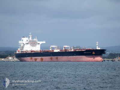
FRONT POLLUX
Tanker
Current Trip
| Time Travelled | 22 days |
|---|---|
| Remaining Time | --- |
| Distance Travelled | 6373.61 nm |
| Remaining Distance | --- |
| AVG Speed | 12 Knots |
| MAX Speed | 15.3 Knots |
| AVG Wind | 11.1 knots |
| MAX Wind | 29 knots |
| MIN Temp | 6.3°C / 43.34°F |
| MAX Temp | 29.3°C / 84.74°F |
| Draught | 12 m |
| Position Received | 1 d ago |
Current Position
| Longitude | --- |
|---|---|
| Latitude | --- |
| Status | Under way using engine |
| Speed | 12.7 Knots |
| Course | 52.9° |
| Area | Eastern China Sea |
| Station | T-AIS |
| Position Received | 1 d ago |
Information
The current position of FRONT POLLUX is in Eastern China Sea with coordinates 30.90202° / 130.91573° as reported on 2025-03-28 09:17 by AIS to our vessel tracker app. The vessel's current speed is 12.7 Knots
The vessel FRONT POLLUX (IMO: 9780263, MMSI: 538007461) is a Tanker It's sailing under the flag of [MH] Marshall Is.
In this page you can find informations about the vessels current position, last detected port calls, and current voyage information. If the vessels is not in coverage by AIS you will find the latest position.
The current position of FRONT POLLUX is detected by our AIS receivers and we are not responsible for the reliability of the data. The last position was recorded while the vessel was in Coverage by the Ais receivers of our vessel tracking app.
The current draught of FRONT POLLUX as reported by AIS is 12 meters
Weather
| Temperature | 5.7°C / 42.26°F |
|---|---|
| Wind Speed | 13 knots |
| Direction | 328° NNW |
| Pressure | 1023.8 hPa |
| Humidity | 80.3 % |
| Cloud Coverage | 95 % |
Featured Company
Last Port Calls
| Port | Arrival | Departure | Time In Port |
|---|---|---|---|
| 2025-03-05 04:27 | 2025-03-07 06:51 | 2 d | |
| 2025-01-27 21:00 | 2025-01-31 22:30 | 4 d | |
| 2025-01-23 00:10 | 2025-01-24 05:15 | 1 d |
Events
| Time | Event | Details | Position / Dest | Info |
|---|---|---|---|---|
| 2025-03-29 06:14 | STOP Moving | 4.89 nm, South West of KUDAMATSU |
33.95943 / 131.76508
JP TKY
|
Speed: 0.3 kn Course: 350° |
| 2025-03-28 09:22 | Status Changed | Default Under way using engine |
30.91201 / 130.93112
JP TKY
|
Speed: 12.7 kn Course: 52.9° |
| 2025-03-28 09:17 | Status Changed | Under way using engine Default |
30.90202 / 130.91573
JP TKY
|
Speed: 12.7 kn Course: 53° |
| 2025-03-28 09:17 | OUT of Coverage |
30.90202 / 130.91573
Eastern China Sea
JP TKY
|
Speed: 12.7 kn Course: 52.9° |
|
| 2025-03-28 08:30 | Status Changed | Default Under way using engine |
30.80029 / 130.76082
JP TKY
|
Speed: 12.5 kn Course: 59.1° |
| 2025-03-28 08:23 | Status Changed | Under way using engine Default |
30.78851 / 130.73813
JP TKY
|
Speed: 12.4 kn Course: 60° |
| 2025-03-28 08:22 | Status Changed | Default Under way using engine |
30.78612 / 130.73351
JP TKY
|
Speed: 12.5 kn Course: 57.3° |
| 2025-03-28 08:05 | Change Sea Area | Japanese part of the Eastern China Sea Malaysian part of the Singapore Strait |
30.73942 / 130.64063
Eastern China Sea
JP TKY
|
Speed: 12.7 kn Course: 60.3° |
| 2025-03-28 08:05 | Status Changed | Under way using engine Default |
30.73942 / 130.64063
JP TKY
|
Speed: 12.6 kn Course: 56° |
| 2025-03-28 07:48 | IN Coverage |
30.73942 / 130.64063
Eastern China Sea
JP TKY
|
Speed: 12.7 kn Course: 60.3° |