
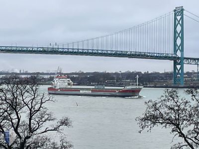
FRASERBORG
General Cargo
Current Trip
SEAFORTH
| Time Travelled | 3 days |
|---|---|
| Remaining Time | --- |
| Distance Travelled | 746.44 nm |
| Remaining Distance | --- |
| AVG Speed | 11.5 Knots |
| MAX Speed | 16.2 Knots |
| AVG Wind | 13.2 knots |
| MAX Wind | 27.3 knots |
| MIN Temp | -18.5°C / -1.3°F |
| MAX Temp | -4.2°C / 24.44°F |
| Draught | 8.1 m |
| Position Received | 3 d ago |
Current Position
| Longitude | --- |
|---|---|
| Latitude | --- |
| Status | Under way using engine |
| Speed | 10.9 Knots |
| Course | 10.8° |
| Area | Gulf of St-Lawrence |
| Station | T-AIS |
| Position Received | 3 d ago |
Info
Information
The current position of FRASERBORG is in Gulf of St-Lawrence with coordinates 46.13043° / -72.95615° as reported on 2026-01-01 16:45 by AIS to our vessel tracker app. The vessel's current speed is 10.9 Knots
The vessel FRASERBORG (IMO: 9419319, MMSI: 245639000) is a General Cargo that was built in 2011 ( 15 years old ). It's sailing under the flag of [NL] Netherlands.
In this page you can find informations about the vessels current position, last detected port calls, and current voyage information. If the vessels is not in coverage by AIS you will find the latest position.
The current position of FRASERBORG is detected by our AIS receivers and we are not responsible for the reliability of the data. The last position was recorded while the vessel was in Coverage by the Ais receivers of our vessel tracking app.
The current draught of FRASERBORG as reported by AIS is 8.1 meters
Weather
| Temperature | -4.5°C / 23.9°F |
|---|---|
| Wind Speed | 16 knots |
| Direction | 326° NW |
| Pressure | 1003.9 hPa |
| Humidity | 85.5 % |
| Cloud Coverage | 100 % |
Featured Company
Last Port Calls
| Port | Arrival | Departure | Time In Port |
|---|---|---|---|
| 2025-12-31 07:14 | 2026-01-01 08:33 | 1 d | |
| 2025-12-24 18:08 | 2025-12-24 18:44 | 35 m | |
| 2025-12-22 09:46 | 2025-12-22 11:28 | 1 h | |
| 2025-12-11 15:18 | 2025-12-21 00:55 | 9 d | |
| 2025-12-10 12:27 | 2025-12-10 14:09 | 1 h | |
| 2025-12-02 06:28 | 2025-12-08 16:02 | 6 d | |
| 2025-11-29 06:38 | 2025-11-29 16:35 | 9 h | |
| 2025-11-25 06:39 | 2025-11-28 22:22 | 3 d | |
| 2025-11-24 04:57 | 2025-11-24 05:33 | 35 m | |
| 2025-11-19 00:02 | 2025-11-22 18:11 | 3 d |
Most Visited Ports (Last year)
| Port | Arrivals | |
|---|---|---|
| 4 | ||
| 4 | ||
| 3 | ||
| 3 | ||
| 2 | ||
| 2 |
Last Trips
| Origin | Departure | Destination | Arrival | Distance | |
|---|---|---|---|---|---|
| 2025-12-24 18:44 | 2025-12-31 07:14 | 305.48 nm | |||
| 2025-12-22 11:28 | 2025-12-24 18:08 | 523.43 nm | |||
| 2025-12-21 00:55 | 2025-12-22 09:46 | 236.70 nm | |||
| 2025-12-10 14:09 | 2025-12-11 15:18 | 293.19 nm | |||
| 2025-12-08 16:02 | 2025-12-10 12:27 | 397.83 nm | |||
| 2025-11-29 16:35 | 2025-12-02 06:28 | 600.56 nm | |||
| 2025-11-28 22:22 | 2025-11-29 06:38 | 87.27 nm | |||
| 2025-11-24 05:33 | 2025-11-25 06:39 | 162.66 nm | |||
| 2025-11-22 18:11 | 2025-11-24 04:57 | 261.11 nm | |||
| 2025-11-18 18:14 | 2025-11-19 00:02 | 32.99 nm |
Events
| Time | Event | Details | Position / Dest | Info |
|---|---|---|---|---|
| 2026-01-03 11:16 | START Moving | 8.69 nm, North of TROIS-PISTOLES |
48.27036 / -69.10667
SEAFORTH
|
Speed: 7.6 kn Course: 352° |
| 2026-01-02 12:14 | STOP Moving | 8.24 nm, North East of TROIS-PISTOLES |
48.26082 / -69.10191
SEAFORTH
|
Speed: 0.2 kn Course: 239° |
| 2026-01-01 16:48 | Status Changed | Default Under way using engine |
46.14146 / -72.95271
SEAFORTH
|
Speed: 10.9 kn Course: 10.8° |
| 2026-01-01 16:45 | Status Changed | Under way using engine Default |
46.13043 / -72.95615
SEAFORTH
|
Speed: 10.9 kn Course: 14° |
| 2026-01-01 16:45 | OUT of Coverage |
46.13043 / -72.95615
Gulf of St-Lawrence
SEAFORTH
|
Speed: 10.9 kn Course: 10.8° |
|
| 2026-01-01 16:43 | Status Changed | Default Under way using engine |
46.12454 / -72.95789
SEAFORTH
|
Speed: 11.7 kn Course: 38° |
| 2026-01-01 15:21 | Status Changed | Under way using engine Default |
45.94654 / -73.21135
SEAFORTH
|
Speed: 12.9 kn Course: 5° |
| 2026-01-01 14:59 | Status Changed | Default Under way using engine |
45.87665 / -73.25172
SEAFORTH
|
Speed: 12.8 kn Course: 33.5° |
| 2026-01-01 13:33 | PORT DEPARTURE |
|
45.63204 / -73.48815
SEAFORTH
|
Speed: 8.5 kn Course: 24° |
| 2026-01-01 13:26 | START Moving |
45.61885 / -73.49828
[CA] MONTREAL
|
Speed: 3.5 kn Course: 45° |