
FRANZISKA
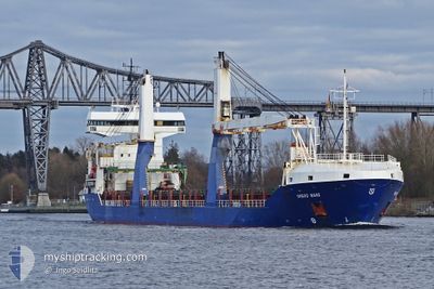
General Cargo
Current Trip
| Time Travelled | 2 days |
|---|---|
| Remaining Time | 1 day |
| Distance Travelled | 663.30 nm |
| Remaining Distance | 657.83 nm |
| AVG Speed | 10.2 Knots |
| MAX Speed | 14.3 Knots |
| AVG Wind | 21.2 knots |
| MAX Wind | 31 knots |
| MIN Temp | 5.5°C / 41.9°F |
| MAX Temp | 9.9°C / 49.82°F |
| Draught | 5.8 m |
| Position Received | 21 h, 10 m ago |
Current Position
| Longitude | --- |
|---|---|
| Latitude | --- |
| Status | Under way using engine |
| Speed | 13 Knots |
| Course | 307.3° |
| Area | Norwegian Sea |
| Station | T-AIS |
| Position Received | 21 h, 10 m ago |
Info
Information
The current position of FRANZISKA is in Norwegian Sea with coordinates 61.79704° / 1.95189° as reported on 2025-12-12 12:49 by AIS to our vessel tracker app. The vessel's current speed is 13 Knots and is heading at the port of AKUREYRI. The estimated time of arrival as calculated by MyShipTracking vessel tracking app is 2025-12-14 12:22 LT
The vessel FRANZISKA (IMO: 9535618, MMSI: 305700000) is a General Cargo that was built in 2011 ( 14 years old ). It's sailing under the flag of [AG] Antigua Barbuda.
In this page you can find informations about the vessels current position, last detected port calls, and current voyage information. If the vessels is not in coverage by AIS you will find the latest position.
The current position of FRANZISKA is detected by our AIS receivers and we are not responsible for the reliability of the data. The last position was recorded while the vessel was in Coverage by the Ais receivers of our vessel tracking app.
The current draught of FRANZISKA as reported by AIS is 5.8 meters
Weather
| Temperature | 6.3°C / 43.34°F |
|---|---|
| Wind Speed | 28 knots |
| Direction | 199° SSW |
| Pressure | 991.9 hPa |
| Humidity | 87.4 % |
| Cloud Coverage | 92 % |
Featured Company
Most Visited Ports (Last year)
| Port | Arrivals | |
|---|---|---|
| 2 | ||
| 2 | ||
| 2 | ||
| 1 | ||
| 1 | ||
| 1 |
Last Trips
| Origin | Departure | Destination | Arrival | Distance | |
|---|---|---|---|---|---|
| 2025-12-03 22:37 | 2025-12-07 20:41 | 927.95 nm | |||
| 2025-11-21 17:42 | 2025-11-30 19:29 | 591.00 nm | |||
| 2025-10-14 21:50 | 2025-10-20 13:38 | 869.43 nm | |||
| 2025-10-10 08:32 | 2025-10-14 07:01 | 748.15 nm | |||
| 2025-08-09 13:02 | 2025-10-09 07:20 | 10399.39 nm |
Events
| Time | Event | Details | Position / Dest | Info |
|---|---|---|---|---|
| 2025-12-12 12:53 | Status Changed | Default Under way using engine |
61.80609 / 1.92932
ISAKU
|
Speed: 13 kn Course: 307.3° |
| 2025-12-12 12:49 | OUT of Coverage |
61.79704 / 1.95189
Norwegian Sea
ISAKU
|
Speed: 13 kn Course: 307.3° |
|
| 2025-12-12 12:47 | Status Changed | Under way using engine Default |
61.79162 / 1.96562
ISAKU
|
Speed: 13.4 kn Course: 309° |
| 2025-12-12 12:29 | Status Changed | Default Under way using engine |
61.74918 / 2.07226
ISAKU
|
Speed: 13.4 kn Course: 307.5° |
| 2025-12-12 12:24 | Status Changed | Under way using engine Default |
61.73701 / 2.10342
ISAKU
|
Speed: 13.7 kn Course: 311° |
| 2025-12-12 12:08 | Status Changed | Default Under way using engine |
61.69916 / 2.19943
ISAKU
|
Speed: 13.6 kn Course: 310.3° |
| 2025-12-12 07:24 | Change Sea Area | Norwegian part of the Norwegian Sea Norwegian part of the North Sea |
61.00153 / 3.83935
Norwegian Sea
ISAKU
|
Speed: 12.1 kn Course: 308.9° |
| 2025-12-11 09:37 | Change Sea Area | Norwegian part of the North Sea Norwegian part of the Skaggerak |
57.80626 / 7.31814
North Sea
ISAKU
|
Speed: 5.5 kn Course: 264.7° |
| 2025-12-11 01:54 | Status Changed | Under way using engine Default |
58.11650 / 8.93489
ISAKU
|
Speed: 9.6 kn Course: 222° |
| 2025-12-11 01:52 | Status Changed | Default Under way using engine |
58.11962 / 8.94066
ISAKU
|
Speed: 10.1 kn Course: 220.9° |