

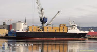
FOLLA
Reefer

Current Trip
| Trip Time | 1 day |
|---|---|
| Trip Distance | 420.26 nm |
| AVG Speed | 11.3 Knots |
| MAX Speed | 13 Knots |
| Draught | 6.4 m |
| AVG Wind | 14 knots |
| MAX Wind | 21 knots |
| MIN Temp | -3.7°C / 25.34°F |
| MAX Temp | 3.2°C / 37.76°F |
| Position Received | 1 d ago |
Current Position
| Longitude | --- |
|---|---|
| Latitude | --- |
| Status | Under way using engine |
| Speed | 0.2 Knots |
| Course | 117° |
| Area | Baltic Sea |
| Station | T-AIS |
| Position Received | 1 d ago |
Information
The current position of FOLLA is in Baltic Sea with coordinates 54.48259° / 13.59723° as reported on 2025-02-20 12:49 by AIS to our vessel tracker app. The vessel's current speed is 0.2 Knots and is currently inside the port of MUKRAN.
The vessel FOLLA (IMO: 9359648, MMSI: 257701000) is a Reefer that was built in 2007 ( 18 years old ). It's sailing under the flag of [NO] Norway.
In this page you can find informations about the vessels current position, last detected port calls, and current voyage information. If the vessels is not in coverage by AIS you will find the latest position.
The current position of FOLLA is detected by our AIS receivers and we are not responsible for the reliability of the data. The last position was recorded while the vessel was in Coverage by the Ais receivers of our vessel tracking app.
The current draught of FOLLA as reported by AIS is 6.4 meters
Weather
| Temperature | 5.1°C / 41.18°F |
|---|---|
| Wind Speed | 15 knots |
| Direction | 161° SSE |
| Pressure | 1018.3 hPa |
| Humidity | 76 % |
| Cloud Coverage | 13 % |

Featured Company
Last Port Calls
| Port | Arrival | Departure | Time In Port |
|---|---|---|---|
| 2025-02-20 12:49 | |||
| 2025-02-18 05:31 | 2025-02-19 01:11 | 19 h | |
| 2025-02-15 12:53 | 2025-02-15 17:09 | 4 h | |
| 2025-02-14 06:14 | 2025-02-14 19:12 | 12 h | |
| 2025-02-12 05:25 | 2025-02-13 08:44 | 1 d | |
| 2025-02-10 02:10 | 2025-02-10 16:29 | 14 h | |
| 2025-02-09 14:06 | 2025-02-09 18:27 | 4 h | |
| 2025-02-09 04:03 | 2025-02-09 04:36 | 32 m | |
| 2025-02-07 12:18 | 2025-02-07 14:35 | 2 h | |
| 2025-02-07 00:34 | 2025-02-07 01:08 | 33 m |
Last Trips
| Origin | Departure | Destination | Arrival | Distance | |
|---|---|---|---|---|---|
| 2025-02-19 02:11 | 2025-02-20 13:49 | 420.26 nm | |||
| 2025-02-15 19:09 | 2025-02-18 06:31 | 799.69 nm | |||
| 2025-02-14 21:12 | 2025-02-15 14:53 | 232.04 nm | |||
| 2025-02-13 09:44 | 2025-02-14 08:14 | 273.80 nm | |||
| 2025-02-10 17:29 | 2025-02-12 06:25 | 341.79 nm | |||
| 2025-02-09 19:27 | 2025-02-10 03:10 | 95.10 nm | |||
| 2025-02-09 05:36 | 2025-02-09 15:06 | 131.80 nm | |||
| 2025-02-07 15:35 | 2025-02-09 05:03 | 176.26 nm | |||
| 2025-02-07 02:08 | 2025-02-07 13:18 | 74.02 nm | |||
| 2025-02-06 11:41 | 2025-02-07 01:34 | 154.17 nm |
Events
| Time | Event | Details | Position / Dest | Info |
|---|---|---|---|---|
| 2025-02-20 12:55 | Status Changed | Default Under way using engine |
54.48325 / 13.59736
[DE] MUKRAN
|
Speed: 0.2 kn Course: 117° |
| 2025-02-20 12:49 | STOP Moving |
54.48259 / 13.59723
[DE] MUKRAN
|
Speed: 0.2 kn Course: 117° |
|
| 2025-02-20 12:49 | OUT of Coverage |
54.48259 / 13.59723
Baltic Sea
[DE] MUKRAN
|
Speed: 0.2 kn Course: 67.1° |
|
| 2025-02-20 12:49 | PORT ARRIVAL |
|
54.48258 / 13.59721
[DE] MUKRAN
|
Speed: 6.5 kn Course: 344° |
| 2025-02-20 12:39 | Status Changed | Under way using engine Default |
54.47161 / 13.59884
DEMUK
|
Speed: 9.6 kn Course: 279° |
| 2025-02-20 12:11 | Status Changed | Default Under way using engine |
54.48782 / 13.71129
DEMUK
|
Speed: 11.8 kn Course: 201.4° |
| 2025-02-20 12:07 | Status Changed | Under way using engine Default |
54.49976 / 13.72250
DEMUK
|
Speed: 11.8 kn Course: 199° |
| 2025-02-20 12:02 | Status Changed | Default Under way using engine |
54.51539 / 13.73165
DEMUK
|
Speed: 11.8 kn Course: 198.6° |
| 2025-02-20 09:01 | Change Sea Area | German part of the Baltic Sea Danish part of the Baltic Sea |
54.86536 / 12.98511
Baltic Sea
DEMUK
|
Speed: 11.8 kn Course: 128.8° |
| 2025-02-20 08:11 | ETA Changed | 2025/02/20 14:00 2025/02/20 15:00 |
54.96130 / 12.75625
DEMUK
|
Speed: 10.8 kn Course: 146.8° |