
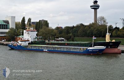
FLOKI
General Cargo
Current Trip
| Time Travelled | 33 days |
|---|---|
| Remaining Time | --- |
| Distance Travelled | 781.41 nm |
| Remaining Distance | --- |
| AVG Speed | 6.4 Knots |
| MAX Speed | 9.3 Knots |
| AVG Wind | 11 knots |
| MAX Wind | 33.3 knots |
| MIN Temp | -0.3°C / 31.46°F |
| MAX Temp | 17.9°C / 64.22°F |
| Draught | 0 m |
| Position Received | 16 h, 43 m ago |
Current Position
| Longitude | --- |
|---|---|
| Latitude | --- |
| Status | Under way using engine |
| Speed | 6.3 Knots |
| Course | 220.3° |
| Area | Sea of Marmara |
| Station | T-AIS |
| Position Received | 16 h, 43 m ago |
Info
Information
The current position of FLOKI is in Sea of Marmara with coordinates 40.08651° / 26.31664° as reported on 2026-01-10 11:05 by AIS to our vessel tracker app. The vessel's current speed is 6.3 Knots and is heading at the port of BAR. The estimated time of arrival as calculated by MyShipTracking vessel tracking app is 2026-01-15 06:00 LT
The vessel FLOKI (IMO: 8503096, MMSI: 511100860) is a General Cargo that was built in 1985 ( 41 years old ). It's sailing under the flag of [PW] Palau.
In this page you can find informations about the vessels current position, last detected port calls, and current voyage information. If the vessels is not in coverage by AIS you will find the latest position.
The current position of FLOKI is detected by our AIS receivers and we are not responsible for the reliability of the data. The last position was recorded while the vessel was in Coverage by the Ais receivers of our vessel tracking app.
Weather
| Temperature | 14.6°C / 58.28°F |
|---|---|
| Wind Speed | 23 knots |
| Direction | 230° SW |
| Pressure | 1000.5 hPa |
| Humidity | 52.9 % |
| Cloud Coverage | 70 % |
Featured Company
Last Port Calls
| Port | Arrival | Departure | Time In Port |
|---|---|---|---|
| 2025-12-08 20:26 | 2025-12-09 04:09 | 7 h | |
| 2025-12-05 16:38 | 2025-12-06 19:57 | 1 d | |
| 2025-11-26 01:19 | 2025-11-28 23:30 | 2 d | |
| 2025-11-24 07:19 | 2025-11-24 18:43 | 11 h | |
| 2025-11-22 19:15 | 2025-11-23 14:52 | 19 h | |
| 2025-11-15 14:23 | 2025-11-18 17:14 | 3 d | |
| 2025-11-13 07:28 | 2025-11-14 07:28 | 23 h | |
| 2025-11-08 12:38 | 2025-11-09 03:56 | 15 h | |
| 2025-11-03 07:06 | 2025-11-06 05:56 | 2 d | |
| 2025-11-01 16:49 |
Last Trips
| Origin | Departure | Destination | Arrival | Distance | |
|---|---|---|---|---|---|
| 2025-12-06 19:57 | 2025-12-08 20:26 | 283.59 nm | |||
| 2025-11-28 23:30 | 2025-12-05 16:38 | 264.42 nm | |||
| 2025-11-24 18:43 | 2025-11-26 01:19 | 226.74 nm | |||
| 2025-11-23 14:52 | 2025-11-24 07:19 | 0.97 nm | |||
| 2025-11-18 17:14 | 2025-11-22 19:15 | 304.30 nm | |||
| 2025-11-14 07:28 | 2025-11-15 14:23 | 247.02 nm | |||
| 2025-11-09 03:56 | 2025-11-13 07:28 | 391.07 nm | |||
| 2025-11-06 05:56 | 2025-11-08 12:38 | 331.57 nm | |||
| 2025-11-01 16:49 | 2025-11-03 07:06 | 272.88 nm |
Events
| Time | Event | Details | Position / Dest | Info |
|---|---|---|---|---|
| 2026-01-10 14:30 | STOP Moving | 2.03 nm, North West of BOZCAADA |
39.86591 / 26.05774
ME BAR
|
Speed: 0.2 kn Course: 211° |
| 2026-01-10 11:05 | OUT of Coverage |
40.08651 / 26.31664
Sea of Marmara
ME BAR
|
Speed: 6.3 kn Course: 220.3° |
|
| 2026-01-10 10:13 | ETA Changed | 2026/01/15 05:00 2026/01/07 05:00 |
40.15842 / 26.38364
ME BAR
|
Speed: 7.8 kn Course: 171.5° |
| 2026-01-10 09:57 | Status Changed | Under way using engine Default |
40.19365 / 26.37671
ME BAR
|
Speed: 6.6 kn Course: 229° |
| 2026-01-10 09:41 | IN Coverage |
40.19365 / 26.37671
Sea of Marmara
|
Speed: 7.2 kn Course: 193.6° |
|
| 2026-01-10 05:55 | START Moving | 5.96 nm, North East of CARDAK |
40.45988 / 26.78819
ME BAR
|
Speed: 5 kn Course: 212° |
| 2026-01-06 08:29 | Status Changed | Default Under way using engine |
40.88941 / 28.54093
ME BAR
|
Speed: 6.3 kn Course: 261.6° |
| 2026-01-06 08:27 | OUT of Coverage |
40.88977 / 28.54438
Sea of Marmara
ME BAR
|
Speed: 6.3 kn Course: 261.6° |
|
| 2026-01-06 06:33 | Status Changed | Under way using engine Default |
40.92040 / 28.81507
ME BAR
|
Speed: 7 kn Course: 261° |
| 2026-01-06 06:17 | Status Changed | Default Under way using engine |
40.92479 / 28.85490
ME BAR
|
Speed: 6.8 kn Course: 261.7° |