

FL STOROE
General Cargo

Current Trip
BEPUU
| Time Travelled | 3 days |
|---|---|
| Remaining Time | --- |
| Distance Travelled | 623.47 nm |
| Remaining Distance | --- |
| AVG Speed | 6 Knots |
| MAX Speed | 13.1 Knots |
| AVG Wind | 6.9 knots |
| MAX Wind | 22.6 knots |
| MIN Temp | -2°C / 28.4°F |
| MAX Temp | 6.4°C / 43.52°F |
| Draught | 5.7 m |
| Position Received | 1 m ago |
Current Position
| Longitude | --- |
|---|---|
| Latitude | --- |
| Status | Under way using engine |
| Speed | 8.7 Knots |
| Course | 315.5° |
| Area | North Sea |
| Station | T-AIS |
| Position Received | 1 m ago |
Information
The current position of FL STOROE is in North Sea with coordinates 53.94889° / 8.64274° as reported on 2025-02-21 00:42 by AIS to our vessel tracker app. The vessel's current speed is 8.7 Knots
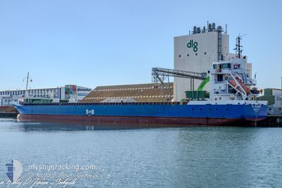
The vessel FL STOROE (IMO: 9268851, MMSI: 255802870) is a General Cargo that was built in 2005 ( 20 years old ). It's sailing under the flag of [PT] Portugal.
In this page you can find informations about the vessels current position, last detected port calls, and current voyage information. If the vessels is not in coverage by AIS you will find the latest position.
The current position of FL STOROE is detected by our AIS receivers and we are not responsible for the reliability of the data. The last position was recorded while the vessel was in Coverage by the Ais receivers of our vessel tracking app.
The current draught of FL STOROE as reported by AIS is 5.7 meters
Weather
| Temperature | 5.4°C / 41.72°F |
|---|---|
| Wind Speed | 16 knots |
| Direction | 191° S |
| Pressure | 1019.2 hPa |
| Humidity | 96.2 % |
| Cloud Coverage | 100 % |


Featured Company
Last Port Calls
| Port | Arrival | Departure | Time In Port |
|---|---|---|---|
| 2025-02-15 21:17 | 2025-02-17 13:10 | 1 d | |
| 2025-02-09 07:44 | 2025-02-10 20:49 | 1 d | |
| 2025-02-01 11:54 | 2025-02-01 11:58 | 4 m | |
| 2025-01-31 23:11 | 2025-02-01 02:43 | 3 h | |
| 2025-01-06 02:50 | 2025-01-31 11:58 | 25 d | |
| 2025-01-02 12:34 | 2025-01-03 15:27 | 1 d | |
| 2024-12-24 10:50 | 2024-12-27 20:27 | 3 d | |
| 2024-12-23 05:07 | 2024-12-23 19:32 | 14 h | |
| 2024-12-20 22:15 | 2024-12-20 22:19 | 4 m | |
| 2024-12-18 00:12 | 2024-12-19 16:48 | 1 d |
Last Trips
| Origin | Departure | Destination | Arrival | Distance | |
|---|---|---|---|---|---|
| 2025-02-10 21:49 | 2025-02-15 23:17 | 911.58 nm | |||
| 2025-02-01 12:58 | 2025-02-09 08:44 | 1591.24 nm | |||
| 2025-02-01 03:43 | 2025-02-01 12:54 | 47.44 nm | |||
| 2025-01-31 12:58 | 2025-02-01 00:11 | 85.24 nm | |||
| 2025-01-03 16:27 | 2025-01-06 03:50 | 180.92 nm | |||
| 2024-12-27 22:27 | 2025-01-02 13:34 | 906.90 nm | |||
| 2024-12-23 20:32 | 2024-12-24 12:50 | 164.42 nm | |||
| 2024-12-20 23:19 | 2024-12-23 06:07 | 574.07 nm | |||
| 2024-12-19 17:48 | 2024-12-20 23:15 | 219.01 nm | |||
| 2024-12-12 22:36 | 2024-12-18 01:12 | 1062.76 nm |
Events
| Time | Event | Details | Position / Dest | Info |
|---|---|---|---|---|
| 2025-02-20 22:50 | START Moving | 0.91 nm, South West of BRUNSBUETTEL |
53.89203 / 9.14219
BEPUU
|
Speed: 3.1 kn Course: 225° |
| 2025-02-20 22:02 | STOP Moving | 0.79 nm, South West of BRUNSBUETTEL |
53.89341 / 9.14480
BEPUU
|
Speed: 0.3 kn Course: 231° |
| 2025-02-20 22:01 | Detected in Sea | German part of the North Sea |
53.89345 / 9.14488
North Sea
BEPUU
|
Speed: 0.4 kn Course: 230° |
| 2025-02-20 18:00 | START Moving | 6.58 nm, North East of FISCHERHUTTE |
54.19666 / 9.54523
BEPUU
|
Speed: 4.1 kn Course: 232° |
| 2025-02-20 17:16 | STOP Moving | 6.69 nm, North East of FISCHERHUTTE |
54.19780 / 9.54804
BEPUU
|
Speed: 0.3 kn Course: 241° |
| 2025-02-20 13:31 | START Moving | 3.98 nm, West of KIEL |
54.35989 / 10.05417
BEPUU
|
Speed: 4.1 kn Course: 263° |
| 2025-02-20 13:24 | STOP Moving | 3.89 nm, West of KIEL |
54.36037 / 10.05729
BEPUU
|
Speed: 0.3 kn Course: 257° |
| 2025-02-20 12:46 | START Moving | 1.42 nm, South West of STICKENHΟRN SPORT |
54.36659 / 10.13846
BEPUU
|
Speed: 3.7 kn Course: 285° |
| 2025-02-20 12:10 | STOP Moving | 1.37 nm, South West of STICKENHΟRN SPORT |
54.36602 / 10.14155
BEPUU
|
Speed: 0.3 kn Course: 284° |
| 2025-02-20 09:52 | Change Sea Area | German part of the Baltic Sea Danish part of the Baltic Sea |
54.56406 / 10.55654
Baltic Sea
BEPUU
|
Speed: 9 kn Course: 247.3° |