
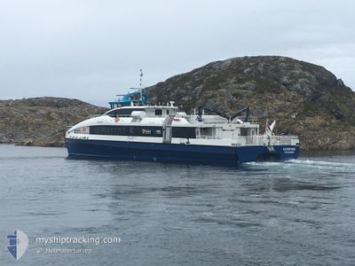
FJORDTIND
High speed craft
Current Trip
NO BOO>
| Time Travelled | 1 h, 25 mins |
|---|---|
| Remaining Time | --- |
| Distance Travelled | 24.12 nm |
| Remaining Distance | --- |
| AVG Speed | 20.1 Knots |
| MAX Speed | 20.1 Knots |
| AVG Wind | 14.2 knots |
| MAX Wind | 17 knots |
| MIN Temp | -5.3°C / 22.46°F |
| MAX Temp | 0.9°C / 33.62°F |
| Draught | 2.3 m |
| Position Received | 2 m ago |
Current Position
| Longitude | --- |
|---|---|
| Latitude | --- |
| Status | Under way using engine |
| Speed | 2.8 Knots |
| Course | 158° |
| Area | Norwegian Sea |
| Station | T-AIS |
| Position Received | 2 m ago |
Info
Information
The current position of FJORDTIND is in Norwegian Sea with coordinates 67.30587° / 13.72378° as reported on 2025-12-11 16:29 by AIS to our vessel tracker app. The vessel's current speed is 2.8 Knots
The vessel FJORDTIND (IMO: 9982392, MMSI: 259026800) is a High speed craft It's sailing under the flag of [NO] Norway.
In this page you can find informations about the vessels current position, last detected port calls, and current voyage information. If the vessels is not in coverage by AIS you will find the latest position.
The current position of FJORDTIND is detected by our AIS receivers and we are not responsible for the reliability of the data. The last position was recorded while the vessel was in Coverage by the Ais receivers of our vessel tracking app.
The current draught of FJORDTIND as reported by AIS is 2.3 meters
Weather
| Temperature | --- |
|---|---|
| Wind Speed | 15 knots |
| Direction | 94° E |
| Pressure | 1008.7 hPa |
| Humidity | 59.9 % |
| Cloud Coverage | --- |
Featured Company
Last Port Calls
| Port | Arrival | Departure | Time In Port |
|---|---|---|---|
| 2025-12-11 15:08 | 2025-12-11 16:06 | 58 m | |
| 2025-12-11 09:45 | 2025-12-11 13:04 | 3 h | |
| 2025-12-11 06:58 | 2025-12-11 07:13 | 14 m | |
| 2025-12-10 18:57 | 2025-12-10 20:04 | 1 h | |
| 2025-12-10 11:04 | 2025-12-10 16:03 | 4 h | |
| 2025-12-10 10:16 | 2025-12-10 10:35 | 18 m | |
| 2025-12-10 07:37 | 2025-12-10 09:04 | 1 h | |
| 2025-12-10 07:02 | 2025-12-10 07:08 | 6 m | |
| 2025-12-10 06:50 | 2025-12-10 06:58 | 8 m | |
| 2025-12-09 18:14 | 2025-12-10 06:20 | 12 h |
Last Trips
| Origin | Departure | Destination | Arrival | Distance | |
|---|---|---|---|---|---|
| 2025-12-11 13:04 | 2025-12-11 15:08 | 34.61 nm | |||
| 2025-12-11 07:13 | 2025-12-11 09:45 | 49.22 nm | |||
| 2025-12-10 20:04 | 2025-12-11 06:58 | 32.12 nm | |||
| 2025-12-10 16:03 | 2025-12-10 18:57 | 49.26 nm | |||
| 2025-12-10 10:35 | 2025-12-10 11:04 | 13.21 nm | |||
| 2025-12-10 09:04 | 2025-12-10 10:16 | 24.88 nm | |||
| 2025-12-10 07:08 | 2025-12-10 07:37 | 13.47 nm | |||
| 2025-12-10 06:58 | 2025-12-10 07:02 | 1.19 nm | |||
| 2025-12-10 06:20 | 2025-12-10 06:50 | 13.28 nm | |||
| 2025-12-09 17:31 | 2025-12-09 18:14 | 18.79 nm |
Events
| Time | Event | Details | Position / Dest | Info |
|---|---|---|---|---|
| 2025-12-11 16:25 | STOP Moving | 11.82 nm, North West of SOR ARNOY |
67.30549 / 13.72396
NO BOO> |
Speed: Course: 187° |
| 2025-12-11 16:02 | START Moving | 13.38 nm, North West of BODOE |
67.40511 / 13.89232
NO BOO> |
Speed: 6.6 kn Course: 221.4° |
| 2025-12-11 15:52 | STOP Moving | 13.23 nm, North West of BODOE |
67.40649 / 13.90219
NO BOO> |
Speed: Course: 205° |
| 2025-12-11 15:30 | START Moving | 7.12 nm, North West of BODOE |
67.39278 / 14.23763
NO BOO> |
Speed: 24.2 kn Course: 307.9° |
| 2025-12-11 15:26 | STOP Moving | 6.84 nm, North West of BODOE |
67.38912 / 14.24544
NO BOO> |
Speed: 0.2 kn Course: 271° |
| 2025-12-11 15:06 | PORT DEPARTURE |
|
67.28952 / 14.36699
NO BOO> |
Speed: 21.4 kn Course: 41° |
| 2025-12-11 15:05 | START Moving |
67.28507 / 14.36769
[NO] BODOE
|
Speed: 6.3 kn Course: 266° |
|
| 2025-12-11 14:11 | STOP Moving |
67.28424 / 14.37231
[NO] BODOE
|
Speed: 0.3 kn Course: 138° |
|
| 2025-12-11 14:08 | PORT ARRIVAL |
|
67.28544 / 14.36515
[NO] BODOE
|
Speed: 6.7 kn Course: 99.5° |
| 2025-12-11 13:50 | START Moving | 6.92 nm, North West of BODOE |
67.38690 / 14.22885
NO BOO> |
Speed: 26.7 kn Course: 240.8° |