

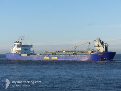
FITNES
Self Discharging Bulk Carrier

Current Trip
| Time Travelled | 1 day |
|---|---|
| Remaining Time | 1 day |
| Distance Travelled | 620.31 nm |
| Remaining Distance | 329.82 nm |
| AVG Speed | 12.7 Knots |
| MAX Speed | 15.7 Knots |
| AVG Wind | 11 knots |
| MAX Wind | 16.3 knots |
| MIN Temp | 4.9°C / 40.82°F |
| MAX Temp | 11.2°C / 52.16°F |
| Draught | 6.5 m |
| Position Received | 1 m ago |
Current Position
| Longitude | --- |
|---|---|
| Latitude | --- |
| Status | Under way using engine |
| Speed | 13.8 Knots |
| Course | 4° |
| Area | North Sea |
| Station | T-AIS |
| Position Received | 1 m ago |
Information
The current position of FITNES is in North Sea with coordinates 60.59603° / 4.19757° as reported on 2025-03-09 19:31 by AIS to our vessel tracker app. The vessel's current speed is 13.8 Knots and is heading at the port of VERDAL. The estimated time of arrival as calculated by MyShipTracking vessel tracking app is 2025-03-10 19:56 LT
The vessel FITNES (IMO: 9490105, MMSI: 305530000) is a Self Discharging Bulk Carrier that was built in 2010 ( 15 years old ). It's sailing under the flag of [AG] Antigua Barbuda.
In this page you can find informations about the vessels current position, last detected port calls, and current voyage information. If the vessels is not in coverage by AIS you will find the latest position.
The current position of FITNES is detected by our AIS receivers and we are not responsible for the reliability of the data. The last position was recorded while the vessel was in Coverage by the Ais receivers of our vessel tracking app.
The current draught of FITNES as reported by AIS is 6.5 meters
Weather
| Temperature | 5.6°C / 42.08°F |
|---|---|
| Wind Speed | 10 knots |
| Direction | 179° S |
| Pressure | 1008.1 hPa |
| Humidity | 95.4 % |
| Cloud Coverage | 100 % |


Featured Company
Last Port Calls
| Port | Arrival | Departure | Time In Port |
|---|---|---|---|
| 2025-03-07 12:31 | 2025-03-07 20:43 | 8 h | |
| 2025-03-07 03:25 | 2025-03-07 12:17 | 8 h | |
| 2025-03-01 02:22 | 2025-03-01 23:59 | 21 h | |
| 2025-02-26 06:21 | 2025-02-26 12:04 | 5 h | |
| 2025-02-23 04:02 | 2025-02-24 05:38 | 1 d | |
| 2025-02-17 12:39 | 2025-02-17 23:13 | 10 h | |
| 2025-02-17 05:28 | 2025-02-17 12:20 | 6 h | |
| 2025-02-15 06:03 | 2025-02-15 16:09 | 10 h | |
| 2025-02-13 02:16 | 2025-02-13 10:52 | 8 h | |
| 2025-02-08 02:50 | 2025-02-08 20:58 | 18 h |
Most Visited Ports (Last year)
| Port | Arrivals | |
|---|---|---|
| 15 | ||
| 7 | ||
| 7 | ||
| 5 | ||
| 5 | ||
| 5 |
Last Trips
| Origin | Departure | Destination | Arrival | Distance | |
|---|---|---|---|---|---|
| 2025-03-07 12:17 | 2025-03-07 12:31 | 0.18 nm | |||
| 2025-03-02 00:59 | 2025-03-07 03:25 | 989.61 nm | |||
| 2025-02-26 13:04 | 2025-03-01 03:22 | 457.22 nm | |||
| 2025-02-24 06:38 | 2025-02-26 07:21 | 501.52 nm | |||
| 2025-02-18 00:13 | 2025-02-23 05:02 | 1026.73 nm | |||
| 2025-02-17 13:20 | 2025-02-17 13:39 | 0.45 nm | |||
| 2025-02-15 17:09 | 2025-02-17 06:28 | 401.37 nm | |||
| 2025-02-13 11:52 | 2025-02-15 07:03 | 406.30 nm | |||
| 2025-02-08 21:58 | 2025-02-13 03:16 | 834.27 nm | |||
| 2025-02-06 06:13 | 2025-02-08 03:50 | 433.93 nm |
Events
| Time | Event | Details | Position / Dest | Info |
|---|---|---|---|---|
| 2025-03-09 00:55 | Change Sea Area | Norwegian part of the North Sea Danish part of the North Sea |
56.44415 / 4.51200
North Sea
NOVER
|
Speed: 13.2 kn Course: 358° |
| 2025-03-08 21:34 | Detected in Sea | Danish part of the North Sea |
55.71456 / 4.33934
North Sea
NOVER
|
Speed: 13.2 kn Course: 9° |
| 2025-03-08 20:09 | Detected in Sea | German part of the North Sea |
55.40205 / 4.25522
North Sea
NOVER
|
Speed: 13.3 kn Course: 7° |
| 2025-03-08 20:09 | Status Changed | Under way using engine Default |
55.40205 / 4.25522
NOVER
|
Speed: 13.4 kn Course: 7° |
| 2025-03-08 19:59 | Status Changed | Default Under way using engine |
55.36299 / 4.24661
NOVER
|
Speed: 13.3 kn Course: 7° |
| 2025-03-08 19:24 | Status Changed | Under way using engine Default |
55.24023 / 4.20648
NOVER
|
Speed: 13.2 kn Course: 20° |
| 2025-03-08 19:20 | Status Changed | Default Under way using engine |
55.22473 / 4.19655
NOVER
|
Speed: 13.3 kn Course: 19° |
| 2025-03-08 19:14 | Detected in Sea | Dutch part of the North Sea |
55.20470 / 4.18373
North Sea
NOVER
|
Speed: 13.3 kn Course: 19° |
| 2025-03-08 19:14 | Status Changed | Under way using engine Default |
55.20470 / 4.18373
NOVER
|
Speed: 13.3 kn Course: 20° |
| 2025-03-08 19:14 | IN Coverage |
55.20470 / 4.18373
North Sea
NOVER
|
Speed: 13.3 kn Course: 19° |