
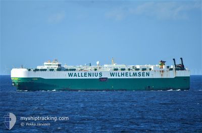
FIGARO
Vehicles Carrier
Current Trip
US NTD
| Time Travelled | 2 days |
|---|---|
| Remaining Time | --- |
| Distance Travelled | 786.02 nm |
| Remaining Distance | --- |
| AVG Speed | 13.4 Knots |
| MAX Speed | 17.8 Knots |
| AVG Wind | 9.3 knots |
| MAX Wind | 18.5 knots |
| MIN Temp | 5.8°C / 42.44°F |
| MAX Temp | 13.3°C / 55.94°F |
| Draught | 9.9 m |
| Position Received | 1 d ago |
Current Position
| Longitude | --- |
|---|---|
| Latitude | --- |
| Status | Under way using engine |
| Speed | 14.3 Knots |
| Course | 327.4° |
| Area | North Pacific Ocean |
| Station | T-AIS |
| Position Received | 1 d ago |
Information
The current position of FIGARO is in North Pacific Ocean with coordinates 36.78370° / -123.03268° as reported on 2025-01-31 22:56 by AIS to our vessel tracker app. The vessel's current speed is 14.3 Knots
The vessel FIGARO (IMO: 9505041, MMSI: 266338000) is a Vehicles Carrier that was built in 2011 ( 14 years old ). It's sailing under the flag of [SE] Sweden.
In this page you can find informations about the vessels current position, last detected port calls, and current voyage information. If the vessels is not in coverage by AIS you will find the latest position.
The current position of FIGARO is detected by our AIS receivers and we are not responsible for the reliability of the data. The last position was recorded while the vessel was in Coverage by the Ais receivers of our vessel tracking app.
The current draught of FIGARO as reported by AIS is 9.9 meters
Weather
| Temperature | 6.3°C / 43.34°F |
|---|---|
| Wind Speed | 15 knots |
| Direction | 270° W |
| Pressure | 1011.8 hPa |
| Humidity | 59.9 % |
| Cloud Coverage | 100 % |
Featured Company
Last Port Calls
| Port | Arrival | Departure | Time In Port |
|---|---|---|---|
| 2025-01-30 12:33 | 2025-01-31 00:41 | 12 h | |
| 2025-01-20 15:49 | 2025-01-21 05:36 | 13 h | |
| 2025-01-15 01:57 | 2025-01-16 01:40 | 23 h | |
| 2025-01-11 18:38 | 2025-01-13 01:21 | 1 d | |
| 2024-12-29 07:52 | 2024-12-30 05:35 | 21 h | |
| 2024-12-23 23:41 | 2024-12-28 16:29 | 4 d | |
| 2024-12-20 03:18 | 2024-12-21 17:29 | 1 d | |
| 2024-12-17 08:44 | 2024-12-18 23:19 | 1 d | |
| 2024-12-05 09:13 | 2024-12-06 01:20 | 16 h | |
| 2024-12-03 21:34 | 2024-12-04 05:30 | 7 h |
Most Visited Ports (Last year)
| Port | Arrivals | |
|---|---|---|
| 4 | ||
| 4 | ||
| 3 | ||
| 3 | ||
| 3 | ||
| 3 |
Last Trips
| Origin | Departure | Destination | Arrival | Distance | |
|---|---|---|---|---|---|
| 2025-01-21 00:36 | 2025-01-30 04:33 | 3111.99 nm | |||
| 2025-01-15 20:40 | 2025-01-20 10:49 | 1524.32 nm | |||
| 2025-01-12 20:21 | 2025-01-14 20:57 | 702.94 nm | |||
| 2024-12-30 05:35 | 2025-01-11 13:38 | 4510.69 nm | |||
| 2024-12-28 17:29 | 2024-12-29 07:52 | 203.81 nm | |||
| 2024-12-21 18:29 | 2024-12-24 00:41 | 627.49 nm | |||
| 2024-12-19 00:19 | 2024-12-20 04:18 | 392.32 nm | |||
| 2024-12-05 20:20 | 2024-12-17 09:44 | 3681.75 nm | |||
| 2024-12-04 00:30 | 2024-12-05 04:13 | 242.21 nm | |||
| 2024-12-02 00:43 | 2024-12-03 16:34 | 409.70 nm |
Events
| Time | Event | Details | Position / Dest | Info |
|---|---|---|---|---|
| 2025-01-31 23:02 | Status Changed | Default Under way using engine |
36.80166 / -123.04732
US NTD
|
Speed: 14.3 kn Course: 327.4° |
| 2025-01-31 22:56 | OUT of Coverage |
36.78370 / -123.03268
North Pacific Ocean
|
Speed: 14.3 kn Course: 327.4° |
|
| 2025-01-31 22:49 | Status Changed | Under way using engine Default |
36.76114 / -123.01434
US NTD
|
Speed: 14.3 kn Course: 326° |
| 2025-01-31 22:39 | Status Changed | Default Under way using engine |
36.72659 / -122.98637
US NTD
|
Speed: 14.3 kn Course: 326.9° |
| 2025-01-31 22:35 | Status Changed | Under way using engine Default |
36.71259 / -122.97500
US NTD
|
Speed: 14.3 kn Course: 327° |
| 2025-01-31 22:28 | Status Changed | Default Under way using engine |
36.68885 / -122.95582
US NTD
|
Speed: 14.4 kn Course: 327.1° |
| 2025-01-31 19:58 | Status Changed | Under way using engine Default |
36.17828 / -122.53584
US NTD
|
Speed: 14.8 kn Course: 326° |
| 2025-01-31 19:49 | Status Changed | Default Under way using engine |
36.14579 / -122.50819
US NTD
|
Speed: 14.7 kn Course: 325.7° |
| 2025-01-31 19:41 | Status Changed | Under way using engine Default |
36.11954 / -122.48607
US NTD
|
Speed: 14.6 kn Course: 325° |
| 2025-01-31 19:29 | Status Changed | Default Under way using engine |
36.07863 / -122.45145
US NTD
|
Speed: 14.2 kn Course: 325.8° |