
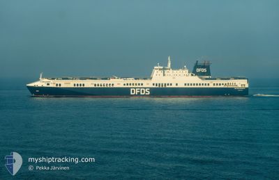
FICARIA SEAWAYS
Ro-Ro Cargo
Current Trip
| Time Travelled | 1 day |
|---|---|
| Remaining Time | 16 mins |
| Distance Travelled | 495.67 nm |
| Remaining Distance | 10.28 nm |
| AVG Speed | 18.7 Knots |
| MAX Speed | 21.9 Knots |
| AVG Wind | 14.1 knots |
| MAX Wind | 27.8 knots |
| MIN Temp | 4.4°C / 39.92°F |
| MAX Temp | 9.3°C / 48.74°F |
| Draught | 7.3 m |
| Position Received | Now |
Current Position
| Longitude | --- |
|---|---|
| Latitude | --- |
| Status | Under way using engine |
| Speed | 17.2 Knots |
| Course | 24° |
| Area | Kattegat |
| Station | T-AIS |
| Position Received | Now |
Info
Information
The current position of FICARIA SEAWAYS is in Kattegat with coordinates 57.64234° / 11.69639° as reported on 2025-03-02 15:10 by AIS to our vessel tracker app. The vessel's current speed is 17.2 Knots and is heading at the port of GOTEBORG. The estimated time of arrival as calculated by MyShipTracking vessel tracking app is 2025-03-02 16:27 LT
The vessel FICARIA SEAWAYS (IMO: 9320568, MMSI: 220464000) is a Ro-Ro Cargo that was built in 2006 ( 19 years old ). It's sailing under the flag of [DK] Denmark.
In this page you can find informations about the vessels current position, last detected port calls, and current voyage information. If the vessels is not in coverage by AIS you will find the latest position.
The current position of FICARIA SEAWAYS is detected by our AIS receivers and we are not responsible for the reliability of the data. The last position was recorded while the vessel was in Coverage by the Ais receivers of our vessel tracking app.
The current draught of FICARIA SEAWAYS as reported by AIS is 7.3 meters
Weather
| Temperature | 4.4°C / 39.92°F |
|---|---|
| Wind Speed | 22 knots |
| Direction | 266° W |
| Pressure | 1022.2 hPa |
| Humidity | 87.1 % |
| Cloud Coverage | 31 % |
Featured Company
Last Port Calls
| Port | Arrival | Departure | Time In Port |
|---|---|---|---|
| 2025-03-01 05:33 | 2025-03-01 13:43 | 8 h | |
| 2025-02-28 00:17 | 2025-02-28 04:52 | 4 h | |
| 2025-02-27 08:28 | 2025-02-27 18:15 | 9 h | |
| 2025-02-25 22:01 | 2025-02-26 04:34 | 6 h | |
| 2025-02-23 16:24 | 2025-02-24 20:38 | 1 d | |
| 2025-02-22 04:57 | 2025-02-22 13:22 | 8 h | |
| 2025-02-21 00:15 | 2025-02-21 04:41 | 4 h | |
| 2025-02-20 08:26 | 2025-02-20 18:23 | 9 h | |
| 2025-02-18 22:09 | 2025-02-19 05:15 | 7 h | |
| 2025-02-16 16:30 | 2025-02-17 20:10 | 1 d |
Last Trips
| Origin | Departure | Destination | Arrival | Distance | |
|---|---|---|---|---|---|
| 2025-02-28 04:52 | 2025-03-01 05:33 | 490.46 nm | |||
| 2025-02-27 18:15 | 2025-02-28 00:17 | 115.56 nm | |||
| 2025-02-26 04:34 | 2025-02-27 08:28 | 500.24 nm | |||
| 2025-02-24 20:38 | 2025-02-25 22:01 | 501.36 nm | |||
| 2025-02-22 13:22 | 2025-02-23 16:24 | 500.52 nm | |||
| 2025-02-21 04:41 | 2025-02-22 04:57 | 488.75 nm | |||
| 2025-02-20 18:23 | 2025-02-21 00:15 | 115.39 nm | |||
| 2025-02-19 05:15 | 2025-02-20 08:26 | 501.26 nm | |||
| 2025-02-17 20:10 | 2025-02-18 22:09 | 501.89 nm | |||
| 2025-02-15 13:00 | 2025-02-16 16:30 | 500.71 nm |
Events
| Time | Event | Details | Position / Dest | Info |
|---|---|---|---|---|
| 2025-03-02 14:04 | Change Sea Area | Swedish part of the Kattegat Danish part of the Kattegat |
57.73092 / 11.14747
Kattegat
GBG SWE
|
Speed: 19.7 kn Course: 110.9° |
| 2025-03-02 13:37 | Change Sea Area | Danish part of the Kattegat Danish part of the Skaggerak |
57.78029 / 10.88562
Kattegat
GBG SWE
|
Speed: 20.4 kn Course: 107.5° |
| 2025-03-02 09:19 | Change Sea Area | Danish part of the Skaggerak Danish part of the North Sea |
57.26182 / 8.38659
Skaggerak
GBG SWE
|
Speed: 20.7 kn Course: 62.8° |
| 2025-03-02 01:17 | Change Sea Area | Danish part of the North Sea German part of the North Sea |
55.46346 / 4.67352
North Sea
GBG SWE
|
Speed: 20 kn Course: 49.3° |
| 2025-03-02 00:38 | Change Sea Area | German part of the North Sea Dutch part of the North Sea |
55.32359 / 4.38080
North Sea
GBG SWE
|
Speed: 20.3 kn Course: 49.9° |
| 2025-03-02 00:01 | Change Sea Area | Dutch part of the North Sea United Kingdom part of the North Sea |
55.18850 / 4.09878
North Sea
GBG SWE
|
Speed: 20.4 kn Course: 50.4° |
| 2025-03-02 00:00 | Status Changed | Under way using engine Default |
55.18415 / 4.08960
GBG SWE
|
Speed: 20.5 kn Course: 49° |
| 2025-03-01 23:48 | IN Coverage |
55.18850 / 4.09878
North Sea
GBG SWE
|
Speed: 20.4 kn Course: 50.4° |
|
| 2025-03-01 20:02 | Status Changed | Default Under way using engine |
54.33496 / 2.26636
GBG SWE
|
Speed: 20.7 kn Course: 56.5° |
| 2025-03-01 19:51 | OUT of Coverage |
54.30101 / 2.17595
North Sea
GBG SWE
|
Speed: 20.7 kn Course: 56.5° |