
FENCHURCH
Sailing
Current Trip
Unknown
| Time Travelled | 8 days |
|---|---|
| Remaining Time | --- |
| Distance Travelled | 30.75 nm |
| Remaining Distance | --- |
| AVG Speed | 6.7 Knots |
| MAX Speed | 7.3 Knots |
| AVG Wind | 5.3 knots |
| MAX Wind | 8.3 knots |
| MIN Temp | 18.4°C / 65.12°F |
| MAX Temp | 27.9°C / 82.22°F |
| Draught | --- |
| Position Received | 2 d ago |
Current Position
| Longitude | --- |
|---|---|
| Latitude | --- |
| Status | Default |
| Speed | 0.1 Knots |
| Course | --- |
| Area | South Atlantic Ocean |
| Station | T-AIS |
| Position Received | 2 d ago |
Info
Information
The current position of FENCHURCH is in South Atlantic Ocean with coordinates -33.94853° / -58.36427° as reported on 2026-03-20 02:36 by AIS to our vessel tracker app. The vessel's current speed is 0.1 Knots
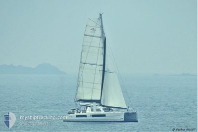
The vessel FENCHURCH (MMSI: 232010625) is a Sailing It's sailing under the flag of [GB] United Kingdom.
In this page you can find informations about the vessels current position, last detected port calls, and current voyage information. If the vessels is not in coverage by AIS you will find the latest position.
The current position of FENCHURCH is detected by our AIS receivers and we are not responsible for the reliability of the data. The last position was recorded while the vessel was in Coverage by the Ais receivers of our vessel tracking app.
Weather
| Temperature | 19.2°C / 66.56°F |
|---|---|
| Wind Speed | 9 knots |
| Direction | 76° ENE |
| Pressure | 1009.7 hPa |
| Humidity | 57.9 % |
| Cloud Coverage | --- |
Featured Company
Last Port Calls
| Port | Arrival | Departure | Time In Port |
|---|---|---|---|
| 2026-03-11 20:13 | 2026-03-14 14:43 | 2 d |
Most Visited Ports (Last year)
| Port | Arrivals | |
|---|---|---|
| 1 |
Last Trips
| Origin | Departure | Destination | Arrival | Distance |
|---|
Events
| Time | Event | Details | Position / Dest | Info |
|---|---|---|---|---|
| 2026-03-20 02:36 | OUT of Coverage |
-33.94853 / -58.36427
South Atlantic Ocean
|
Speed: 0.1 kn Course: 511° |
|
| 2026-03-20 00:42 | IN Coverage |
-33.94866 / -58.36429
South Atlantic Ocean
|
Speed: Course: 172.9° |
|
| 2026-03-15 07:44 | OUT of Coverage |
-33.94847 / -58.36430
South Atlantic Ocean
|
Speed: Course: 9.7° |
|
| 2026-03-15 05:26 | IN Coverage |
-33.94841 / -58.36430
South Atlantic Ocean
|
Speed: Course: 342° |
|
| 2026-03-14 15:45 | OUT of Coverage |
-34.31824 / -58.53432
South Atlantic Ocean
|
Speed: 7.2 kn Course: 344.9° |
|
| 2026-03-14 14:43 | START Moving | --- |
-34.42477 / -58.54060
|
Speed: 6.5 kn Course: 356.2° |
| 2026-03-14 14:43 | PORT DEPARTURE |
|
-34.42477 / -58.54060
|
Speed: 6.4 kn Course: 357.3° |
| 2026-03-13 05:53 | IN Coverage |
-34.43497 / -58.54075
South Atlantic Ocean
[AR] SAN FERNANDO
|
Speed: 0.1 kn Course: 335.9° |
|
| 2026-03-13 02:44 | OUT of Coverage |
-34.43503 / -58.54070
South Atlantic Ocean
[AR] SAN FERNANDO
|
Speed: Course: 296.7° |