
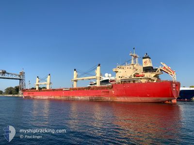
FEDERAL BERING
Cargo
Current Trip
| Trip Time | 16 h, 31 mins |
|---|---|
| Trip Distance | 218.12 nm |
| AVG Speed | 14.3 Knots |
| MAX Speed | 14.6 Knots |
| Draught | 6.5 m |
| AVG Wind | 12.8 knots |
| MAX Wind | 20.9 knots |
| MIN Temp | 4.7°C / 40.46°F |
| MAX Temp | 12°C / 53.6°F |
| Position Received | 6 d ago |
Current Position
| Longitude | -83.66545° |
|---|---|
| Latitude | 45.71170° |
| Status | Under way using engine |
| Speed | 14.5 Knots |
| Course | 325.8° |
| Area | Gulf of St-Lawrence |
| Station | T-AIS |
| Position Received | 6 d ago |
Info
Information
The current position of FEDERAL BERING is in Gulf of St-Lawrence with coordinates 45.71170° / -83.66545° as reported on 2024-05-07 12:23 by AIS to our vessel tracker app. The vessel's current speed is 14.5 Knots and is currently inside the port of THUNDER BAY.
The vessel FEDERAL BERING (IMO: 9697832, MMSI: 538006432) is a Cargo It's sailing under the flag of [MH] Marshall Is.
In this page you can find informations about the vessels current position, last detected port calls, and current voyage information. If the vessels is not in coverage by AIS you will find the latest position.
The current position of FEDERAL BERING is detected by our AIS receivers and we are not responsible for the reliability of the data. The last position was recorded while the vessel was in Coverage by the Ais receivers of our vessel tracking app.
The current draught of FEDERAL BERING as reported by AIS is 6.5 meters
Weather
| Temperature | 6.5°C / 43.7°F |
|---|---|
| Wind Speed | 9 knots |
| Direction | 334° NNW |
| Pressure | 1010.8 hPa |
| Humidity | 58.9 % |
| Cloud Coverage | 11 % |
Featured Company
Last Port Calls
| Port | Arrival | Departure | Time In Port |
|---|---|---|---|
| 2024-05-08 14:26 | |||
| 2024-05-07 19:51 | 2024-05-07 21:55 | 2 h | |
| 2024-05-04 10:13 | 2024-05-06 18:51 | 2 d | |
| 2024-05-01 15:40 | 2024-05-04 02:33 | 2 d | |
| 2024-04-30 19:50 | 2024-04-30 20:24 | 34 m | |
| 2024-04-28 20:45 | 2024-04-30 16:57 | 1 d | |
| 2024-04-27 11:43 | 2024-04-27 12:19 | 35 m | |
| 2024-04-06 10:30 | 2024-04-13 16:49 | 7 d | |
| 2024-04-03 14:38 | 2024-04-05 21:42 | 2 d | |
| 2024-03-13 08:01 | 2024-03-28 12:13 | 15 d |
Most Visited Ports (Last year)
| Port | Arrivals | |
|---|---|---|
| 7 | ||
| 7 | ||
| 5 | ||
| 3 | ||
| 3 | ||
| 3 |
Last Trips
| Origin | Departure | Destination | Arrival | Distance | |
|---|---|---|---|---|---|
| 2024-05-07 17:55 | 2024-05-08 10:26 | 218.12 nm | |||
| 2024-05-06 14:51 | 2024-05-07 15:51 | 283.94 nm | |||
| 2024-05-03 22:33 | 2024-05-04 06:13 | 88.39 nm | |||
| 2024-04-30 16:24 | 2024-05-01 11:40 | 161.03 nm | |||
| 2024-04-30 12:57 | 2024-04-30 15:50 | 27.47 nm | |||
| 2024-04-27 08:19 | 2024-04-28 16:45 | 316.30 nm | |||
| 2024-04-13 18:49 | 2024-04-27 07:43 | 3540.60 nm | |||
| 2024-04-05 23:42 | 2024-04-06 12:30 | 155.72 nm | |||
| 2024-03-28 14:13 | 2024-04-03 16:38 | 1129.94 nm | |||
| 2024-02-18 04:38 | 2024-03-13 10:01 | 6852.52 nm |
Events
| Time | Event | Details | Position / Dest | Info |
|---|---|---|---|---|
| 2024-05-08 14:26 | PORT ARRIVAL |
|
48.40680 / -89.21511
[CA] THUNDER BAY
|
Speed: 12.8 kn Course: 321° |
| 2024-05-07 21:55 | PORT DEPARTURE |
|
46.60114 / -84.71697
THUNDERBAY
|
Speed: Course: 266° |
| 2024-05-07 20:52 | STOP Moving |
46.50298 / -84.35120
[CA] SAULT STE MARIE
|
Speed: Course: 266° |
|
| 2024-05-07 19:51 | PORT ARRIVAL |
|
46.50315 / -84.34717
[CA] SAULT STE MARIE
|
Speed: 3.2 kn Course: 334° |
| 2024-05-07 12:53 | Status Changed | Default Under way using engine |
45.81234 / -83.76345
THUNDERBAY
|
Speed: 14.5 kn Course: 325.8° |
| 2024-05-07 12:23 | OUT of Coverage |
45.71170 / -83.66545
Gulf of St-Lawrence
THUNDERBAY
|
Speed: 14.5 kn Course: 325.8° |
|
| 2024-05-07 11:30 | Status Changed | Under way using engine Default |
45.53341 / -83.49683
THUNDERBAY
|
Speed: 14.4 kn Course: 327° |
| 2024-05-07 11:04 | Status Changed | Default Under way using engine |
45.44694 / -83.41550
THUNDERBAY
|
Speed: 14.4 kn Course: 326.1° |
| 2024-05-07 11:00 | Status Changed | Under way using engine Default |
45.43489 / -83.40422
THUNDERBAY
|
Speed: 14.4 kn Course: 327° |
| 2024-05-07 11:00 | IN Coverage |
45.43489 / -83.40422
Gulf of St-Lawrence
THUNDERBAY
|
Speed: 14.4 kn Course: 326.1° |