
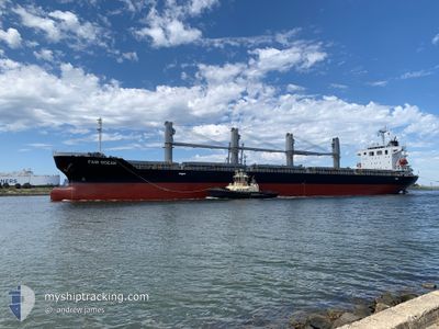
FAIR OCEAN
Cargo
Current Trip
DRIFTING OPL
| Time Travelled | 3 days |
|---|---|
| Remaining Time | --- |
| Distance Travelled | 253.27 nm |
| Remaining Distance | --- |
| AVG Speed | 10 Knots |
| MAX Speed | 14.8 Knots |
| AVG Wind | 10 knots |
| MAX Wind | 25 knots |
| MIN Temp | 15.1°C / 59.18°F |
| MAX Temp | 19.5°C / 67.1°F |
| Draught | 6.1 m |
| Position Received | 1 d ago |
Current Position
| Longitude | 129.62183° |
|---|---|
| Latitude | 34.16268° |
| Status | Under way using engine |
| Speed | 11 Knots |
| Course | 221° |
| Area | Japan Sea |
| Station | T-AIS |
| Position Received | 1 d ago |
Info
Information
The current position of FAIR OCEAN is in Japan Sea with coordinates 34.16268° / 129.62183° as reported on 2024-04-29 06:41 by AIS to our vessel tracker app. The vessel's current speed is 11 Knots
The vessel FAIR OCEAN (IMO: 9652480, MMSI: 357279000) is a Cargo It's sailing under the flag of [PA] Panama.
In this page you can find informations about the vessels current position, last detected port calls, and current voyage information. If the vessels is not in coverage by AIS you will find the latest position.
The current position of FAIR OCEAN is detected by our AIS receivers and we are not responsible for the reliability of the data. The last position was recorded while the vessel was in Coverage by the Ais receivers of our vessel tracking app.
The current draught of FAIR OCEAN as reported by AIS is 6.1 meters
Weather
| Temperature | 17.1°C / 62.78°F |
|---|---|
| Wind Speed | 8 knots |
| Direction | 147° SSE |
| Pressure | 1008.2 hPa |
| Humidity | 87.4 % |
| Cloud Coverage | 100 % |
Featured Company
Last Trips
| Origin | Departure | Destination | Arrival | Distance | |
|---|---|---|---|---|---|
| 2024-04-04 07:45 | 2024-04-20 07:16 | 2029.11 nm | |||
| 2024-03-28 08:40 | 2024-03-31 14:37 | 924.34 nm | |||
| 2024-03-14 12:09 | 2024-03-25 08:37 | 2838.39 nm | |||
| 2024-02-24 12:51 | 2024-03-10 12:20 | 1366.36 nm | |||
| 2024-01-29 18:15 | 2024-02-17 08:59 | 5037.67 nm |
Events
| Time | Event | Details | Position / Dest | Info |
|---|---|---|---|---|
| 2024-04-29 19:18 | STOP Moving |
34.16088 / 128.36095
DRIFTING OPL
|
Speed: 0.2 kn Course: 7° |
|
| 2024-04-29 06:48 | Status Changed | Default Under way using engine |
34.14442 / 129.60274
DRIFTING OPL
|
Speed: 11 kn Course: 221° |
| 2024-04-29 06:41 | OUT of Coverage |
34.16268 / 129.62183
Japan Sea
|
Speed: 11 kn Course: 221° |
|
| 2024-04-29 06:40 | Status Changed | Under way using engine Default |
34.16498 / 129.62425
DRIFTING OPL
|
Speed: 11 kn Course: 221° |
| 2024-04-29 06:36 | IN Coverage |
34.16268 / 129.62183
Japan Sea
|
Speed: 11 kn Course: 221° |
|
| 2024-04-28 22:36 | START Moving |
34.19408 / 129.80875
DRIFTING OPL
|
Speed: 3.2 kn Course: 188° |
|
| 2024-04-28 08:52 | Status Changed | Default Not under command |
34.40264 / 129.80261
DRIFTING OPL
|
Speed: 0.3 kn Course: 107° |
| 2024-04-28 08:50 | STOP Moving | 18.94 nm, South East of HITOE |
34.40269 / 129.80245
DRIFTING OPL
|
Speed: 0.3 kn Course: 107° |
| 2024-04-28 08:50 | OUT of Coverage |
34.40269 / 129.80245
Japan Sea
|
Speed: 0.3 kn Course: 109.6° |
|
| 2024-04-28 08:26 | Status Changed | Not under command Default |
34.40300 / 129.79815
DRIFTING OPL
|
Speed: 0.9 kn Course: 92° |