
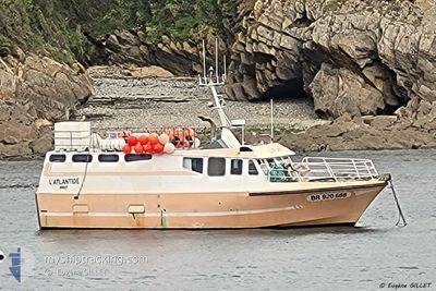
F/V L'ATLANTIDE
Fishing
Current Trip
LE CONQUET
| Time Travelled | --- |
|---|---|
| Remaining Time | --- |
| Distance Travelled | 165.64 nm |
| Remaining Distance | --- |
| AVG Speed | 7.2 Knots |
| MAX Speed | 10 Knots |
| AVG Wind | 13.7 knots |
| MAX Wind | 24 knots |
| MIN Temp | 11°C / 51.8°F |
| MAX Temp | 12.7°C / 54.86°F |
| Draught | 2 m |
| Position Received | 3 d ago |
Current Position
| Longitude | -4.77904° |
|---|---|
| Latitude | 48.36000° |
| Status | Default |
| Speed | |
| Course | --- |
| Area | Celtic Sea |
| Station | T-AIS |
| Position Received | 3 d ago |
Info
Information
The current position of F/V L'ATLANTIDE is in Celtic Sea with coordinates 48.36000° / -4.77904° as reported on 2024-05-06 08:52 by AIS to our vessel tracker app. The vessel's current speed is 0 Knots
The vessel F/V L'ATLANTIDE (MMSI: 227312180) is a Fishing It's sailing under the flag of [FR] France.
In this page you can find informations about the vessels current position, last detected port calls, and current voyage information. If the vessels is not in coverage by AIS you will find the latest position.
The current position of F/V L'ATLANTIDE is detected by our AIS receivers and we are not responsible for the reliability of the data. The last position was recorded while the vessel was in Coverage by the Ais receivers of our vessel tracking app.
The current draught of F/V L'ATLANTIDE as reported by AIS is 2 meters
Weather
| Temperature | 12.3°C / 54.14°F |
|---|---|
| Wind Speed | 15 knots |
| Direction | 354° N |
| Pressure | 1006.2 hPa |
| Humidity | 80.4 % |
| Cloud Coverage | 84 % |
Featured Company
Last Port Calls
Most Visited Ports (Last year)
| Port | Arrivals | |
|---|---|---|
| 1 |
Last Trips
| Origin | Departure | Destination | Arrival | Distance |
|---|
Events
| Time | Event | Details | Position / Dest | Info |
|---|---|---|---|---|
| 2024-05-06 08:52 | OUT of Coverage |
48.36000 / -4.77904
Celtic Sea
|
Speed: Course: 297.9° |
|
| 2024-05-06 08:52 | IN Coverage |
48.36000 / -4.77904
Celtic Sea
|
Speed: Course: 297.9° |
|
| 2024-05-05 11:59 | OUT of Coverage |
48.34053 / -4.82688
Celtic Sea
|
Speed: 10.1 kn Course: 51.2° |
|
| 2024-05-05 10:40 | IN Coverage |
48.23826 / -5.07291
Celtic Sea
|
Speed: 8.7 kn Course: 56.7° |
|
| 2024-05-05 09:21 | OUT of Coverage |
48.21021 / -5.08383
Celtic Sea
|
Speed: 2.9 kn Course: 189.4° |
|
| 2024-05-05 09:07 | IN Coverage |
48.21628 / -5.09950
Celtic Sea
|
Speed: 3.2 kn Course: 90.2° |
|
| 2024-05-05 03:00 | OUT of Coverage |
48.29718 / -5.10078
Celtic Sea
|
Speed: 7.8 kn Course: 266.2° |
|
| 2024-05-05 01:17 | IN Coverage |
48.35887 / -4.78632
Celtic Sea
|
Speed: 4.6 kn Course: 238.7° |
|
| 2024-05-03 12:30 | OUT of Coverage |
48.35983 / -4.78120
Celtic Sea
|
Speed: 1.6 kn Course: 93.5° |
|
| 2024-05-03 08:16 | IN Coverage |
48.67506 / -5.18172
Celtic Sea
|
Speed: 2.3 kn Course: 45.9° |