
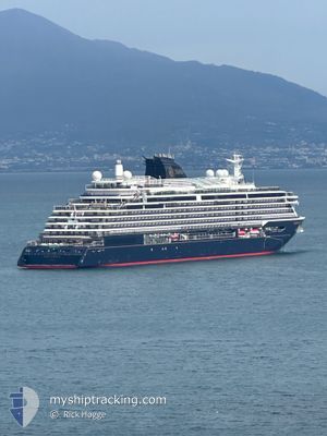
EXPLORA II
Passenger
Current Trip
| Time Travelled | 5 h, 10 mins |
|---|---|
| Remaining Time | 5 h, 32 mins |
| Distance Travelled | 42.97 nm |
| Remaining Distance | 74.23 nm |
| AVG Speed | 8.5 Knots |
| MAX Speed | 10.1 Knots |
| AVG Wind | 17.1 knots |
| MAX Wind | 18 knots |
| MIN Temp | 27.1°C / 80.78°F |
| MAX Temp | 27.3°C / 81.14°F |
| Draught | 7.1 m |
| Position Received | 3 h, 52 m ago |
Current Position
| Longitude | --- |
|---|---|
| Latitude | --- |
| Status | Under way using engine |
| Speed | 9.3 Knots |
| Course | 267.9° |
| Area | Caribbean Sea |
| Station | T-AIS |
| Position Received | 3 h, 52 m ago |
Info
Information
The current position of EXPLORA II is in Caribbean Sea with coordinates 13.10703° / -59.79015° as reported on 2025-12-15 00:47 by AIS to our vessel tracker app. The vessel's current speed is 9.3 Knots and is heading at the port of BEQUIA. The estimated time of arrival as calculated by MyShipTracking vessel tracking app is 2025-12-15 06:11 LT
The vessel EXPLORA II (IMO: 9869887, MMSI: 256798000) is a Passenger It's sailing under the flag of [MT] Malta.
In this page you can find informations about the vessels current position, last detected port calls, and current voyage information. If the vessels is not in coverage by AIS you will find the latest position.
The current position of EXPLORA II is detected by our AIS receivers and we are not responsible for the reliability of the data. The last position was recorded while the vessel was in Coverage by the Ais receivers of our vessel tracking app.
The current draught of EXPLORA II as reported by AIS is 7.1 meters
Weather
| Temperature | 27.1°C / 80.78°F |
|---|---|
| Wind Speed | 17 knots |
| Direction | 98° E |
| Pressure | 1013.7 hPa |
| Humidity | 68.5 % |
| Cloud Coverage | 81 % |
Featured Company
Last Port Calls
| Port | Arrival | Departure | Time In Port |
|---|---|---|---|
| 2025-12-14 05:30 | 2025-12-14 19:29 | 13 h | |
| 2025-12-12 06:57 | 2025-12-12 18:51 | 11 h | |
| 2025-12-11 06:41 | 2025-12-11 18:40 | 11 h | |
| 2025-12-09 08:59 | 2025-12-09 18:09 | 9 h | |
| 2025-12-08 07:04 | 2025-12-08 17:21 | 10 h | |
| 2025-12-05 05:54 | 2025-12-05 18:49 | 12 h | |
| 2025-12-04 07:49 | 2025-12-04 17:06 | 9 h | |
| 2025-12-02 07:35 | 2025-12-02 17:23 | 9 h | |
| 2025-12-01 07:03 | 2025-12-01 18:11 | 11 h | |
| 2025-11-30 06:52 | 2025-11-30 17:48 | 10 h |
Last Trips
| Origin | Departure | Destination | Arrival | Distance | |
|---|---|---|---|---|---|
| 2025-12-12 18:51 | 2025-12-14 05:30 | 186.47 nm | |||
| 2025-12-11 18:40 | 2025-12-12 06:57 | 134.91 nm | |||
| 2025-12-09 18:09 | 2025-12-11 06:41 | 189.24 nm | |||
| 2025-12-08 17:21 | 2025-12-09 08:59 | 265.63 nm | |||
| 2025-12-05 18:49 | 2025-12-08 07:04 | 1002.51 nm | |||
| 2025-12-04 17:06 | 2025-12-05 05:54 | 165.00 nm | |||
| 2025-12-02 17:23 | 2025-12-04 07:49 | 696.45 nm | |||
| 2025-12-01 18:11 | 2025-12-02 07:35 | 173.82 nm | |||
| 2025-11-30 17:48 | 2025-12-01 07:03 | 218.46 nm | |||
| 2025-11-28 19:32 | 2025-11-30 06:52 | 521.90 nm |
Events
| Time | Event | Details | Position / Dest | Info |
|---|---|---|---|---|
| 2025-12-15 00:49 | Status Changed | Default Under way using engine |
13.10697 / -59.79637
VCBQU
|
Speed: 9.3 kn Course: 267.9° |
| 2025-12-15 00:47 | OUT of Coverage |
13.10703 / -59.79015
Caribbean Sea
VCBQU
|
Speed: 9.3 kn Course: 267.9° |
|
| 2025-12-15 00:07 | Draught Changed | 7.1 7 |
13.10767 / -59.70083
VCBQU
|
Speed: 5.7 kn Course: 270.2° |
| 2025-12-15 00:07 | Destination Changed | VCBQU VCKTN |
13.10767 / -59.70083
VCBQU
|
Speed: 5.7 kn Course: 270.2° |
| 2025-12-15 00:07 | ETA Changed | 2025/12/15 10:48 |
13.10767 / -59.70083
VCBQU
|
Speed: 5.7 kn Course: 270.2° |
| 2025-12-14 23:49 | Status Changed | Under way using engine Default |
13.10745 / -59.67058
VCKTN
|
Speed: 6 kn Course: 269° |
| 2025-12-14 23:38 | Status Changed | Default Under way using engine |
13.10833 / -59.65167
VCKTN
|
Speed: 6 kn Course: 269.7° |
| 2025-12-14 23:35 | Status Changed | Under way using engine Default |
13.10858 / -59.64528
VCKTN
|
Speed: 5 kn Course: -1° |
| 2025-12-14 23:29 | START Moving | 0.3 nm, West of BRIDGETOWN |
13.10833 / -59.63667
VCKTN
|
Speed: 5 kn Course: -1° |
| 2025-12-14 23:29 | PORT DEPARTURE |
|
13.10833 / -59.63667
VCKTN
|
Speed: 1 kn Course: -1° |