

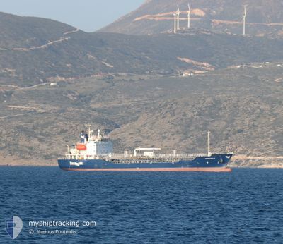
EVIAPETROL IV
Oil/Chemical Tanker

Current Trip
GRLVR
| Time Travelled | 6 h, 50 mins |
|---|---|
| Remaining Time | --- |
| Distance Travelled | 28.31 nm |
| Remaining Distance | --- |
| AVG Speed | 11.6 Knots |
| MAX Speed | 11.9 Knots |
| AVG Wind | 4.8 knots |
| MAX Wind | 8 knots |
| MIN Temp | 16.4°C / 61.52°F |
| MAX Temp | 17.1°C / 62.78°F |
| Draught | 5.6 m |
| Position Received | 4 h, 21 m ago |
Current Position
| Longitude | --- |
|---|---|
| Latitude | --- |
| Status | Under way sailing |
| Speed | 11.7 Knots |
| Course | 302.1° |
| Area | Aegean Sea |
| Station | T-AIS |
| Position Received | 4 h, 21 m ago |
Information
The current position of EVIAPETROL IV is in Aegean Sea with coordinates 38.19631° / 24.10879° as reported on 2025-03-27 17:40 by AIS to our vessel tracker app. The vessel's current speed is 11.7 Knots
The vessel EVIAPETROL IV (IMO: 9301689, MMSI: 241262000) is a Oil/Chemical Tanker that was built in 2005 ( 20 years old ). It's sailing under the flag of [GR] Greece.
In this page you can find informations about the vessels current position, last detected port calls, and current voyage information. If the vessels is not in coverage by AIS you will find the latest position.
The current position of EVIAPETROL IV is detected by our AIS receivers and we are not responsible for the reliability of the data. The last position was recorded while the vessel was in Coverage by the Ais receivers of our vessel tracking app.
The current draught of EVIAPETROL IV as reported by AIS is 5.6 meters
Weather
| Temperature | 13.4°C / 56.12°F |
|---|---|
| Wind Speed | 1 knots |
| Direction | 228° SW |
| Pressure | 1003.9 hPa |
| Humidity | 81.4 % |
| Cloud Coverage | 80 % |


Featured Company
Last Port Calls
| Port | Arrival | Departure | Time In Port |
|---|---|---|---|
| 2025-03-27 07:21 | 2025-03-27 17:11 | 9 h | |
| 2025-03-21 07:43 | 2025-03-22 07:38 | 23 h | |
| 2025-03-10 07:28 | 2025-03-10 16:16 | 8 h | |
| 2025-03-06 08:12 | 2025-03-06 17:21 | 9 h | |
| 2025-03-01 07:17 | 2025-03-01 13:28 | 6 h | |
| 2025-02-21 07:37 | 2025-02-21 16:34 | 8 h | |
| 2025-02-19 09:55 | 2025-02-20 11:54 | 1 d | |
| 2025-02-18 07:44 | 2025-02-18 16:38 | 8 h | |
| 2025-02-15 07:31 | 2025-02-15 16:37 | 9 h | |
| 2025-02-06 07:56 | 2025-02-07 07:41 | 23 h |
Last Trips
| Origin | Departure | Destination | Arrival | Distance | |
|---|---|---|---|---|---|
| 2025-03-22 07:38 | 2025-03-27 07:21 | 323.48 nm | |||
| 2025-03-10 16:16 | 2025-03-21 07:43 | 534.66 nm | |||
| 2025-03-06 17:21 | 2025-03-10 07:28 | 379.24 nm | |||
| 2025-03-01 13:28 | 2025-03-06 08:12 | 211.44 nm | |||
| 2025-02-21 16:34 | 2025-03-01 07:17 | 552.21 nm | |||
| 2025-02-20 11:54 | 2025-02-21 07:37 | 46.18 nm | |||
| 2025-02-18 16:38 | 2025-02-19 09:55 | 41.79 nm | |||
| 2025-02-15 16:37 | 2025-02-18 07:44 | 467.82 nm | |||
| 2025-02-07 07:41 | 2025-02-15 07:31 | 351.68 nm | |||
| 2025-02-03 16:44 | 2025-02-06 07:56 | 19.12 nm |
Events
| Time | Event | Details | Position / Dest | Info |
|---|---|---|---|---|
| 2025-03-27 19:18 | STOP Moving | 1.16 nm, South West of ALIVERI |
38.37829 / 24.02947
GRLVR
|
Speed: 0.2 kn Course: 88° |
| 2025-03-27 17:52 | Status Changed | Default Under way sailing |
38.22580 / 24.07333
GRLVR
|
Speed: 11.7 kn Course: 302.1° |
| 2025-03-27 17:40 | OUT of Coverage |
38.19631 / 24.10879
Aegean Sea
GRLVR
|
Speed: 11.7 kn Course: 302.1° |
|
| 2025-03-27 15:29 | Draught Changed | 5.6 4.7 |
37.77804 / 24.10807
GRLVR
|
Speed: 11.3 kn Course: 13.3° |
| 2025-03-27 15:29 | Destination Changed | GRLVR GRLAV |
37.77804 / 24.10807
GRLVR
|
Speed: 11.3 kn Course: 13.3° |
| 2025-03-27 15:29 | ETA Changed | 2025/03/27 19:00 2025/03/25 21:00 |
37.77804 / 24.10807
GRLVR
|
Speed: 11.3 kn Course: 13.3° |
| 2025-03-27 15:11 | PORT DEPARTURE |
|
37.73976 / 24.07864
GRLAV
|
Speed: 5.8 kn Course: 111° |
| 2025-03-27 15:09 | IN Coverage |
37.74062 / 24.07586
Aegean Sea
[GR] SYRI
|
Speed: 5.8 kn Course: 111.9° |
|
| 2025-03-27 05:37 | STOP Moving |
37.74242 / 24.07075
[GR] SYRI
|
Speed: Course: 48° |
|
| 2025-03-27 05:23 | OUT of Coverage |
37.74167 / 24.07116
Aegean Sea
[GR] SYRI
|
Speed: 1.5 kn Course: 340.2° |