

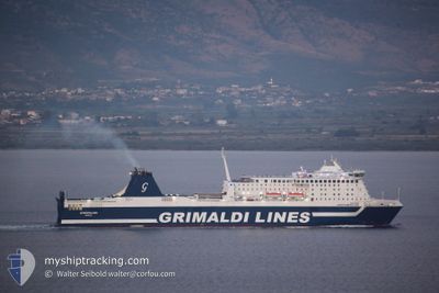
EUROPALINK
Ro-Ro/Passenger Ship

Current Trip
| Time Travelled | 7 days |
|---|---|
| Remaining Time | 5 h, 49 mins |
| Distance Travelled | 1296.92 nm |
| Remaining Distance | 104.04 nm |
| AVG Speed | 16.4 Knots |
| MAX Speed | 18.4 Knots |
| AVG Wind | 9.4 knots |
| MAX Wind | 38 knots |
| MIN Temp | 9.4°C / 48.92°F |
| MAX Temp | 18.1°C / 64.58°F |
| Draught | 7.1 m |
| Position Received | 22 m ago |
Current Position
| Longitude | --- |
|---|---|
| Latitude | --- |
| Status | Under way using engine |
| Speed | 17 Knots |
| Course | 108.4° |
| Area | Adriatic Sea |
| Station | T-AIS |
| Position Received | 22 m ago |
Information
The current position of EUROPALINK is in Adriatic Sea with coordinates 40.57274° / 18.63558° as reported on 2025-03-28 14:10 by AIS to our vessel tracker app. The vessel's current speed is 17 Knots and is heading at the port of IGOUMENITSA. The estimated time of arrival as calculated by MyShipTracking vessel tracking app is 2025-03-28 22:21 LT
The vessel EUROPALINK (IMO: 9319454, MMSI: 247415800) is a Ro-Ro/Passenger Ship that was built in 2007 ( 18 years old ). It's sailing under the flag of [IT] Italy.
In this page you can find informations about the vessels current position, last detected port calls, and current voyage information. If the vessels is not in coverage by AIS you will find the latest position.
The current position of EUROPALINK is detected by our AIS receivers and we are not responsible for the reliability of the data. The last position was recorded while the vessel was in Coverage by the Ais receivers of our vessel tracking app.
The current draught of EUROPALINK as reported by AIS is 7.1 meters
Weather
| Temperature | 14.5°C / 58.1°F |
|---|---|
| Wind Speed | 22 knots |
| Direction | 169° S |
| Pressure | 1002.4 hPa |
| Humidity | 79.3 % |
| Cloud Coverage | 54 % |


Featured Company
Last Port Calls
| Port | Arrival | Departure | Time In Port |
|---|---|---|---|
| 2025-03-21 08:20 | 2025-03-21 13:21 | 5 h | |
| 2025-03-16 08:36 | 2025-03-16 13:05 | 4 h | |
| 2025-03-09 08:30 | 2025-03-09 13:02 | 4 h | |
| 2025-03-08 09:13 | 2025-03-08 13:05 | 3 h | |
| 2025-03-07 08:17 | 2025-03-07 13:09 | 4 h | |
| 2025-02-08 08:48 | 2025-02-08 13:32 | 4 h | |
| 2025-02-07 08:53 | 2025-02-07 13:17 | 4 h | |
| 2025-02-02 21:50 |
Most Visited Ports (Last year)
| Port | Arrivals | |
|---|---|---|
| 144 | ||
| 28 | ||
| 1 |
Last Trips
| Origin | Departure | Destination | Arrival | Distance | |
|---|---|---|---|---|---|
| 2025-03-16 13:05 | 2025-03-21 08:20 | 1037.66 nm | |||
| 2025-03-09 13:02 | 2025-03-16 08:36 | 1481.12 nm | |||
| 2025-03-08 13:05 | 2025-03-09 08:30 | 210.07 nm | |||
| 2025-03-07 13:09 | 2025-03-08 09:13 | 221.34 nm | |||
| 2025-02-08 13:32 | 2025-03-07 08:17 | 5454.96 nm | |||
| 2025-02-07 13:17 | 2025-02-08 08:48 | 209.59 nm | |||
| 2025-02-02 21:50 | 2025-02-07 08:53 | 1022.39 nm |
Events
| Time | Event | Details | Position / Dest | Info |
|---|---|---|---|---|
| 2025-03-28 13:13 | Destination Changed | GRIGO ITBDS |
40.66655 / 18.30510
GRIGO
|
Speed: 16.7 kn Course: 110.6° |
| 2025-03-28 13:13 | ETA Changed | 2025/03/28 20:00 2025/03/28 08:00 |
40.66655 / 18.30510
GRIGO
|
Speed: 16.7 kn Course: 110.6° |
| 2025-03-28 12:53 | IN Coverage |
40.69676 / 18.20221
Adriatic Sea
ITBDS
|
Speed: 16.3 kn Course: 111° |
|
| 2025-03-28 07:21 | OUT of Coverage |
40.66222 / 18.01146
Adriatic Sea
ITBDS
|
Speed: 12.6 kn Course: 262.6° |
|
| 2025-03-28 04:34 | Change Sea Area | Italian part of the Adriatic Sea Albanian part of the Adriatic Sea |
40.33199 / 18.85953
Adriatic Sea
ITBDS
|
Speed: 16.7 kn Course: 268.7° |
| 2025-03-28 04:13 | Change Sea Area | Albanian part of the Adriatic Sea Greek part of the Adriatic Sea |
40.33111 / 18.98634
Adriatic Sea
ITBDS
|
Speed: 16.7 kn Course: 272.1° |
| 2025-03-28 04:13 | IN Coverage |
40.33111 / 18.98634
Adriatic Sea
ITBDS
|
Speed: 16.7 kn Course: 272.1° |
|
| 2025-03-28 01:04 | OUT of Coverage |
39.85229 / 19.90264
Adriatic Sea
ITBDS
|
Speed: 16.4 kn Course: 309.2° |
|
| 2025-03-28 00:49 | Change Sea Area | Greek part of the Adriatic Sea Albanian part of the Adriatic Sea |
39.80946 / 19.97001
Adriatic Sea
ITBDS
|
Speed: 16.4 kn Course: 310.2° |
| 2025-03-28 00:45 | Draught Changed | 7.1 7.2 |
39.79469 / 19.98060
ITBDS
|
Speed: 16.4 kn Course: 3.5° |