
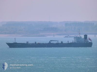
ERIN SCHULTE
Oil/Chemical Tanker
Current Trip
| Time Travelled | 2 days |
|---|---|
| Remaining Time | 3 days |
| Distance Travelled | 308.50 nm |
| Remaining Distance | 312.03 nm |
| AVG Speed | 8.2 Knots |
| MAX Speed | 13 Knots |
| AVG Wind | 28.4 knots |
| MAX Wind | 34 knots |
| MIN Temp | 8.9°C / 48.02°F |
| MAX Temp | 11.4°C / 52.52°F |
| Draught | 6.9 m |
| Position Received | 14 h, 50 m ago |
Current Position
| Longitude | --- |
|---|---|
| Latitude | --- |
| Status | Under way using engine |
| Speed | 4 Knots |
| Course | 231° |
| Area | North Sea |
| Station | T-AIS |
| Position Received | 14 h, 50 m ago |
Info
Information
The current position of ERIN SCHULTE is in North Sea with coordinates 56.93688° / 6.95057° as reported on 2024-11-26 06:55 by AIS to our vessel tracker app. The vessel's current speed is 4 Knots and is heading at the port of AMSTERDAM. The estimated time of arrival as calculated by MyShipTracking vessel tracking app is 2024-11-30 12:05 LT
The vessel ERIN SCHULTE (IMO: 9439814, MMSI: 235070283) is a Oil/Chemical Tanker that was built in 2009 ( 15 years old ). It's sailing under the flag of [GB] United Kingdom.
In this page you can find informations about the vessels current position, last detected port calls, and current voyage information. If the vessels is not in coverage by AIS you will find the latest position.
The current position of ERIN SCHULTE is detected by our AIS receivers and we are not responsible for the reliability of the data. The last position was recorded while the vessel was in Coverage by the Ais receivers of our vessel tracking app.
The current draught of ERIN SCHULTE as reported by AIS is 6.9 meters
Weather
| Temperature | 9.5°C / 49.1°F |
|---|---|
| Wind Speed | 19 knots |
| Direction | 273° W |
| Pressure | 1013.4 hPa |
| Humidity | 74.7 % |
| Cloud Coverage | 55 % |
Featured Company
Last Port Calls
| Port | Arrival | Departure | Time In Port |
|---|---|---|---|
| 2024-11-23 02:17 | 2024-11-24 18:33 | 1 d | |
| 2024-11-15 00:58 | 2024-11-16 06:48 | 1 d | |
| 2024-11-12 20:36 | 2024-11-12 21:28 | 51 m | |
| 2024-11-10 08:35 | 2024-11-11 12:15 | 1 d | |
| 2024-10-24 12:06 | 2024-10-31 12:12 | 7 d | |
| 2024-09-22 18:19 | 2024-10-23 19:58 | ||
| 2024-09-20 17:20 | 2024-09-21 17:35 | 1 d | |
| 2024-09-08 17:21 | 2024-09-10 10:10 | 1 d | |
| 2024-09-01 23:11 |
Most Visited Ports (Last year)
| Port | Arrivals | |
|---|---|---|
| 11 | ||
| 7 | ||
| 5 | ||
| 3 | ||
| 3 | ||
| 3 |
Last Trips
| Origin | Departure | Destination | Arrival | Distance | |
|---|---|---|---|---|---|
| 2024-11-16 06:48 | 2024-11-23 02:17 | 664.79 nm | |||
| 2024-11-12 21:28 | 2024-11-15 00:58 | 392.33 nm | |||
| 2024-11-11 12:15 | 2024-11-12 20:36 | 380.18 nm | |||
| 2024-10-31 12:12 | 2024-11-10 08:35 | 1763.66 nm | |||
| 2024-10-23 19:58 | 2024-10-24 12:06 | 11.22 nm | |||
| 2024-09-21 17:35 | 2024-09-22 18:19 | 260.29 nm | |||
| 2024-09-10 10:10 | 2024-09-20 17:20 | 563.99 nm | |||
| 2024-09-01 23:11 | 2024-09-08 17:21 | 1232.41 nm |
Events
| Time | Event | Details | Position / Dest | Info |
|---|---|---|---|---|
| 2024-11-26 06:58 | Status Changed | Default Under way using engine |
56.93407 / 6.94517
NLAMS
|
Speed: 4 kn Course: 231° |
| 2024-11-26 06:55 | Status Changed | Under way using engine Default |
56.93688 / 6.95057
NLAMS
|
Speed: 3.1 kn Course: 232° |
| 2024-11-26 06:55 | OUT of Coverage |
56.93688 / 6.95057
North Sea
NLAMS
|
Speed: 4 kn Course: 226.3° |
|
| 2024-11-26 06:45 | Status Changed | Default Under way using engine |
56.94539 / 6.96566
NLAMS
|
Speed: 3.6 kn Course: 233° |
| 2024-11-26 06:02 | Status Changed | Under way using engine Default |
56.97685 / 7.03133
NLAMS
|
Speed: 2.9 kn Course: 230° |
| 2024-11-26 06:02 | IN Coverage |
56.97679 / 7.03108
North Sea
NLAMS
|
Speed: 3.9 kn Course: 234.4° |
|
| 2024-11-26 04:58 | Status Changed | Default Under way using engine |
57.01742 / 7.11694
NLAMS
|
Speed: 2.5 kn Course: 226° |
| 2024-11-26 04:49 | OUT of Coverage |
57.02282 / 7.12485
North Sea
NLAMS
|
Speed: 2.5 kn Course: 209.7° |
|
| 2024-11-26 04:29 | Status Changed | Under way using engine Default |
57.03404 / 7.14495
NLAMS
|
Speed: 1.6 kn Course: 233° |
| 2024-11-26 04:21 | Status Changed | Default Under way using engine |
57.03768 / 7.15240
NLAMS
|
Speed: 2.2 kn Course: 248° |