
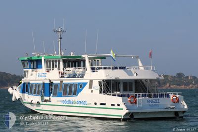
ENEZIZ
Passenger
Current Trip
BREHAT-ARCOUEST
| Time Travelled | --- |
|---|---|
| Remaining Time | --- |
| Distance Travelled | 32.40 nm |
| Remaining Distance | --- |
| AVG Speed | 14.4 Knots |
| MAX Speed | 20 Knots |
| AVG Wind | 14.2 knots |
| MAX Wind | 17.5 knots |
| MIN Temp | 2.5°C / 36.5°F |
| MAX Temp | 9.2°C / 48.56°F |
| Draught | 1.7 m |
| Position Received | 3 d ago |
Current Position
| Longitude | --- |
|---|---|
| Latitude | --- |
| Status | Under way using engine |
| Speed | 0.5 Knots |
| Course | 32° |
| Area | English Channel |
| Station | T-AIS |
| Position Received | 3 d ago |
Info
Information
The current position of ENEZIZ is in English Channel with coordinates 48.83454° / -3.00617° as reported on 2025-03-14 13:51 by AIS to our vessel tracker app. The vessel's current speed is 0.5 Knots
The vessel ENEZIZ (IMO: 9961647, MMSI: 228142440) is a Passenger It's sailing under the flag of [FR] France.
In this page you can find informations about the vessels current position, last detected port calls, and current voyage information. If the vessels is not in coverage by AIS you will find the latest position.
The current position of ENEZIZ is detected by our AIS receivers and we are not responsible for the reliability of the data. The last position was recorded while the vessel was in Coverage by the Ais receivers of our vessel tracking app.
The current draught of ENEZIZ as reported by AIS is 1.7 meters
Weather
| Temperature | 7.4°C / 45.32°F |
|---|---|
| Wind Speed | 12 knots |
| Direction | 59° ENE |
| Pressure | 1009.5 hPa |
| Humidity | 71.6 % |
| Cloud Coverage | 78 % |
Featured Company
Last Port Calls
Most Visited Ports (Last year)
| Port | Arrivals | |
|---|---|---|
| 20 | ||
| 1 | ||
| 1 |
Last Trips
| Origin | Departure | Destination | Arrival | Distance |
|---|
Events
| Time | Event | Details | Position / Dest | Info |
|---|---|---|---|---|
| 2025-03-14 13:51 | OUT of Coverage |
48.83454 / -3.00617
English Channel
|
Speed: 0.5 kn Course: 317.3° |
|
| 2025-03-14 13:43 | STOP Moving | 8.91 nm, East of TREGUIER |
48.83602 / -3.00958
BREHAT-ARCOUEST
|
Speed: 0.3 kn Course: 35° |
| 2025-03-14 13:37 | START Moving | 8.78 nm, East of TREGUIER |
48.82795 / -3.00901
BREHAT-ARCOUEST
|
Speed: 7 kn Course: 353.7° |
| 2025-03-14 13:09 | STOP Moving | 8.66 nm, East of TREGUIER |
48.82498 / -3.01105
BREHAT-ARCOUEST
|
Speed: 0.3 kn Course: 203° |
| 2025-03-14 13:03 | START Moving | 9.02 nm, East of TREGUIER |
48.83325 / -3.00531
BREHAT-ARCOUEST
|
Speed: 7.3 kn Course: 193.8° |
| 2025-03-14 12:53 | STOP Moving | 8.91 nm, East of TREGUIER |
48.83602 / -3.00956
BREHAT-ARCOUEST
|
Speed: 0.1 kn Course: 36° |
| 2025-03-14 12:51 | START Moving | 8.93 nm, East of TREGUIER |
48.83554 / -3.00882
BREHAT-ARCOUEST
|
Speed: 3.8 kn Course: 301° |
| 2025-03-14 11:21 | STOP Moving | 9.06 nm, East of TREGUIER |
48.83399 / -3.00470
BREHAT-ARCOUEST
|
Speed: 0.3 kn Course: 91° |
| 2025-03-14 11:05 | START Moving | 8.73 nm, East of TREGUIER |
48.82927 / -3.01096
BREHAT-ARCOUEST
|
Speed: 10.6 kn Course: 343.6° |
| 2025-03-14 11:01 | Status Changed | Under way using engine Default |
48.82382 / -3.01304
BREHAT-ARCOUEST
|
Speed: 0.3 kn Course: 159° |