
ENERGY INTELLIGENCE
Tanker
Current Trip
ATLANTIC FOR ORDERS
| Time Travelled | 9 days |
|---|---|
| Remaining Time | --- |
| Distance Travelled | 3413.10 nm |
| Remaining Distance | --- |
| AVG Speed | 15.3 Knots |
| MAX Speed | 18 Knots |
| AVG Wind | 13.2 knots |
| MAX Wind | 31.8 knots |
| MIN Temp | 5.5°C / 41.9°F |
| MAX Temp | 23.6°C / 74.48°F |
| Draught | 9.5 m |
| Position Received | 6 d ago |
Current Position
| Longitude | --- |
|---|---|
| Latitude | --- |
| Status | Under way using engine |
| Speed | 16.8 Knots |
| Course | 241.7° |
| Area | North Atlantic Ocean |
| Station | T-AIS |
| Position Received | 6 d ago |
Info
Information
The current position of ENERGY INTELLIGENCE is in North Atlantic Ocean with coordinates 38.63224° / -30.85356° as reported on 2025-02-12 05:20 by AIS to our vessel tracker app. The vessel's current speed is 16.8 Knots
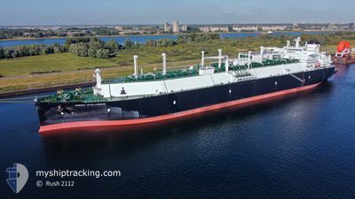
The vessel ENERGY INTELLIGENCE (IMO: 9881201, MMSI: 538008876) is a Tanker It's sailing under the flag of [MH] Marshall Is.
In this page you can find informations about the vessels current position, last detected port calls, and current voyage information. If the vessels is not in coverage by AIS you will find the latest position.
The current position of ENERGY INTELLIGENCE is detected by our AIS receivers and we are not responsible for the reliability of the data. The last position was recorded while the vessel was in Coverage by the Ais receivers of our vessel tracking app.
The current draught of ENERGY INTELLIGENCE as reported by AIS is 9.5 meters
Weather
| Temperature | 22.8°C / 73.04°F |
|---|---|
| Wind Speed | 7 knots |
| Direction | 180° S |
| Pressure | 1020.7 hPa |
| Humidity | 76.5 % |
| Cloud Coverage | 25 % |
Featured Company
Last Port Calls
| Port | Arrival | Departure | Time In Port |
|---|---|---|---|
| 2025-02-07 17:21 | 2025-02-08 17:47 | 1 d | |
| 2025-01-07 02:06 | 2025-01-08 01:35 | 23 h | |
| 2024-12-03 22:04 | 2024-12-04 22:40 | 1 d |
Most Visited Ports (Last year)
| Port | Arrivals | |
|---|---|---|
| 2 | ||
| 1 | ||
| 1 | ||
| 1 | ||
| 1 |
Last Trips
| Origin | Departure | Destination | Arrival | Distance | |
|---|---|---|---|---|---|
| 2025-01-08 02:35 | 2025-02-07 17:21 | 10507.14 nm | |||
| 2024-12-05 01:40 | 2025-01-07 03:06 | 11382.91 nm | |||
| 2024-11-27 21:23 | 2024-12-04 01:04 | 1427.76 nm |
Events
| Time | Event | Details | Position / Dest | Info |
|---|---|---|---|---|
| 2025-02-12 05:28 | Status Changed | Default Under way using engine |
38.61478 / -30.89635
ATLANTIC FOR ORDERS
|
Speed: 16.8 kn Course: 241.7° |
| 2025-02-12 05:20 | Status Changed | Under way using engine Default |
38.63224 / -30.85356
ATLANTIC FOR ORDERS
|
Speed: 17.1 kn Course: 243° |
| 2025-02-12 05:20 | OUT of Coverage |
38.63224 / -30.85356
North Atlantic Ocean
ATLANTIC FOR ORDERS
|
Speed: 16.8 kn Course: 241.7° |
|
| 2025-02-12 05:09 | Status Changed | Default Under way using engine |
38.65686 / -30.79220
ATLANTIC FOR ORDERS
|
Speed: 16.8 kn Course: 243.5° |
| 2025-02-11 19:37 | ETA Changed | 2025/02/25 05:59 2025/02/24 23:59 |
39.97499 / -27.73645
ATLANTIC FOR ORDERS
|
Speed: 16.3 kn Course: 240.8° |
| 2025-02-11 19:14 | Status Changed | Under way using engine Default |
40.02784 / -27.61714
ATLANTIC FOR ORDERS
|
Speed: 16.7 kn Course: 240° |
| 2025-02-11 18:53 | Status Changed | Default Under way using engine |
40.07776 / -27.50767
ATLANTIC FOR ORDERS
|
Speed: 17.1 kn Course: 239.5° |
| 2025-02-11 18:40 | Status Changed | Under way using engine Default |
40.10970 / -27.43799
ATLANTIC FOR ORDERS
|
Speed: 17 kn Course: 240° |
| 2025-02-11 18:32 | Status Changed | Default Under way using engine |
40.12996 / -27.39397
ATLANTIC FOR ORDERS
|
Speed: 16.9 kn Course: 239.3° |
| 2025-02-11 18:12 | Change Sea Area | Portuguese (Azores) part of the North Atlantic Ocean Irish part of the Celtic Sea |
40.17822 / -27.28678
North Atlantic Ocean
ATLANTIC FOR ORDERS
|
Speed: 17.1 kn Course: 239.4° |