
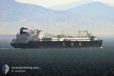
ENERGOS POWER
Tanker
Current Trip
MUKRAN
| Time Travelled | 1 day |
|---|---|
| Remaining Time | --- |
| Distance Travelled | 7.46 nm |
| Remaining Distance | --- |
| AVG Speed | 6.1 Knots |
| MAX Speed | 6.7 Knots |
| AVG Wind | 9.5 knots |
| MAX Wind | 16 knots |
| MIN Temp | -2.3°C / 27.86°F |
| MAX Temp | 0.8°C / 33.44°F |
| Draught | 9.1 m |
| Position Received | 45 m ago |
Current Position
| Longitude | --- |
|---|---|
| Latitude | --- |
| Status | At anchor |
| Speed | |
| Course | 305° |
| Area | Baltic Sea |
| Station | T-AIS |
| Position Received | 45 m ago |
Info
Information
The current position of ENERGOS POWER is in Baltic Sea with coordinates 54.41180° / 13.79276° as reported on 2025-02-18 04:48 by AIS to our vessel tracker app. The vessel's current speed is 0 Knots
The vessel ENERGOS POWER (IMO: 9861809, MMSI: 215888000) is a Tanker It's sailing under the flag of [MT] Malta.
In this page you can find informations about the vessels current position, last detected port calls, and current voyage information. If the vessels is not in coverage by AIS you will find the latest position.
The current position of ENERGOS POWER is detected by our AIS receivers and we are not responsible for the reliability of the data. The last position was recorded while the vessel was in Coverage by the Ais receivers of our vessel tracking app.
The current draught of ENERGOS POWER as reported by AIS is 9.1 meters
Weather
| Temperature | 0.8°C / 33.44°F |
|---|---|
| Wind Speed | 16 knots |
| Direction | 309° NW |
| Pressure | 1027 hPa |
| Humidity | 74.1 % |
| Cloud Coverage | 58 % |
Featured Company
Most Visited Ports (Last year)
| Port | Arrivals | |
|---|---|---|
| 2 | ||
| 1 |
Last Trips
| Origin | Departure | Destination | Arrival | Distance |
|---|
Events
| Time | Event | Details | Position / Dest | Info |
|---|---|---|---|---|
| 2025-02-17 12:18 | IN Coverage |
54.41220 / 13.79301
Baltic Sea
|
Speed: Course: 6° |
|
| 2025-02-17 11:12 | OUT of Coverage |
54.41239 / 13.79303
Baltic Sea
|
Speed: Course: 263.5° |
|
| 2025-02-17 08:48 | IN Coverage |
54.41283 / 13.79302
Baltic Sea
|
Speed: Course: 198.2° |
|
| 2025-02-17 07:42 | OUT of Coverage |
54.41280 / 13.79303
Baltic Sea
|
Speed: Course: 188.5° |
|
| 2025-02-17 02:12 | IN Coverage |
54.41243 / 13.79291
Baltic Sea
|
Speed: Course: 14.2° |
|
| 2025-02-17 01:03 | OUT of Coverage |
54.41080 / 13.79049
Baltic Sea
|
Speed: Course: 105.1° |
|
| 2025-02-16 23:03 | IN Coverage |
54.41071 / 13.78989
Baltic Sea
|
Speed: Course: 257.2° |
|
| 2025-02-16 21:54 | OUT of Coverage |
54.41107 / 13.79132
Baltic Sea
|
Speed: Course: 97.8° |
|
| 2025-02-16 17:43 | Status Changed | At anchor Under way using engine |
54.41305 / 13.78602
MUKRAN
|
Speed: 0.1 kn Course: 90° |
| 2025-02-16 17:39 | STOP Moving | 7.71 nm, South East of SASSNITZ |
54.41362 / 13.78559
MUKRAN
|
Speed: 0.3 kn Course: 98° |