
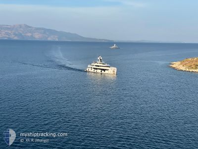
EMOCEAN
Not available
Current Trip
NASSAU
| Time Travelled | 23 h, 49 mins |
|---|---|
| Remaining Time | --- |
| Distance Travelled | 33.59 nm |
| Remaining Distance | --- |
| AVG Speed | 8.8 Knots |
| MAX Speed | 10.4 Knots |
| AVG Wind | 21.4 knots |
| MAX Wind | 22.9 knots |
| MIN Temp | 21.7°C / 71.06°F |
| MAX Temp | 23.5°C / 74.3°F |
| Draught | 2.5 m |
| Position Received | 2 m ago |
Current Position
| Longitude | --- |
|---|---|
| Latitude | --- |
| Status | At anchor |
| Speed | |
| Course | 40° |
| Area | North Atlantic Ocean |
| Station | T-AIS |
| Position Received | 2 m ago |
Info
Information
The current position of EMOCEAN is in North Atlantic Ocean with coordinates 24.71534° / -76.83887° as reported on 2025-03-07 13:38 by AIS to our vessel tracker app. The vessel's current speed is 0 Knots
The vessel EMOCEAN (IMO: 9878840, MMSI: 319218400) is a Not available It's sailing under the flag of [KY] Cayman Is.
In this page you can find informations about the vessels current position, last detected port calls, and current voyage information. If the vessels is not in coverage by AIS you will find the latest position.
The current position of EMOCEAN is detected by our AIS receivers and we are not responsible for the reliability of the data. The last position was recorded while the vessel was in Coverage by the Ais receivers of our vessel tracking app.
The current draught of EMOCEAN as reported by AIS is 2.5 meters
Weather
| Temperature | 21.7°C / 71.06°F |
|---|---|
| Wind Speed | 8 knots |
| Direction | 35° NE |
| Pressure | 1019 hPa |
| Humidity | 56.8 % |
| Cloud Coverage | 7 % |
Featured Company
Last Port Calls
| Port | Arrival | Departure | Time In Port |
|---|---|---|---|
| 2025-03-06 13:52 | |||
| 2025-02-16 21:07 | 2025-02-25 14:36 | 8 d | |
| 2025-02-15 16:39 | 2025-02-16 17:03 | 1 d | |
| 2025-02-02 13:41 | 2025-02-14 20:13 | 12 d | |
| 2025-02-01 12:26 | 2025-02-01 19:14 | 6 h | |
| 2025-01-23 11:05 | 2025-01-25 18:58 | 2 d | |
| 2025-01-06 13:52 | 2025-01-22 20:06 | 16 d | |
| 2025-01-04 20:59 | 2025-01-04 23:39 | 2 h |
Most Visited Ports (Last year)
| Port | Arrivals | |
|---|---|---|
| 5 | ||
| 5 | ||
| 4 | ||
| 4 | ||
| 4 | ||
| 3 |
Last Trips
| Origin | Departure | Destination | Arrival | Distance | |
|---|---|---|---|---|---|
| 2025-02-16 13:03 | 2025-02-16 17:07 | 18.02 nm | |||
| 2025-02-14 16:13 | 2025-02-15 12:39 | 17.55 nm | |||
| 2025-02-01 15:14 | 2025-02-02 09:41 | 109.60 nm | |||
| 2025-01-25 14:58 | 2025-02-01 08:26 | 112.37 nm | |||
| 2025-01-22 16:06 | 2025-01-23 07:05 | 107.93 nm | |||
| 2025-01-04 19:39 | 2025-01-06 09:52 | 41.40 nm | |||
| 2024-12-30 16:07 | 2025-01-04 16:59 | 95.71 nm |
Events
| Time | Event | Details | Position / Dest | Info |
|---|---|---|---|---|
| 2025-03-07 12:08 | IN Coverage |
24.71526 / -76.83860
North Atlantic Ocean
|
Speed: 0.1 kn Course: 99.1° |
|
| 2025-03-06 15:15 | OUT of Coverage |
24.93171 / -77.15323
North Atlantic Ocean
NASSAU
|
Speed: 10.1 kn Course: 156.2° |
|
| 2025-03-06 15:10 | Status Changed | Under way using engine Moored |
24.94613 / -77.16025
NASSAU
|
Speed: 10.1 kn Course: 152.3° |
| 2025-03-06 14:02 | ETA Changed | 2025/03/06 12:30 2025/03/01 12:30 |
25.06910 / -77.27097
NASSAU
|
Speed: 8.5 kn Course: 100.4° |
| 2025-03-06 13:52 | PORT DEPARTURE |
|
25.07435 / -77.29012
NASSAU
|
Speed: 5 kn Course: 101° |
| 2025-03-06 13:40 | START Moving |
25.07756 / -77.31732
[BS] NASSAU
|
Speed: 6.5 kn Course: 91° |
|
| 2025-03-06 10:32 | IN Coverage |
25.07893 / -77.31866
North Atlantic Ocean
[BS] NASSAU
|
Speed: Course: 124.2° |
|
| 2025-03-06 02:41 | OUT of Coverage |
25.07897 / -77.31868
North Atlantic Ocean
[BS] NASSAU
|
Speed: Course: 8.7° |
|
| 2025-03-03 11:17 | IN Coverage |
25.07894 / -77.31864
North Atlantic Ocean
[BS] NASSAU
|
Speed: Course: 16.6° |
|
| 2025-03-03 09:35 | OUT of Coverage |
25.07896 / -77.31867
North Atlantic Ocean
[BS] NASSAU
|
Speed: Course: 16.6° |