
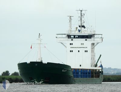
ELLI F
General Cargo
Current Trip
| Time Travelled | 2 days |
|---|---|
| Remaining Time | --- |
| Distance Travelled | 461.74 nm |
| Remaining Distance | --- |
| AVG Speed | 10.4 Knots |
| MAX Speed | 13.8 Knots |
| AVG Wind | 12 knots |
| MAX Wind | 17 knots |
| MIN Temp | 5.8°C / 42.44°F |
| MAX Temp | 9.3°C / 48.74°F |
| Draught | 4.2 m |
| Position Received | 21 m ago |
Current Position
| Longitude | --- |
|---|---|
| Latitude | --- |
| Status | Moored |
| Speed | |
| Course | 306° |
| Area | Kattegat |
| Station | T-AIS |
| Position Received | 21 m ago |
Info
Information
The current position of ELLI F is in Kattegat with coordinates 57.05645° / 10.04606° as reported on 2025-12-13 18:14 by AIS to our vessel tracker app. The vessel's current speed is 0 Knots
The vessel ELLI F (IMO: 8607725, MMSI: 268249201) is a General Cargo that was built in 1986 ( 39 years old ). It's sailing under the flag of [SM] San Marino.
In this page you can find informations about the vessels current position, last detected port calls, and current voyage information. If the vessels is not in coverage by AIS you will find the latest position.
The current position of ELLI F is detected by our AIS receivers and we are not responsible for the reliability of the data. The last position was recorded while the vessel was in Coverage by the Ais receivers of our vessel tracking app.
The current draught of ELLI F as reported by AIS is 4.2 meters
Weather
| Temperature | 6°C / 42.8°F |
|---|---|
| Wind Speed | 11 knots |
| Direction | 248° WSW |
| Pressure | 1019.3 hPa |
| Humidity | 93.4 % |
| Cloud Coverage | 26 % |
Featured Company
Last Port Calls
| Port | Arrival | Departure | Time In Port |
|---|---|---|---|
| 2025-12-10 02:37 | 2025-12-11 14:09 | 1 d | |
| 2025-12-07 11:24 | 2025-12-09 10:47 | 1 d | |
| 2025-12-02 20:25 | 2025-12-05 11:31 | 2 d | |
| 2025-11-27 19:28 | 2025-11-30 01:24 | 2 d | |
| 2025-11-22 09:43 | 2025-11-25 17:31 | 3 d | |
| 2025-11-19 23:00 | 2025-11-21 17:56 | 1 d | |
| 2025-11-19 21:12 | 2025-11-19 22:02 | 50 m | |
| 2025-11-09 06:36 | 2025-11-14 14:40 | 5 d | |
| 2025-11-04 13:00 | 2025-11-05 14:39 | 1 d | |
| 2025-10-29 19:17 | 2025-10-30 11:01 | 15 h |
Most Visited Ports (Last year)
| Port | Arrivals | |
|---|---|---|
| 6 | ||
| 5 | ||
| 4 | ||
| 4 | ||
| 4 | ||
| 3 |
Last Trips
| Origin | Departure | Destination | Arrival | Distance | |
|---|---|---|---|---|---|
| 2025-12-09 11:47 | 2025-12-10 03:37 | 150.45 nm | |||
| 2025-12-05 12:31 | 2025-12-07 12:24 | 421.22 nm | |||
| 2025-11-30 02:24 | 2025-12-02 21:25 | 130.45 nm | |||
| 2025-11-25 18:31 | 2025-11-27 20:28 | 444.31 nm | |||
| 2025-11-21 18:56 | 2025-11-22 10:43 | 122.43 nm | |||
| 2025-11-19 23:02 | 2025-11-20 00:00 | 7.17 nm | |||
| 2025-11-14 16:40 | 2025-11-19 22:12 | 822.61 nm | |||
| 2025-11-05 15:39 | 2025-11-09 08:36 | 968.40 nm | |||
| 2025-10-30 13:01 | 2025-11-04 14:00 | 948.90 nm | |||
| 2025-10-21 17:16 | 2025-10-29 21:17 | 761.06 nm |
Events
| Time | Event | Details | Position / Dest | Info |
|---|---|---|---|---|
| 2025-12-13 18:20 | Status Changed | Default Moored |
57.05643 / 10.04605
DKAAL
|
Speed: Course: 306° |
| 2025-12-13 18:14 | Status Changed | Moored Default |
57.05645 / 10.04606
DKAAL
|
Speed: Course: 306° |
| 2025-12-13 18:07 | Status Changed | Default Moored |
57.05645 / 10.04609
DKAAL
|
Speed: Course: 306° |
| 2025-12-13 18:02 | Status Changed | Moored Default |
57.05644 / 10.04605
DKAAL
|
Speed: Course: 306° |
| 2025-12-13 17:43 | Status Changed | Default Moored |
57.05645 / 10.04607
DKAAL
|
Speed: Course: 306° |
| 2025-12-13 17:37 | Status Changed | Moored Default |
57.05646 / 10.04604
DKAAL
|
Speed: Course: 306° |
| 2025-12-13 17:29 | IN Coverage |
57.05646 / 10.04604
Kattegat
DKAAL
|
Speed: Course: 151.6° |
|
| 2025-12-13 16:28 | Status Changed | Default Moored |
57.05645 / 10.04608
DKAAL
|
Speed: Course: 306° |
| 2025-12-13 16:23 | Status Changed | Moored Default |
57.05646 / 10.04613
DKAAL
|
Speed: Course: 306° |
| 2025-12-13 16:23 | OUT of Coverage |
57.05646 / 10.04613
Kattegat
DKAAL
|
Speed: Course: 37.3° |