

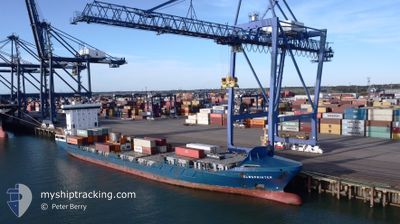
ELBSPRINTER
Container Ship

Current Trip
| Time Travelled | 3 h, 4 mins |
|---|---|
| Remaining Time | 2 days |
| Distance Travelled | 34.48 nm |
| Remaining Distance | 957.58 nm |
| AVG Speed | 12.7 Knots |
| MAX Speed | 15.9 Knots |
| AVG Wind | 7.7 knots |
| MAX Wind | 11.5 knots |
| MIN Temp | 7.7°C / 45.86°F |
| MAX Temp | 8.3°C / 46.94°F |
| Draught | 7.5 m |
| Position Received | Now |
Current Position
| Longitude | --- |
|---|---|
| Latitude | --- |
| Status | Under way using engine |
| Speed | 14.1 Knots |
| Course | 11° |
| Area | North Sea |
| Station | T-AIS |
| Position Received | Now |
Information
The current position of ELBSPRINTER is in North Sea with coordinates 52.50258° / 3.90587° as reported on 2025-03-27 19:09 by AIS to our vessel tracker app. The vessel's current speed is 14.1 Knots and is heading at the port of GDANSK. The estimated time of arrival as calculated by MyShipTracking vessel tracking app is 2025-03-30 16:50 LT
The vessel ELBSPRINTER (IMO: 9349215, MMSI: 210167000) is a Container Ship that was built in 2007 ( 18 years old ). It's sailing under the flag of [CY] Cyprus.
In this page you can find informations about the vessels current position, last detected port calls, and current voyage information. If the vessels is not in coverage by AIS you will find the latest position.
The current position of ELBSPRINTER is detected by our AIS receivers and we are not responsible for the reliability of the data. The last position was recorded while the vessel was in Coverage by the Ais receivers of our vessel tracking app.
The current draught of ELBSPRINTER as reported by AIS is 7.5 meters
Weather
| Temperature | 7.9°C / 46.22°F |
|---|---|
| Wind Speed | 11 knots |
| Direction | 207° SSW |
| Pressure | 1017.5 hPa |
| Humidity | 88.2 % |
| Cloud Coverage | 6 % |


Featured Company
Last Port Calls
| Port | Arrival | Departure | Time In Port |
|---|---|---|---|
| 2025-03-27 00:51 | 2025-03-27 17:06 | 16 h | |
| 2025-03-26 03:53 | 2025-03-27 00:47 | 20 h | |
| 2025-03-22 15:19 | 2025-03-26 03:37 | 3 d | |
| 2025-03-22 09:21 | 2025-03-22 14:00 | 4 h | |
| 2025-03-21 03:44 | 2025-03-21 12:53 | 9 h | |
| 2025-03-19 04:47 | 2025-03-20 01:40 | 20 h | |
| 2025-03-17 17:34 | 2025-03-18 02:41 | 9 h | |
| 2025-03-11 08:04 | 2025-03-15 06:37 | 3 d | |
| 2025-03-10 22:11 | 2025-03-11 06:49 | 8 h | |
| 2025-03-09 14:15 | 2025-03-10 02:19 | 12 h |
Most Visited Ports (Last year)
| Port | Arrivals | |
|---|---|---|
| 43 | ||
| 41 | ||
| 12 | ||
| 8 | ||
| 8 | ||
| 7 |
Last Trips
| Origin | Departure | Destination | Arrival | Distance | |
|---|---|---|---|---|---|
| 2025-03-27 00:47 | 2025-03-27 00:51 | 0.36 nm | |||
| 2025-03-26 03:37 | 2025-03-26 03:53 | 0.53 nm | |||
| 2025-03-22 14:00 | 2025-03-22 15:19 | 15.64 nm | |||
| 2025-03-21 12:53 | 2025-03-22 09:21 | 276.10 nm | |||
| 2025-03-20 01:40 | 2025-03-21 03:44 | 376.08 nm | |||
| 2025-03-18 02:41 | 2025-03-19 04:47 | 163.59 nm | |||
| 2025-03-15 06:37 | 2025-03-17 17:34 | 549.30 nm | |||
| 2025-03-11 06:49 | 2025-03-11 08:04 | 15.32 nm | |||
| 2025-03-10 02:19 | 2025-03-10 22:11 | 263.78 nm | |||
| 2025-03-08 05:20 | 2025-03-09 14:15 | 369.64 nm |
Events
| Time | Event | Details | Position / Dest | Info |
|---|---|---|---|---|
| 2025-03-27 16:44 | ETA Changed | 2025/03/28 08:00 2025/03/28 09:00 |
52.01465 / 4.00318
PLGDN VIA NOK
|
Speed: 11 kn Course: 299° |
| 2025-03-27 16:11 | START Moving | 0.79 nm, South East of MAASVLAKTE - ROTTERDAM |
51.95145 / 4.08203
PLGDN VIA NOK
|
Speed: 5.1 kn Course: 10° |
| 2025-03-27 16:08 | STOP Moving | 0.88 nm, South East of MAASVLAKTE - ROTTERDAM |
51.94965 / 4.08217
PLGDN VIA NOK
|
Speed: 0.3 kn Course: 313° |
| 2025-03-27 16:06 | PORT DEPARTURE |
|
51.94972 / 4.08062
PLGDN VIA NOK
|
Speed: 3.3 kn Course: 267° |
| 2025-03-27 15:58 | START Moving |
51.94833 / 4.06882
[NL] MAASVLAKTE - ROTTERDAM
|
Speed: 3.4 kn Course: 266° |
|
| 2025-03-27 15:34 | Status Changed | Under way using engine Moored |
51.94987 / 4.06718
[NL] MAASVLAKTE - ROTTERDAM
|
Speed: 0.1 kn Course: 258° |
| 2025-03-27 15:27 | Status Changed | Moored Default |
51.94987 / 4.06708
[NL] MAASVLAKTE - ROTTERDAM
|
Speed: Course: 258° |
| 2025-03-27 15:24 | Status Changed | Default Moored |
51.94997 / 4.06743
[NL] MAASVLAKTE - ROTTERDAM
|
Speed: 0.2 kn Course: 258° |
| 2025-03-27 15:13 | ETA Changed | 2025/03/28 09:00 2025/03/28 08:30 |
51.95028 / 4.06745
[NL] MAASVLAKTE - ROTTERDAM
|
Speed: 0.1 kn Course: 258° |
| 2025-03-27 15:03 | Status Changed | Moored Default |
51.95017 / 4.06695
[NL] MAASVLAKTE - ROTTERDAM
|
Speed: 0.2 kn Course: 258° |