

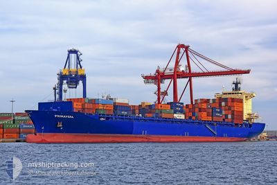
ELBSPIRIT
Container Ship

Current Trip
| Time Travelled | 1 day |
|---|---|
| Remaining Time | 20 h, 55 mins |
| Distance Travelled | 494.95 nm |
| Remaining Distance | 409.01 nm |
| AVG Speed | 15.7 Knots |
| MAX Speed | 17.9 Knots |
| AVG Wind | 7.2 knots |
| MAX Wind | 9 knots |
| MIN Temp | 14.1°C / 57.38°F |
| MAX Temp | 15.8°C / 60.44°F |
| Draught | 11.6 m |
| Position Received | 1 d ago |
Current Position
| Longitude | --- |
|---|---|
| Latitude | --- |
| Status | Under way using engine |
| Speed | 15.7 Knots |
| Course | 106.8° |
| Area | Mediterranean Sea - Eastern Basin |
| Station | T-AIS |
| Position Received | 1 d ago |
Information
The current position of ELBSPIRIT is in Mediterranean Sea - Eastern Basin with coordinates 35.64795° / 15.25411° as reported on 2025-02-17 08:43 by AIS to our vessel tracker app. The vessel's current speed is 15.7 Knots and is heading at the port of SUEZ CANAL. The estimated time of arrival as calculated by MyShipTracking vessel tracking app is 2025-02-19 18:19 LT
The vessel ELBSPIRIT (IMO: 9372860, MMSI: 636091619) is a Container Ship that was built in 2008 ( 17 years old ). It's sailing under the flag of [LR] Liberia.
In this page you can find informations about the vessels current position, last detected port calls, and current voyage information. If the vessels is not in coverage by AIS you will find the latest position.
The current position of ELBSPIRIT is detected by our AIS receivers and we are not responsible for the reliability of the data. The last position was recorded while the vessel was in Coverage by the Ais receivers of our vessel tracking app.
The current draught of ELBSPIRIT as reported by AIS is 11.6 meters
Weather
| Temperature | 16°C / 60.8°F |
|---|---|
| Wind Speed | 8 knots |
| Direction | 310° NW |
| Pressure | 1018.7 hPa |
| Humidity | 72.3 % |
| Cloud Coverage | 100 % |


Featured Company
Last Port Calls
| Port | Arrival | Departure | Time In Port |
|---|---|---|---|
| 2025-02-15 13:35 | 2025-02-17 06:27 | 1 d | |
| 2025-02-10 07:13 | 2025-02-11 05:48 | 22 h | |
| 2025-02-08 05:51 | 2025-02-09 04:16 | 22 h | |
| 2025-01-30 07:04 | 2025-01-31 22:10 | 1 d | |
| 2025-01-25 02:49 | 2025-01-25 08:09 | 5 h | |
| 2025-01-22 15:11 | 2025-01-22 23:45 | 8 h | |
| 2025-01-22 05:46 | 2025-01-22 13:46 | 7 h | |
| 2025-01-18 06:14 | 2025-01-19 12:01 | 1 d | |
| 2025-01-16 03:26 | 2025-01-16 13:23 | 9 h | |
| 2025-01-13 04:13 | 2025-01-13 13:16 | 9 h |
Most Visited Ports (Last year)
| Port | Arrivals | |
|---|---|---|
| 16 | ||
| 16 | ||
| 11 | ||
| 10 | ||
| 9 | ||
| 7 |
Last Trips
| Origin | Departure | Destination | Arrival | Distance | |
|---|---|---|---|---|---|
| 2025-02-11 06:48 | 2025-02-15 14:35 | 1041.12 nm | |||
| 2025-02-09 05:16 | 2025-02-10 08:13 | 103.64 nm | |||
| 2025-01-31 23:10 | 2025-02-08 06:51 | 1180.59 nm | |||
| 2025-01-25 11:09 | 2025-01-30 08:04 | 1142.42 nm | |||
| 2025-01-23 01:45 | 2025-01-25 05:49 | 392.04 nm | |||
| 2025-01-19 15:01 | 2025-01-22 17:11 | 720.86 nm | |||
| 2025-01-19 15:01 | 2025-01-22 07:46 | 631.14 nm | |||
| 2025-01-16 15:23 | 2025-01-18 09:14 | 568.04 nm | |||
| 2025-01-11 14:04 | 2025-01-16 05:26 | 696.28 nm | |||
| 2025-01-11 14:04 | 2025-01-13 06:13 | 267.81 nm |
Events
| Time | Event | Details | Position / Dest | Info |
|---|---|---|---|---|
| 2025-02-17 08:57 | Status Changed | Default Under way using engine |
35.62976 / 15.32825
SUEZ CANAL
|
Speed: 15.7 kn Course: 106.8° |
| 2025-02-17 08:43 | OUT of Coverage |
35.64795 / 15.25411
Mediterranean Sea - Eastern Basin
SUEZ CANAL
|
Speed: 15.7 kn Course: 106.8° |
|
| 2025-02-17 06:27 | PORT DEPARTURE |
|
35.81580 / 14.55399
SUEZ CANAL
|
Speed: 7.4 kn Course: 150° |
| 2025-02-17 06:17 | START Moving |
35.82319 / 14.53755
[MT] MARSAXLOKK
|
Speed: 3.5 kn Course: 75° |
|
| 2025-02-17 06:05 | Status Changed | Under way using engine Moored |
35.82054 / 14.53913
[MT] MARSAXLOKK
|
Speed: Course: 136° |
| 2025-02-17 05:39 | Status Changed | Moored Default |
35.82057 / 14.53919
[MT] MARSAXLOKK
|
Speed: Course: 137° |
| 2025-02-17 05:36 | Status Changed | Default Moored |
35.82058 / 14.53919
[MT] MARSAXLOKK
|
Speed: Course: 137° |
| 2025-02-17 05:34 | Draught Changed | 11.6 11.3 |
35.82057 / 14.53919
[MT] MARSAXLOKK
|
Speed: Course: 137° |
| 2025-02-17 05:34 | Destination Changed | SUEZ CANAL MTMAR |
35.82057 / 14.53919
[MT] MARSAXLOKK
|
Speed: Course: 137° |
| 2025-02-17 05:34 | ETA Changed | 2025/02/19 20:00 2025/02/15 11:00 |
35.82057 / 14.53919
[MT] MARSAXLOKK
|
Speed: Course: 137° |