
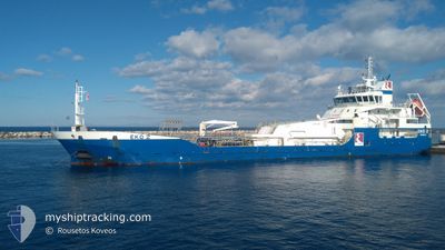
EKO2
Oil Products Tanker
Current Trip
| Trip Time | 4 h, 37 mins |
|---|---|
| Trip Distance | 23.57 nm |
| AVG Speed | 9.7 Knots |
| MAX Speed | 10 Knots |
| Draught | 4.8 m |
| AVG Wind | 16.4 knots |
| MAX Wind | 18 knots |
| MIN Temp | 13.7°C / 56.66°F |
| MAX Temp | 15°C / 59°F |
| Position Received | 8 d ago |
Current Position
| Longitude | --- |
|---|---|
| Latitude | --- |
| Status | Under way using engine |
| Speed | 11 Knots |
| Course | 50.4° |
| Area | Aegean Sea |
| Station | T-AIS |
| Position Received | 8 d ago |
Info
Information
The current position of EKO2 is in Aegean Sea with coordinates 37.70387° / 24.25551° as reported on 2026-01-01 20:47 by AIS to our vessel tracker app. The vessel's current speed is 11 Knots and is currently inside the port of SKOPELOS.
The vessel EKO2 (IMO: 9393955, MMSI: 240827000) is a Oil Products Tanker that was built in 2009 ( 17 years old ). It's sailing under the flag of [GR] Greece.
In this page you can find informations about the vessels current position, last detected port calls, and current voyage information. If the vessels is not in coverage by AIS you will find the latest position.
The current position of EKO2 is detected by our AIS receivers and we are not responsible for the reliability of the data. The last position was recorded while the vessel was in Coverage by the Ais receivers of our vessel tracking app.
The current draught of EKO2 as reported by AIS is 4.8 meters
Weather
| Temperature | 15°C / 59°F |
|---|---|
| Wind Speed | 18 knots |
| Direction | 216° SW |
| Pressure | 1008.2 hPa |
| Humidity | 72.4 % |
| Cloud Coverage | 11 % |
Featured Company
Last Port Calls
| Port | Arrival | Departure | Time In Port |
|---|---|---|---|
| 2026-01-10 00:08 | |||
| 2026-01-09 17:06 | 2026-01-09 19:31 | 2 h | |
| 2026-01-03 03:16 | |||
| 2025-12-31 02:26 | 2026-01-01 18:02 | 1 d | |
| 2025-12-30 18:35 | 2025-12-31 02:00 | 7 h | |
| 2025-12-30 17:24 | 2025-12-30 18:19 | 54 m | |
| 2025-12-30 08:55 | 2025-12-30 17:04 | 8 h | |
| 2025-12-29 13:42 | 2025-12-29 15:07 | 1 h | |
| 2025-12-29 08:04 | 2025-12-29 11:38 | 3 h | |
| 2025-12-28 17:49 | 2025-12-28 21:40 | 3 h |
Last Trips
| Origin | Departure | Destination | Arrival | Distance | |
|---|---|---|---|---|---|
| 2026-01-09 19:31 | 2026-01-10 00:08 | 23.57 nm | |||
| 2026-01-03 03:16 | 2026-01-09 17:06 | 147.42 nm | |||
| 2025-12-31 02:00 | 2025-12-31 02:26 | 1.65 nm | |||
| 2025-12-30 18:19 | 2025-12-30 18:35 | 0.45 nm | |||
| 2025-12-30 17:04 | 2025-12-30 17:24 | 1.72 nm | |||
| 2025-12-29 15:07 | 2025-12-30 08:55 | 182.29 nm | |||
| 2025-12-29 11:38 | 2025-12-29 13:42 | 1.00 nm | |||
| 2025-12-28 21:40 | 2025-12-29 08:04 | 2.00 nm | |||
| 2025-12-28 09:54 | 2025-12-28 17:49 | 89.17 nm | |||
| 2025-12-27 13:10 | 2025-12-27 14:15 | 11.59 nm |
Events
| Time | Event | Details | Position / Dest | Info |
|---|---|---|---|---|
| 2026-01-09 22:08 | PORT ARRIVAL |
|
39.12167 / 23.73167
[GR] SKOPELOS
|
Speed: 10 kn Course: 287° |
| 2026-01-09 17:31 | PORT DEPARTURE |
|
39.13334 / 23.51833
GRMYR
|
Speed: Course: -1° |
| 2026-01-09 15:06 | PORT ARRIVAL |
|
39.16167 / 23.49167
[GR] SKIATHOS
|
Speed: 10.6 kn Course: 207° |
| 2026-01-09 03:49 | START Moving | 7.01 nm, North of MOUDROS |
39.98667 / 25.28667
GRMYR
|
Speed: 5 kn Course: 8° |
| 2026-01-03 04:02 | STOP Moving | 6.59 nm, North of MOUDROS |
39.97952 / 25.28748
GRMYR
|
Speed: 0.2 kn Course: 204° |
| 2026-01-03 01:16 | START Moving | 0.58 nm, West of LIMNOS |
39.87167 / 25.04500
GRMYR
|
Speed: 7 kn Course: -1° |
| 2026-01-03 01:16 | PORT DEPARTURE |
|
39.87167 / 25.04500
GRMYR
|
Speed: Course: -1° |
| 2026-01-01 20:47 | OUT of Coverage |
37.70387 / 24.25551
Aegean Sea
|
Speed: 11 kn Course: 50.4° |
|
| 2026-01-01 19:41 | IN Coverage |
37.61530 / 24.03140
Aegean Sea
|
Speed: 11.6 kn Course: 93.4° |
|
| 2026-01-01 17:39 | OUT of Coverage |
37.76917 / 23.64197
Aegean Sea
|
Speed: 11.3 kn Course: 155.5° |