
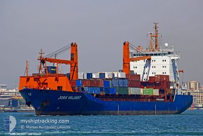
EGY CROWN
Container Ship
Current Trip
| Time Travelled | 14 h, 43 mins |
|---|---|
| Remaining Time | --- |
| Distance Travelled | 159.49 nm |
| Remaining Distance | --- |
| AVG Speed | 11.8 Knots |
| MAX Speed | 12.5 Knots |
| AVG Wind | 12.4 knots |
| MAX Wind | 16 knots |
| MIN Temp | 19.5°C / 67.1°F |
| MAX Temp | 22.6°C / 72.68°F |
| Draught | 10 m |
| Position Received | 3 d ago |
Current Position
| Longitude | --- |
|---|---|
| Latitude | --- |
| Status | Under way using engine |
| Speed | 11.6 Knots |
| Course | 43° |
| Area | Mediterranean Sea - Eastern Basin |
| Station | T-AIS |
| Position Received | 3 d ago |
Info
Information
The current position of EGY CROWN is in Mediterranean Sea - Eastern Basin with coordinates 31.44412° / 32.33603° as reported on 2024-11-18 14:40 by AIS to our vessel tracker app. The vessel's current speed is 11.6 Knots and is heading at the port of MERSIN. The estimated time of arrival as calculated by MyShipTracking vessel tracking app is 2024-11-14 03:00 LT
The vessel EGY CROWN (IMO: 9216107, MMSI: 622113180) is a Container Ship that was built in 2000 ( 24 years old ). It's sailing under the flag of [EG] Egypt.
In this page you can find informations about the vessels current position, last detected port calls, and current voyage information. If the vessels is not in coverage by AIS you will find the latest position.
The current position of EGY CROWN is detected by our AIS receivers and we are not responsible for the reliability of the data. The last position was recorded while the vessel was in Coverage by the Ais receivers of our vessel tracking app.
The current draught of EGY CROWN as reported by AIS is 10 meters
Weather
| Temperature | 21.8°C / 71.24°F |
|---|---|
| Wind Speed | 14 knots |
| Direction | 234° SW |
| Pressure | 1015.7 hPa |
| Humidity | 73.8 % |
| Cloud Coverage | 8 % |
Featured Company
Last Port Calls
| Port | Arrival | Departure | Time In Port |
|---|---|---|---|
| 2024-11-20 13:04 | 2024-11-21 07:55 | 18 h | |
| 2024-11-19 02:35 | 2024-11-19 23:54 | 21 h | |
| 2024-11-16 02:32 | 2024-11-17 00:54 | 22 h | |
| 2024-11-13 05:16 | 2024-11-13 16:32 | 11 h | |
| 2024-11-11 06:39 | 2024-11-11 15:39 | 8 h | |
| 2024-11-09 15:25 | 2024-11-10 09:09 | 17 h | |
| 2024-11-06 15:30 | 2024-11-07 15:43 | 1 d | |
| 2024-11-01 12:59 | 2024-11-02 11:47 | 22 h | |
| 2024-10-30 08:12 | 2024-10-30 19:32 | 11 h | |
| 2024-10-29 06:19 | 2024-10-29 13:56 | 7 h |
Most Visited Ports (Last year)
| Port | Arrivals | |
|---|---|---|
| 29 | ||
| 19 | ||
| 16 | ||
| 15 | ||
| 12 | ||
| 11 |
Last Trips
| Origin | Departure | Destination | Arrival | Distance | |
|---|---|---|---|---|---|
| 2024-11-19 23:54 | 2024-11-20 13:04 | 129.21 nm | |||
| 2024-11-17 00:54 | 2024-11-19 02:35 | 404.73 nm | |||
| 2024-11-13 16:32 | 2024-11-16 02:32 | 87.13 nm | |||
| 2024-11-11 15:39 | 2024-11-13 05:16 | 210.33 nm | |||
| 2024-11-10 09:09 | 2024-11-11 06:39 | 275.49 nm | |||
| 2024-11-07 15:43 | 2024-11-09 15:25 | 568.56 nm | |||
| 2024-11-02 11:47 | 2024-11-06 15:30 | 603.09 nm | |||
| 2024-10-30 19:32 | 2024-11-01 12:59 | 87.80 nm | |||
| 2024-10-29 13:56 | 2024-10-30 08:12 | 193.26 nm | |||
| 2024-10-28 02:15 | 2024-10-29 06:19 | 255.89 nm |
Events
| Time | Event | Details | Position / Dest | Info |
|---|---|---|---|---|
| 2024-11-21 05:55 | PORT DEPARTURE |
|
31.16152 / 29.83039
TRMER
|
Speed: 8.9 kn Course: 237° |
| 2024-11-21 05:31 | START Moving |
31.19132 / 29.87004
[EG] ALEXANDRIA
|
Speed: 3.6 kn Course: 245° |
|
| 2024-11-20 11:49 | STOP Moving |
31.18874 / 29.87525
[EG] ALEXANDRIA
|
Speed: Course: 127° |
|
| 2024-11-20 11:04 | PORT ARRIVAL |
|
31.16385 / 29.84692
[EG] ALEXANDRIA
|
Speed: 9.7 kn Course: 115° |
| 2024-11-20 10:08 | START Moving | 3.74 nm, North West of ALEXANDRIA |
31.21074 / 29.79835
TRMER
|
Speed: 3.6 kn Course: 271° |
| 2024-11-20 09:28 | STOP Moving | 3.78 nm, North of EL DEKHEILA |
31.20848 / 29.79301
TRMER
|
Speed: 0.1 kn Course: 309° |
| 2024-11-19 21:54 | PORT DEPARTURE |
|
31.49433 / 31.75990
TRMER
|
Speed: 9.2 kn Course: 12° |
| 2024-11-19 21:38 | START Moving |
31.46180 / 31.76051
[EG] DAMIETTA
|
Speed: 6.7 kn Course: 320° |
|
| 2024-11-19 01:08 | STOP Moving |
31.45652 / 31.76348
[EG] DAMIETTA
|
Speed: Course: 135° |
|
| 2024-11-19 00:35 | PORT ARRIVAL |
|
31.48198 / 31.75688
[EG] DAMIETTA
|
Speed: 6 kn Course: 190° |