
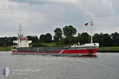
EEMSBORG
General Cargo
Current Trip
FI KOK VIA NOK
| Time Travelled | 2 days |
|---|---|
| Remaining Time | --- |
| Distance Travelled | 450.03 nm |
| Remaining Distance | --- |
| AVG Speed | 9.1 Knots |
| MAX Speed | 11.7 Knots |
| AVG Wind | 21 knots |
| MAX Wind | 27 knots |
| MIN Temp | 7.9°C / 46.22°F |
| MAX Temp | 14.2°C / 57.56°F |
| Draught | 7.9 m |
| Position Received | 1 d ago |
Current Position
| Longitude | --- |
|---|---|
| Latitude | --- |
| Status | Under way using engine |
| Speed | 8.8 Knots |
| Course | 2° |
| Area | North Atlantic Ocean |
| Station | T-AIS |
| Position Received | 1 d ago |
Info
Information
The current position of EEMSBORG is in North Atlantic Ocean with coordinates 39.19983° / -9.85000° as reported on 2026-01-06 22:56 by AIS to our vessel tracker app. The vessel's current speed is 8.8 Knots
The vessel EEMSBORG (IMO: 9423748, MMSI: 245278000) is a General Cargo that was built in 2009 ( 17 years old ). It's sailing under the flag of [NL] Netherlands.
In this page you can find informations about the vessels current position, last detected port calls, and current voyage information. If the vessels is not in coverage by AIS you will find the latest position.
The current position of EEMSBORG is detected by our AIS receivers and we are not responsible for the reliability of the data. The last position was recorded while the vessel was in Coverage by the Ais receivers of our vessel tracking app.
The current draught of EEMSBORG as reported by AIS is 7.9 meters
Weather
| Temperature | 14.2°C / 57.56°F |
|---|---|
| Wind Speed | 20 knots |
| Direction | 232° SW |
| Pressure | 1027 hPa |
| Humidity | 81.5 % |
| Cloud Coverage | 100 % |
Featured Company
Last Port Calls
| Port | Arrival | Departure | Time In Port |
|---|---|---|---|
| 2026-01-02 15:00 | 2026-01-05 17:36 | 3 d | |
| 2025-12-27 00:32 | 2025-12-29 06:26 | 2 d | |
| 2025-12-09 14:50 | 2025-12-15 10:01 | 5 d | |
| 2025-11-29 00:39 | 2025-12-01 20:42 | 2 d | |
| 2025-11-25 14:04 | 2025-11-27 04:34 | 1 d |
Most Visited Ports (Last year)
| Port | Arrivals | |
|---|---|---|
| 4 | ||
| 4 | ||
| 3 | ||
| 3 | ||
| 2 | ||
| 2 |
Last Trips
| Origin | Departure | Destination | Arrival | Distance | |
|---|---|---|---|---|---|
| 2025-12-29 06:26 | 2026-01-02 15:00 | 286.47 nm | |||
| 2025-12-15 10:01 | 2025-12-27 00:32 | 1569.78 nm | |||
| 2025-12-01 20:42 | 2025-12-09 14:50 | 1657.15 nm | |||
| 2025-11-27 04:34 | 2025-11-29 00:39 | 15.93 nm | |||
| 2025-10-30 13:32 | 2025-11-25 14:04 | 3262.26 nm |
Events
| Time | Event | Details | Position / Dest | Info |
|---|---|---|---|---|
| 2026-01-08 07:47 | STOP Moving |
42.14667 / -9.80333
FI KOK VIA NOK
|
Speed: Course: -1° |
|
| 2026-01-07 21:35 | START Moving |
41.59317 / -9.81483
FI KOK VIA NOK
|
Speed: 3.2 kn Course: 1° |
|
| 2026-01-07 20:47 | STOP Moving |
41.57333 / -9.81167
FI KOK VIA NOK
|
Speed: Course: -1° |
|
| 2026-01-06 23:08 | Status Changed | Default Under way using engine |
39.22833 / -9.84833
FI KOK VIA NOK
|
Speed: 8.8 kn Course: 2° |
| 2026-01-06 22:56 | OUT of Coverage |
39.19983 / -9.85000
North Atlantic Ocean
FI KOK VIA NOK
|
Speed: 8.8 kn Course: 2° |
|
| 2026-01-06 16:20 | Status Changed | Under way using engine Default |
38.31017 / -9.74300
FI KOK VIA NOK
|
Speed: 7.8 kn Course: 347° |
| 2026-01-06 16:18 | Status Changed | Default Under way using engine |
38.30667 / -9.74217
FI KOK VIA NOK
|
Speed: 7.5 kn Course: 348° |
| 2026-01-06 16:13 | Status Changed | Under way using engine Default |
38.29517 / -9.73900
FI KOK VIA NOK
|
Speed: 7.5 kn Course: 349° |
| 2026-01-06 16:11 | IN Coverage |
38.29583 / -9.73917
North Atlantic Ocean
FI KOK VIA NOK
|
Speed: 7.5 kn Course: 348° |
|
| 2026-01-06 07:23 | OUT of Coverage |
37.22600 / -9.42283
North Atlantic Ocean
FI KOK VIA NOK
|
Speed: 7.3 kn Course: 345° |