

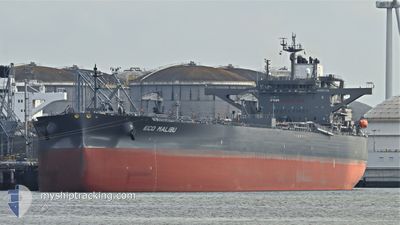
ECO MALIBU
Tanker

Current Trip
| Time Travelled | 16 days |
|---|---|
| Remaining Time | --- |
| Distance Travelled | 2911.42 nm |
| Remaining Distance | --- |
| AVG Speed | 11.2 Knots |
| MAX Speed | 14.9 Knots |
| AVG Wind | 7.6 knots |
| MAX Wind | 15.8 knots |
| MIN Temp | 24.9°C / 76.82°F |
| MAX Temp | 29.5°C / 85.1°F |
| Draught | 9.3 m |
| Position Received | 5 d ago |
Current Position
| Longitude | --- |
|---|---|
| Latitude | --- |
| Status | Under way using engine |
| Speed | 11.7 Knots |
| Course | 307.6° |
| Area | Laccadive Sea |
| Station | T-AIS |
| Position Received | 5 d ago |
Information
The current position of ECO MALIBU is in Laccadive Sea with coordinates 7.12096° / 78.27333° as reported on 2025-03-17 00:43 by AIS to our vessel tracker app. The vessel's current speed is 11.7 Knots and is heading at the port of FUJAIRAH. The estimated time of arrival as calculated by MyShipTracking vessel tracking app is 2025-03-22 20:00 LT
The vessel ECO MALIBU (IMO: 9902823, MMSI: 538009214) is a Tanker It's sailing under the flag of [MH] Marshall Is.
In this page you can find informations about the vessels current position, last detected port calls, and current voyage information. If the vessels is not in coverage by AIS you will find the latest position.
The current position of ECO MALIBU is detected by our AIS receivers and we are not responsible for the reliability of the data. The last position was recorded while the vessel was in Coverage by the Ais receivers of our vessel tracking app.
The current draught of ECO MALIBU as reported by AIS is 9.3 meters
Weather
| Temperature | 28.9°C / 84.02°F |
|---|---|
| Wind Speed | 13 knots |
| Direction | 266° W |
| Pressure | 1010.3 hPa |
| Humidity | 75.7 % |
| Cloud Coverage | 100 % |


Featured Company
Last Port Calls
| Port | Arrival | Departure | Time In Port |
|---|---|---|---|
| 2025-03-04 07:15 | 2025-03-06 10:44 | 2 d | |
| 2025-01-04 08:58 | 2025-01-06 21:47 | 2 d |
Most Visited Ports (Last year)
| Port | Arrivals | |
|---|---|---|
| 1 | ||
| 1 | ||
| 1 | ||
| 1 | ||
| 1 | ||
| 1 |
Last Trips
| Origin | Departure | Destination | Arrival | Distance | |
|---|---|---|---|---|---|
| 2025-01-06 21:47 | 2025-03-04 07:15 | 7607.54 nm | |||
| 2024-12-24 10:47 | 2025-01-04 08:58 | 1712.28 nm |
Events
| Time | Event | Details | Position / Dest | Info |
|---|---|---|---|---|
| 2025-03-18 13:22 | START Moving |
6.22168 / 78.87815
SGSIN-AEFJR
|
Speed: 3.5 kn Course: 219° |
|
| 2025-03-17 09:09 | STOP Moving |
6.29918 / 79.02818
SGSIN-AEFJR
|
Speed: 0.3 kn Course: 57° |
|
| 2025-03-17 00:45 | Status Changed | Default Under way using engine |
7.12582 / 78.26962
SGSIN-AEFJR
|
Speed: 11.7 kn Course: 307.6° |
| 2025-03-17 00:43 | Status Changed | Under way using engine Default |
7.12096 / 78.27333
SGSIN-AEFJR
|
Speed: 11.8 kn Course: 306° |
| 2025-03-17 00:43 | OUT of Coverage |
7.12096 / 78.27333
Laccadive Sea
SGSIN-AEFJR
|
Speed: 11.7 kn Course: 307.6° |
|
| 2025-03-17 00:43 | Detected in Sea | Indian part of the Laccadive Sea |
7.12096 / 78.27333
Laccadive Sea
SGSIN-AEFJR
|
Speed: 11.7 kn Course: 307.6° |
| 2025-03-17 00:25 | IN Coverage |
7.12096 / 78.27333
Laccadive Sea
SGSIN-AEFJR
|
Speed: 11.7 kn Course: 307.6° |
|
| 2025-03-16 13:20 | Status Changed | Default Under way using engine |
5.83225 / 80.14800
SGSIN-AEFJR
|
Speed: 11.7 kn Course: 273.5° |
| 2025-03-16 13:17 | OUT of Coverage |
5.83124 / 80.15713
Laccadive Sea
SGSIN-AEFJR
|
Speed: 11.7 kn Course: 273.5° |
|
| 2025-03-16 13:16 | Status Changed | Under way using engine Default |
5.83104 / 80.16040
SGSIN-AEFJR
|
Speed: 11.8 kn Course: 272° |