
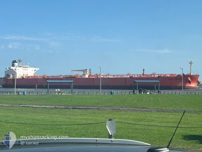
EAGLE KUANTAN
Crude Oil Tanker
Current Trip
CCLZ
| Time Travelled | 3 days |
|---|---|
| Remaining Time | --- |
| Distance Travelled | 397.74 nm |
| Remaining Distance | --- |
| AVG Speed | 9.3 Knots |
| MAX Speed | 13.1 Knots |
| AVG Wind | 11.4 knots |
| MAX Wind | 23.6 knots |
| MIN Temp | 20.2°C / 68.36°F |
| MAX Temp | 33.1°C / 91.58°F |
| Draught | 13.4 m |
| Position Received | 33 m ago |
Current Position
| Longitude | -96.61705° |
|---|---|
| Latitude | 27.69680° |
| Status | Under way using engine |
| Speed | 12.2 Knots |
| Course | 93.3° |
| Area | Gulf of Mexico |
| Station | T-AIS |
| Position Received | 33 m ago |
Info
Information
The current position of EAGLE KUANTAN is in Gulf of Mexico with coordinates 27.69680° / -96.61705° as reported on 2024-05-15 19:18 by AIS to our vessel tracker app. The vessel's current speed is 12.2 Knots
The vessel EAGLE KUANTAN (IMO: 9417012, MMSI: 565949000) is a Crude Oil Tanker that was built in 2010 ( 14 years old ). It's sailing under the flag of [SG] Singapore.
In this page you can find informations about the vessels current position, last detected port calls, and current voyage information. If the vessels is not in coverage by AIS you will find the latest position.
The current position of EAGLE KUANTAN is detected by our AIS receivers and we are not responsible for the reliability of the data. The last position was recorded while the vessel was in Coverage by the Ais receivers of our vessel tracking app.
The current draught of EAGLE KUANTAN as reported by AIS is 13.4 meters
Weather
| Temperature | 26.4°C / 79.52°F |
|---|---|
| Wind Speed | 11 knots |
| Direction | 122° ESE |
| Pressure | 1009.3 hPa |
| Humidity | 79.6 % |
| Cloud Coverage | 30 % |
Featured Company
Last Port Calls
| Port | Arrival | Departure | Time In Port |
|---|---|---|---|
| 2024-05-10 19:54 | 2024-05-12 07:17 | 1 d | |
| 2024-05-03 13:55 | 2024-05-06 08:33 | 2 d | |
| 2024-05-02 16:50 | 2024-05-02 17:32 | 41 m | |
| 2024-05-01 08:15 | 2024-05-01 08:54 | 39 m | |
| 2024-04-16 18:37 | 2024-04-18 16:51 | 1 d | |
| 2024-04-10 15:53 | 2024-04-12 09:40 | 1 d | |
| 2024-04-08 10:32 | 2024-04-10 15:23 | 2 d | |
| 2024-03-28 20:51 | 2024-03-30 09:46 | 1 d | |
| 2024-03-18 11:23 | 2024-03-20 07:06 | 1 d | |
| 2024-03-12 17:45 | 2024-03-14 15:49 | 1 d |
Most Visited Ports (Last year)
| Port | Arrivals | |
|---|---|---|
| 13 | ||
| 11 | ||
| 6 | ||
| 3 | ||
| 3 | ||
| 2 |
Last Trips
| Origin | Departure | Destination | Arrival | Distance | |
|---|---|---|---|---|---|
| 2024-05-06 08:33 | 2024-05-10 19:54 | 295.09 nm | |||
| 2024-05-02 17:32 | 2024-05-03 13:55 | 226.53 nm | |||
| 2024-05-01 08:54 | 2024-05-02 16:50 | 6.28 nm | |||
| 2024-04-18 16:51 | 2024-05-01 08:15 | 797.21 nm | |||
| 2024-04-12 09:40 | 2024-04-16 18:37 | 267.15 nm | |||
| 2024-04-10 15:23 | 2024-04-10 15:53 | 2.15 nm | |||
| 2024-03-30 09:46 | 2024-04-08 10:32 | 301.42 nm | |||
| 2024-03-20 07:06 | 2024-03-28 20:51 | 355.14 nm | |||
| 2024-03-14 15:49 | 2024-03-18 11:23 | 241.67 nm | |||
| 2024-03-12 16:49 | 2024-03-12 17:45 | 5.32 nm |
Events
| Time | Event | Details | Position / Dest | Info |
|---|---|---|---|---|
| 2024-05-15 19:26 | Status Changed | Default Under way using engine |
27.69523 / -96.58701
CCLZ
|
Speed: 12.2 kn Course: 93.3° |
| 2024-05-15 18:53 | Draught Changed | 13.4 9.1 |
27.70736 / -96.70987
CCLZ
|
Speed: 12.2 kn Course: 101° |
| 2024-05-15 18:53 | Destination Changed | CCLZ CORPUS |
27.70736 / -96.70987
CCLZ
|
Speed: 12.2 kn Course: 101° |
| 2024-05-15 18:53 | ETA Changed | 2024/05/15 21:00 2024/05/13 16:00 |
27.70736 / -96.70987
CCLZ
|
Speed: 12.2 kn Course: 101° |
| 2024-05-15 18:36 | Status Changed | Under way using engine Default |
27.71871 / -96.77561
CORPUS
|
Speed: 12 kn Course: 101° |
| 2024-05-15 18:23 | IN Coverage |
27.71871 / -96.77561
Gulf of Mexico
|
Speed: 12.1 kn Course: 101.1° |
|
| 2024-05-15 13:27 | START Moving | 5.72 nm, West of CORPUS CHRISTI |
27.82606 / -97.49010
CORPUS
|
Speed: 4.3 kn Course: 126° |
| 2024-05-14 02:03 | STOP Moving | 6 nm, West of CORPUS CHRISTI |
27.83069 / -97.49489
CORPUS
|
Speed: 0.2 kn Course: 111° |
| 2024-05-14 00:27 | Status Changed | Default Under way using engine |
27.81317 / -97.40500
CORPUS
|
Speed: 6.9 kn Course: 283.5° |
| 2024-05-14 00:19 | OUT of Coverage |
27.81186 / -97.39087
Gulf of Mexico
|
Speed: 6.9 kn Course: 283.5° |