
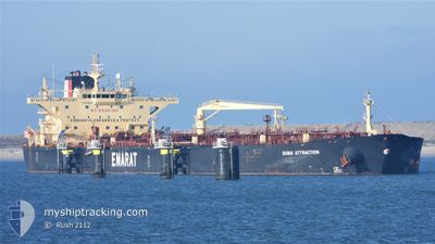
DUBAI ATTRACTION
Crude Oil Tanker
Current Trip
| Time Travelled | 13 days |
|---|---|
| Remaining Time | 2 days |
| Distance Travelled | 3864.45 nm |
| Remaining Distance | 853.22 nm |
| AVG Speed | 12.1 Knots |
| MAX Speed | 15.8 Knots |
| AVG Wind | 11.2 knots |
| MAX Wind | 21.9 knots |
| MIN Temp | 11.5°C / 52.7°F |
| MAX Temp | 28.8°C / 83.84°F |
| Draught | 12.7 m |
| Position Received | 8 d ago |
Current Position
| Longitude | -74.95045° |
|---|---|
| Latitude | 28.99316° |
| Status | Under way using engine |
| Speed | 12.6 Knots |
| Course | 55° |
| Area | North Atlantic Ocean |
| Station | T-AIS |
| Position Received | 8 d ago |
Info
Information
The current position of DUBAI ATTRACTION is in North Atlantic Ocean with coordinates 28.99316° / -74.95045° as reported on 2024-05-12 23:18 by AIS to our vessel tracker app. The vessel's current speed is 12.6 Knots and is heading at the port of CORK. The estimated time of arrival as calculated by MyShipTracking vessel tracking app is 2024-05-23 18:40 LT
The vessel DUBAI ATTRACTION (IMO: 9422536, MMSI: 538004172) is a Crude Oil Tanker that was built in 2011 ( 13 years old ). It's sailing under the flag of [MH] Marshall Is.
In this page you can find informations about the vessels current position, last detected port calls, and current voyage information. If the vessels is not in coverage by AIS you will find the latest position.
The current position of DUBAI ATTRACTION is detected by our AIS receivers and we are not responsible for the reliability of the data. The last position was recorded while the vessel was in Coverage by the Ais receivers of our vessel tracking app.
The current draught of DUBAI ATTRACTION as reported by AIS is 12.7 meters
Weather
| Temperature | 11.5°C / 52.7°F |
|---|---|
| Wind Speed | 11 knots |
| Direction | 359° N |
| Pressure | 1024.6 hPa |
| Humidity | 57.7 % |
| Cloud Coverage | 98 % |
Featured Company
Last Port Calls
| Port | Arrival | Departure | Time In Port |
|---|---|---|---|
| 2024-05-06 02:51 | 2024-05-07 20:04 | 1 d | |
| 2024-05-02 13:10 | 2024-05-04 12:50 | 1 d | |
| 2024-03-17 07:14 | 2024-03-18 22:05 | 1 d |
Most Visited Ports (Last year)
| Port | Arrivals | |
|---|---|---|
| 5 | ||
| 3 | ||
| 2 | ||
| 2 | ||
| 2 | ||
| 1 |
Last Trips
| Origin | Departure | Destination | Arrival | Distance | |
|---|---|---|---|---|---|
| 2024-05-04 07:50 | 2024-05-05 21:51 | 109.06 nm | |||
| 2024-03-18 15:05 | 2024-05-02 08:10 | 3962.47 nm | |||
| 2024-02-14 17:10 | 2024-03-17 00:14 | 6499.80 nm |
Events
| Time | Event | Details | Position / Dest | Info |
|---|---|---|---|---|
| 2024-05-12 23:41 | Status Changed | Default Under way using engine |
29.03935 / -74.87850
IE ORK
|
Speed: 12.6 kn Course: 55° |
| 2024-05-12 23:18 | OUT of Coverage |
28.99316 / -74.95045
North Atlantic Ocean
IE ORK
|
Speed: 12.6 kn Course: 55° |
|
| 2024-05-12 23:13 | Status Changed | Under way using engine Default |
28.98346 / -74.96634
IE ORK
|
Speed: 12.6 kn Course: 55° |
| 2024-05-12 22:47 | Status Changed | Default Under way using engine |
28.93175 / -75.05255
IE ORK
|
Speed: 12.7 kn Course: 55° |
| 2024-05-12 17:30 | Status Changed | Under way using engine Default |
28.29221 / -76.07720
IE ORK
|
Speed: 12.6 kn Course: 53° |
| 2024-05-12 17:30 | IN Coverage |
28.29221 / -76.07720
North Atlantic Ocean
IE ORK
|
Speed: 12.7 kn Course: 53° |
|
| 2024-05-11 23:11 | Status Changed | Default Under way using engine |
26.59188 / -79.37598
IE ORK
|
Speed: 14.7 kn Course: 0° |
| 2024-05-11 23:08 | OUT of Coverage |
26.57793 / -79.37583
North Atlantic Ocean
IE ORK
|
Speed: 14.7 kn Course: 0° |
|
| 2024-05-11 20:42 | Status Changed | Under way using engine Default |
25.96835 / -79.46195
IE ORK
|
Speed: 15.5 kn Course: 11° |
| 2024-05-11 20:34 | Status Changed | Default Under way using engine |
25.93555 / -79.46912
IE ORK
|
Speed: 15.6 kn Course: 11° |