
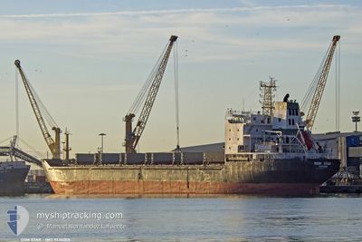
DSM STAR
Bulk Carrier
Current Trip
| Time Travelled | 7 days |
|---|---|
| Remaining Time | 5 days |
| Distance Travelled | 914.82 nm |
| Remaining Distance | 741.99 nm |
| AVG Speed | 7.9 Knots |
| MAX Speed | 11.8 Knots |
| AVG Wind | 12.9 knots |
| MAX Wind | 33.5 knots |
| MIN Temp | 9.8°C / 49.64°F |
| MAX Temp | 20.8°C / 69.44°F |
| Draught | 9.9 m |
| Position Received | 19 h, 52 m ago |
Current Position
| Longitude | 14.74418° |
|---|---|
| Latitude | 35.90117° |
| Status | At anchor |
| Speed | |
| Course | 135° |
| Area | Mediterranean Sea - Eastern Basin |
| Station | T-AIS |
| Position Received | 19 h, 52 m ago |
Info
Information
The current position of DSM STAR is in Mediterranean Sea - Eastern Basin with coordinates 35.90117° / 14.74418° as reported on 2024-04-26 12:27 by AIS to our vessel tracker app. The vessel's current speed is 0 Knots and is heading at the port of CASTELLON. The estimated time of arrival as calculated by MyShipTracking vessel tracking app is 2024-05-02 16:21 LT
The vessel DSM STAR (IMO: 9524205, MMSI: 511100661) is a Bulk Carrier that was built in 2008 ( 16 years old ). It's sailing under the flag of [PW] Palau.
In this page you can find informations about the vessels current position, last detected port calls, and current voyage information. If the vessels is not in coverage by AIS you will find the latest position.
The current position of DSM STAR is detected by our AIS receivers and we are not responsible for the reliability of the data. The last position was recorded while the vessel was in Coverage by the Ais receivers of our vessel tracking app.
The current draught of DSM STAR as reported by AIS is 9.9 meters
Weather
| Temperature | 16°C / 60.8°F |
|---|---|
| Wind Speed | 14 knots |
| Direction | 89° E |
| Pressure | 1014.9 hPa |
| Humidity | 81.9 % |
| Cloud Coverage | --- |
Featured Company
Last Port Calls
| Port | Arrival | Departure | Time In Port |
|---|---|---|---|
| 2024-04-18 11:54 | 2024-04-20 01:45 | 1 d | |
| 2024-03-29 11:59 | 2024-04-02 13:54 | 4 d | |
| 2024-03-09 14:25 | |||
| 2024-02-06 02:32 | 2024-02-10 13:00 | 4 d |
Most Visited Ports (Last year)
| Port | Arrivals | |
|---|---|---|
| 3 | ||
| 3 | ||
| 2 | ||
| 2 | ||
| 2 | ||
| 1 |
Last Trips
| Origin | Departure | Destination | Arrival | Distance | |
|---|---|---|---|---|---|
| 2024-04-02 15:54 | 2024-04-18 14:54 | 1678.86 nm | |||
| 2024-03-09 16:25 | 2024-03-29 12:59 | 1998.71 nm | |||
| 2024-01-25 09:45 | 2024-02-06 03:32 | 2005.18 nm |
Events
| Time | Event | Details | Position / Dest | Info |
|---|---|---|---|---|
| 2024-04-26 12:46 | Status Changed | Default At anchor |
35.90167 / 14.74333
ES CAS
|
Speed: Course: 135° |
| 2024-04-26 12:27 | Status Changed | At anchor Under way using engine |
35.90117 / 14.74418
ES CAS
|
Speed: 0.7 kn Course: 149° |
| 2024-04-26 12:27 | STOP Moving | 10.68 nm, North East of MARSAXLOKK |
35.90117 / 14.74418
ES CAS
|
Speed: Course: 135° |
| 2024-04-26 12:27 | OUT of Coverage |
35.90117 / 14.74418
Mediterranean Sea - Eastern Basin
ES CAS
|
Speed: Course: 65.5° |
|
| 2024-04-26 11:50 | Status Changed | Under way using engine Default |
35.90950 / 14.71837
ES CAS
|
Speed: 4.4 kn Course: 127° |
| 2024-04-26 11:25 | Status Changed | Default Under way using engine |
35.92919 / 14.68130
ES CAS
|
Speed: 6.1 kn Course: 105.7° |
| 2024-04-26 11:10 | Status Changed | Under way using engine Default |
35.93710 / 14.65078
ES CAS
|
Speed: 5.5 kn Course: 122° |
| 2024-04-26 11:05 | Status Changed | Default Under way using engine |
35.94087 / 14.64283
ES CAS
|
Speed: 4.5 kn Course: 118° |
| 2024-04-26 10:40 | Change Sea Area | Maltese part of the Mediterranean Sea - Eastern Basin Greek part of the Mediterranean Sea - Eastern Basin |
35.93659 / 14.62732
Mediterranean Sea - Eastern Basin
ES CAS
|
Speed: 1.5 kn Course: 327.3° |
| 2024-04-26 10:39 | Status Changed | Under way using engine Default |
35.93623 / 14.62763
ES CAS
|
Speed: 2.1 kn Course: 307° |