

DR. RAY
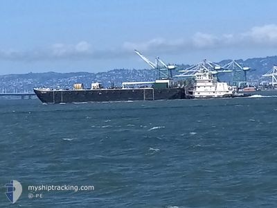
Tug

Current Trip
US^0V0H>0V0K
| Time Travelled | 1 day |
|---|---|
| Remaining Time | --- |
| Distance Travelled | 39.08 nm |
| Remaining Distance | --- |
| AVG Speed | 6.6 Knots |
| MAX Speed | 6.6 Knots |
| AVG Wind | 9.5 knots |
| MAX Wind | 14 knots |
| MIN Temp | 9.6°C / 49.28°F |
| MAX Temp | 14.7°C / 58.46°F |
| Draught | 3.1 m |
| Position Received | 1 m ago |
Current Position
| Longitude | --- |
|---|---|
| Latitude | --- |
| Status | Pushing Ahead - Towing |
| Speed | 7.2 Knots |
| Course | 330.1° |
| Area | North Pacific Ocean |
| Station | T-AIS |
| Position Received | 1 m ago |
Information
The current position of DR. RAY is in North Pacific Ocean with coordinates 37.86983° / -122.39847° as reported on 2025-04-24 18:10 by AIS to our vessel tracker app. The vessel's current speed is 7.2 Knots
The vessel DR. RAY (MMSI: 368171270) is a Tug It's sailing under the flag of [US] USA.
In this page you can find informations about the vessels current position, last detected port calls, and current voyage information. If the vessels is not in coverage by AIS you will find the latest position.
The current position of DR. RAY is detected by our AIS receivers and we are not responsible for the reliability of the data. The last position was recorded while the vessel was in Coverage by the Ais receivers of our vessel tracking app.
The current draught of DR. RAY as reported by AIS is 3.1 meters
Weather
| Temperature | 11.1°C / 51.98°F |
|---|---|
| Wind Speed | 10 knots |
| Direction | 262° W |
| Pressure | 1016.8 hPa |
| Humidity | 78.4 % |
| Cloud Coverage | 100 % |


Featured Company
Last Port Calls
| Port | Arrival | Departure | Time In Port |
|---|---|---|---|
| 2025-04-23 00:55 | 2025-04-23 08:37 | 7 h | |
| 2025-04-20 20:47 | 2025-04-21 17:02 | 20 h | |
| 2025-04-20 17:35 | 2025-04-20 19:26 | 1 h | |
| 2025-04-17 19:26 | 2025-04-18 16:27 | 21 h | |
| 2025-04-17 08:52 | 2025-04-17 14:26 | 5 h | |
| 2025-04-14 13:44 | 2025-04-15 03:02 | 13 h | |
| 2025-04-13 11:48 | 2025-04-14 01:05 | 13 h | |
| 2025-04-12 21:25 | 2025-04-13 08:14 | 10 h | |
| 2025-04-12 07:08 | 2025-04-12 16:17 | 9 h | |
| 2025-04-11 08:00 | 2025-04-11 14:35 | 6 h |
Most Visited Ports (Last year)
| Port | Arrivals | |
|---|---|---|
| 125 | ||
| 26 | ||
| 21 | ||
| 5 |
Last Trips
| Origin | Departure | Destination | Arrival | Distance | |
|---|---|---|---|---|---|
| 2025-04-21 17:02 | 2025-04-23 00:55 | 18.27 nm | |||
| 2025-04-20 19:26 | 2025-04-20 20:47 | 8.99 nm | |||
| 2025-04-18 16:27 | 2025-04-20 17:35 | 64.83 nm | |||
| 2025-04-17 14:26 | 2025-04-17 19:26 | 9.85 nm | |||
| 2025-04-15 03:02 | 2025-04-17 08:52 | 59.79 nm | |||
| 2025-04-14 01:05 | 2025-04-14 13:44 | 17.00 nm | |||
| 2025-04-13 08:14 | 2025-04-13 11:48 | 19.88 nm | |||
| 2025-04-12 16:17 | 2025-04-12 21:25 | 27.52 nm | |||
| 2025-04-11 14:35 | 2025-04-12 07:08 | 21.44 nm | |||
| 2025-04-11 06:48 | 2025-04-11 08:00 | 2.84 nm |
Events
| Time | Event | Details | Position / Dest | Info |
|---|---|---|---|---|
| 2025-04-24 17:07 | Destination Changed | US^0V0H>0V0K US^0V0H> |
37.75467 / -122.33927
US^0V0H>0V0K
|
Speed: 6.7 kn Course: 351.1° |
| 2025-04-24 17:06 | Status Changed | Pushing Ahead - Towing Under way using engine |
37.75159 / -122.33866
US^0V0H>
|
Speed: 6.7 kn Course: 351.7° |
| 2025-04-24 17:02 | START Moving | 2.28 nm, South East of SAN FRANCISCO |
37.74979 / -122.33986
US^0V0H>
|
Speed: 3.3 kn Course: 291° |
| 2025-04-24 16:43 | Status Changed | Under way using engine Moored |
37.74932 / -122.34056
US^0V0H>
|
Speed: 0.1 kn Course: 320° |
| 2025-04-24 11:46 | Status Changed | Moored Pushing Ahead - Towing |
37.75117 / -122.34039
US^0V0H>
|
Speed: 0.2 kn Course: 259° |
| 2025-04-24 11:41 | ETA Changed | 2026/01/01 00:00 |
37.75142 / -122.34024
US^0V0H>
|
Speed: 0.2 kn Course: 261° |
| 2025-04-24 11:27 | STOP Moving | 2.14 nm, South East of SAN FRANCISCO |
37.75185 / -122.34181
US^0V0H>
|
Speed: 0.3 kn Course: 209° |
| 2025-04-24 09:35 | Destination Changed | US^0V0H> US^0V0H>0V0K |
37.90735 / -122.40677
US^0V0H>
|
Speed: 6.1 kn Course: 268.9° |
| 2025-04-24 09:10 | START Moving | 2.25 nm, East of CHEVRON SF |
37.91558 / -122.36337
US^0V0H>0V0K
|
Speed: 4 kn Course: 171° |
| 2025-04-24 08:24 | Status Changed | Pushing Ahead - Towing Moored |
37.92071 / -122.36895
US^0V0H>0V0K
|
Speed: Course: 309° |