
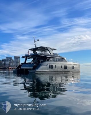
DOUBLE HAPPINESS
Pleasure Craft
Current Trip
Unknown
| Time Travelled | 21 h, 17 mins |
|---|---|
| Remaining Time | --- |
| Distance Travelled | 17.61 nm |
| Remaining Distance | --- |
| AVG Speed | 7.4 Knots |
| MAX Speed | 9 Knots |
| AVG Wind | 16.6 knots |
| MAX Wind | 18 knots |
| MIN Temp | 26.7°C / 80.06°F |
| MAX Temp | 27.6°C / 81.68°F |
| Draught | --- |
| Position Received | 16 h, 39 m ago |
Current Position
| Longitude | --- |
|---|---|
| Latitude | --- |
| Status | Default |
| Speed | 0.2 Knots |
| Course | --- |
| Area | Caribbean Sea |
| Station | T-AIS |
| Position Received | 16 h, 39 m ago |
Info
Information
The current position of DOUBLE HAPPINESS is in Caribbean Sea with coordinates 17.15893° / -61.85193° as reported on 2024-12-18 21:10 by AIS to our vessel tracker app. The vessel's current speed is 0.2 Knots
The vessel DOUBLE HAPPINESS (MMSI: 319287700) is a Pleasure Craft It's sailing under the flag of [KY] Cayman Is.
In this page you can find informations about the vessels current position, last detected port calls, and current voyage information. If the vessels is not in coverage by AIS you will find the latest position.
The current position of DOUBLE HAPPINESS is detected by our AIS receivers and we are not responsible for the reliability of the data. The last position was recorded while the vessel was in Coverage by the Ais receivers of our vessel tracking app.
Weather
| Temperature | 26.7°C / 80.06°F |
|---|---|
| Wind Speed | 18 knots |
| Direction | 80° E |
| Pressure | 1015.3 hPa |
| Humidity | 75.8 % |
| Cloud Coverage | 38 % |
Featured Company
Last Port Calls
| Port | Arrival | Departure | Time In Port |
|---|---|---|---|
| 2024-12-10 20:32 | 2024-12-18 16:32 | 7 d | |
| 2024-12-06 16:30 | 2024-12-10 14:32 | 3 d | |
| 2024-11-19 19:12 | 2024-11-20 14:55 | 19 h | |
| 2024-11-06 19:03 | 2024-11-15 10:20 | 8 d | |
| 2024-11-05 19:51 | 2024-11-06 07:33 | 11 h | |
| 2024-11-04 10:23 |
Last Trips
| Origin | Departure | Destination | Arrival | Distance | |
|---|---|---|---|---|---|
| 2024-12-10 10:32 | 2024-12-10 16:32 | 1.29 nm | |||
| 2024-11-20 14:55 | 2024-12-06 12:30 | 2629.93 nm | |||
| 2024-11-15 11:20 | 2024-11-19 19:12 | 724.58 nm | |||
| 2024-11-06 08:33 | 2024-11-06 20:03 | 65.20 nm | |||
| 2024-11-04 10:23 | 2024-11-05 20:51 | 122.85 nm |
Events
| Time | Event | Details | Position / Dest | Info |
|---|---|---|---|---|
| 2024-12-18 21:10 | OUT of Coverage |
17.15893 / -61.85193
Caribbean Sea
|
Speed: 0.2 kn Course: 511° |
|
| 2024-12-18 21:10 | STOP Moving | 2.14 nm, North of ST JOHNS |
17.15893 / -61.85193
|
Speed: 0.2 kn Course: 511° |
| 2024-12-18 20:48 | IN Coverage |
17.16302 / -61.85345
Caribbean Sea
|
Speed: 4.2 kn Course: 155.1° |
|
| 2024-12-18 18:09 | OUT of Coverage |
17.09954 / -61.91462
Caribbean Sea
|
Speed: 8.7 kn Course: 18° |
|
| 2024-12-18 16:32 | PORT DEPARTURE |
|
17.01230 / -61.77672
|
Speed: 5.2 kn Course: 267.2° |
| 2024-12-18 16:29 | START Moving |
17.01333 / -61.77198
[AG] ANTIGUA
|
Speed: 4.8 kn Course: 272.5° |
|
| 2024-12-18 12:41 | IN Coverage |
17.01331 / -61.76976
Caribbean Sea
[AG] ANTIGUA
|
Speed: Course: 511° |
|
| 2024-12-18 11:32 | OUT of Coverage |
17.01328 / -61.76976
Caribbean Sea
[AG] ANTIGUA
|
Speed: Course: 511° |
|
| 2024-12-18 09:08 | IN Coverage |
17.01327 / -61.76977
Caribbean Sea
[AG] ANTIGUA
|
Speed: Course: 511° |
|
| 2024-12-18 06:53 | OUT of Coverage |
17.01328 / -61.76976
Caribbean Sea
[AG] ANTIGUA
|
Speed: Course: 511° |