
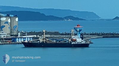
DONG YONG NO.8
General Cargo
Current Trip
| Time Travelled | 1 h, 35 mins |
|---|---|
| Remaining Time | --- |
| Distance Travelled | 10.65 nm |
| Remaining Distance | --- |
| AVG Speed | 8.1 Knots |
| MAX Speed | 8.9 Knots |
| AVG Wind | 4.7 knots |
| MAX Wind | 6 knots |
| MIN Temp | 15.7°C / 60.26°F |
| MAX Temp | 22.8°C / 73.04°F |
| Draught | 5.2 m |
| Position Received | 14 d ago |
Current Position
| Longitude | --- |
|---|---|
| Latitude | --- |
| Status | Moored |
| Speed | 0.1 Knots |
| Course | 75° |
| Area | Eastern China Sea |
| Station | T-AIS |
| Position Received | 14 d ago |
Info
Information
The current position of DONG YONG NO.8 is in Eastern China Sea with coordinates 25.14612° / 121.75799° as reported on 2025-12-06 07:55 by AIS to our vessel tracker app. The vessel's current speed is 0.1 Knots
The vessel DONG YONG NO.8 (IMO: 9085065, MMSI: 416434000) is a General Cargo that was built in 1994 ( 31 years old ). It's sailing under the flag of [TW] Taiwan.
In this page you can find informations about the vessels current position, last detected port calls, and current voyage information. If the vessels is not in coverage by AIS you will find the latest position.
The current position of DONG YONG NO.8 is detected by our AIS receivers and we are not responsible for the reliability of the data. The last position was recorded while the vessel was in Coverage by the Ais receivers of our vessel tracking app.
The current draught of DONG YONG NO.8 as reported by AIS is 5.2 meters
Weather
| Temperature | 22.8°C / 73.04°F |
|---|---|
| Wind Speed | 6 knots |
| Direction | 191° S |
| Pressure | 1017.5 hPa |
| Humidity | 78.4 % |
| Cloud Coverage | 50 % |
Featured Company
Last Port Calls
| Port | Arrival | Departure | Time In Port |
|---|---|---|---|
| 2025-12-20 13:40 | 2025-12-20 21:49 | 8 h | |
| 2025-12-19 08:26 | 2025-12-20 03:02 | 18 h | |
| 2025-12-18 13:54 | 2025-12-18 20:27 | 6 h | |
| 2025-12-16 06:50 | 2025-12-18 00:18 | 1 d | |
| 2025-12-15 06:41 | 2025-12-15 13:15 | 6 h | |
| 2025-12-13 06:53 | 2025-12-14 17:24 | 1 d | |
| 2025-12-12 09:51 | 2025-12-12 18:51 | 9 h | |
| 2025-12-11 03:37 | 2025-12-11 23:09 | 19 h | |
| 2025-12-10 08:10 | 2025-12-10 14:27 | 6 h | |
| 2025-11-28 11:26 | 2025-12-09 17:27 | 11 d |
Last Trips
| Origin | Departure | Destination | Arrival | Distance | |
|---|---|---|---|---|---|
| 2025-12-20 03:02 | 2025-12-20 13:40 | 72.49 nm | |||
| 2025-12-18 20:27 | 2025-12-19 08:26 | 91.26 nm | |||
| 2025-12-18 00:18 | 2025-12-18 13:54 | 91.24 nm | |||
| 2025-12-15 13:15 | 2025-12-16 06:50 | 98.94 nm | |||
| 2025-12-14 17:24 | 2025-12-15 06:41 | 92.46 nm | |||
| 2025-12-12 18:51 | 2025-12-13 06:53 | 73.24 nm | |||
| 2025-12-11 23:09 | 2025-12-12 09:51 | 70.54 nm | |||
| 2025-12-10 14:27 | 2025-12-11 03:37 | 93.12 nm | |||
| 2025-12-09 17:27 | 2025-12-10 08:10 | 92.46 nm | |||
| 2025-11-27 16:41 | 2025-11-28 11:26 | 93.86 nm |
Events
| Time | Event | Details | Position / Dest | Info |
|---|---|---|---|---|
| 2025-12-20 13:49 | PORT DEPARTURE |
|
24.29408 / 121.76555
HUALIEN
|
Speed: 2.4 kn Course: 91° |
| 2025-12-20 06:36 | STOP Moving |
24.30440 / 121.75837
[TW] HOPING
|
Speed: Course: 16° |
|
| 2025-12-20 05:40 | PORT ARRIVAL |
|
24.29940 / 121.76070
[TW] HOPING
|
Speed: 6 kn Course: 218° |
| 2025-12-19 19:02 | PORT DEPARTURE |
|
25.16505 / 121.75256
HUALIEN
|
Speed: 5.6 kn Course: 344° |
| 2025-12-19 18:54 | START Moving |
25.15298 / 121.75008
[TW] KEELUNG
|
Speed: 5.6 kn Course: 69° |
|
| 2025-12-19 00:42 | STOP Moving |
25.15178 / 121.74595
[TW] KEELUNG
|
Speed: 0.1 kn Course: 47° |
|
| 2025-12-19 00:26 | PORT ARRIVAL |
|
25.15808 / 121.75410
[TW] KEELUNG
|
Speed: 6.8 kn Course: 143° |
| 2025-12-18 12:27 | PORT DEPARTURE |
|
23.99910 / 121.66337
HUALIEN
|
Speed: Course: 53° |
| 2025-12-18 06:25 | STOP Moving |
23.98362 / 121.62850
[TW] HUALIEN
|
Speed: Course: 53° |
|
| 2025-12-18 05:54 | PORT ARRIVAL |
|
23.98362 / 121.62850
[TW] HUALIEN
|
Speed: 8.9 kn Course: 233° |