
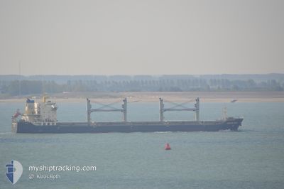
DONG FANG WEI YE
Bulk Carrier
Current Trip
| Time Travelled | 1 day |
|---|---|
| Remaining Time | 7 h, 11 mins |
| Distance Travelled | 220.52 nm |
| Remaining Distance | 440.28 nm |
| AVG Speed | 9.6 Knots |
| MAX Speed | 11.9 Knots |
| AVG Wind | 14.4 knots |
| MAX Wind | 19.1 knots |
| MIN Temp | 6.2°C / 43.16°F |
| MAX Temp | 12.8°C / 55.04°F |
| Draught | 6.5 m |
| Position Received | 1 d ago |
Current Position
| Longitude | --- |
|---|---|
| Latitude | --- |
| Status | Under way using engine |
| Speed | 11.2 Knots |
| Course | 31.4° |
| Area | Japan Sea |
| Station | T-AIS |
| Position Received | 1 d ago |
Info
Information
The current position of DONG FANG WEI YE is in Japan Sea with coordinates 36.19635° / 129.56315° as reported on 2024-11-22 00:11 by AIS to our vessel tracker app. The vessel's current speed is 11.2 Knots and is heading at the port of VLADIVOSTOK. The estimated time of arrival as calculated by MyShipTracking vessel tracking app is 2024-11-23 18:46 LT
The vessel DONG FANG WEI YE (IMO: 9584798, MMSI: 413229350) is a Bulk Carrier that was built in 2010 ( 14 years old ). It's sailing under the flag of [CN] China.
In this page you can find informations about the vessels current position, last detected port calls, and current voyage information. If the vessels is not in coverage by AIS you will find the latest position.
The current position of DONG FANG WEI YE is detected by our AIS receivers and we are not responsible for the reliability of the data. The last position was recorded while the vessel was in Coverage by the Ais receivers of our vessel tracking app.
The current draught of DONG FANG WEI YE as reported by AIS is 6.5 meters
Weather
| Temperature | 6.2°C / 43.16°F |
|---|---|
| Wind Speed | 19 knots |
| Direction | 8° N |
| Pressure | 1030.6 hPa |
| Humidity | 56 % |
| Cloud Coverage | 59 % |
Featured Company
Last Port Calls
| Port | Arrival | Departure | Time In Port |
|---|---|---|---|
| 2024-11-20 00:39 | 2024-11-21 22:46 | 1 d | |
| 2024-10-29 03:29 | 2024-10-31 02:31 | 1 d | |
| 2024-10-02 13:20 | 2024-10-03 19:16 | 1 d | |
| 2024-09-24 16:52 | 2024-09-28 19:19 | 4 d | |
| 2024-09-12 20:34 | 2024-09-15 22:33 | 3 d | |
| 2024-09-07 22:47 | 2024-09-11 11:24 | 3 d | |
| 2024-09-03 07:28 | 2024-09-04 23:24 | 1 d |
Most Visited Ports (Last year)
| Port | Arrivals | |
|---|---|---|
| 6 | ||
| 4 | ||
| 4 | ||
| 2 | ||
| 2 | ||
| 1 |
Last Trips
| Origin | Departure | Destination | Arrival | Distance | |
|---|---|---|---|---|---|
| 2024-10-31 10:31 | 2024-11-20 09:39 | 1630.90 nm | |||
| 2024-10-04 02:16 | 2024-10-29 11:29 | 2771.95 nm | |||
| 2024-09-29 02:19 | 2024-10-02 20:20 | 1013.61 nm | |||
| 2024-09-16 07:33 | 2024-09-24 23:52 | 2006.47 nm | |||
| 2024-09-11 20:24 | 2024-09-13 05:34 | 202.29 nm | |||
| 2024-09-05 07:24 | 2024-09-08 07:47 | 660.57 nm | |||
| 2024-08-31 15:19 | 2024-09-03 15:28 | 628.12 nm |
Events
| Time | Event | Details | Position / Dest | Info |
|---|---|---|---|---|
| 2024-11-22 00:27 | Status Changed | Default Under way using engine |
36.24153 / 129.59286
RU VVO
|
Speed: 11.2 kn Course: 31.4° |
| 2024-11-22 00:11 | OUT of Coverage |
36.19635 / 129.56315
Japan Sea
RU VVO
|
Speed: 11.2 kn Course: 31.4° |
|
| 2024-11-21 22:49 | Draught Changed | 6.5 10.2 |
36.02482 / 129.42922
RU VVO
|
Speed: 8.1 kn Course: 84.4° |
| 2024-11-21 22:49 | Destination Changed | RU VVO KR KPO |
36.02482 / 129.42922
RU VVO
|
Speed: 8.1 kn Course: 84.4° |
| 2024-11-21 22:49 | ETA Changed | 2024/11/24 00:00 2024/11/17 09:00 |
36.02482 / 129.42922
RU VVO
|
Speed: 8.1 kn Course: 84.4° |
| 2024-11-21 22:46 | PORT DEPARTURE |
|
36.02467 / 129.42738
KR KPO
|
Speed: 7.3 kn Course: 85° |
| 2024-11-21 22:42 | START Moving |
36.02410 / 129.41872
[KR] POHANG
|
Speed: 3.6 kn Course: 85° |
|
| 2024-11-21 22:39 | Status Changed | Under way using engine Default |
36.02472 / 129.41641
[KR] POHANG
|
Speed: Course: 289° |
| 2024-11-21 22:26 | IN Coverage |
36.02426 / 129.41688
Japan Sea
[KR] POHANG
|
Speed: 2.1 kn Course: 126.1° |
|
| 2024-11-20 01:16 | STOP Moving |
36.02652 / 129.41769
[KR] POHANG
|
Speed: Course: 290° |