

DOLLARD
Cargo

Current Trip
| Time Travelled | 15 h, 18 mins |
|---|---|
| Remaining Time | 7 h, 32 mins |
| Distance Travelled | 54.40 nm |
| Remaining Distance | 57.11 nm |
| AVG Speed | 7.7 Knots |
| MAX Speed | 10.5 Knots |
| AVG Wind | 8.4 knots |
| MAX Wind | 15 knots |
| MIN Temp | 4°C / 39.2°F |
| MAX Temp | 9.5°C / 49.1°F |
| Draught | 1.5 m |
| Position Received | 1 m ago |
Current Position
| Longitude | --- |
|---|---|
| Latitude | --- |
| Status | Under way using engine |
| Speed | 7.6 Knots |
| Course | 143.7° |
| Area | North Sea |
| Station | T-AIS |
| Position Received | 1 m ago |
Information
The current position of DOLLARD is in North Sea with coordinates 52.49826° / 6.05669° as reported on 2025-04-10 06:15 by AIS to our vessel tracker app. The vessel's current speed is 7.6 Knots and is heading at the port of TOLKAMER. The estimated time of arrival as calculated by MyShipTracking vessel tracking app is 2025-04-10 15:48 LT
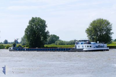
The vessel DOLLARD (MMSI: 244700652) is a Cargo It's sailing under the flag of [NL] Netherlands.
In this page you can find informations about the vessels current position, last detected port calls, and current voyage information. If the vessels is not in coverage by AIS you will find the latest position.
The current position of DOLLARD is detected by our AIS receivers and we are not responsible for the reliability of the data. The last position was recorded while the vessel was in Coverage by the Ais receivers of our vessel tracking app.
The current draught of DOLLARD as reported by AIS is 1.5 meters
Weather
| Temperature | 5.3°C / 41.54°F |
|---|---|
| Wind Speed | 5 knots |
| Direction | 311° NW |
| Pressure | 1027.7 hPa |
| Humidity | 95.1 % |
| Cloud Coverage | 63 % |


Featured Company
Last Port Calls
| Port | Arrival | Departure | Time In Port |
|---|---|---|---|
| 2025-04-09 10:37 | 2025-04-09 16:58 | 6 h | |
| 2025-04-08 17:53 | 2025-04-08 18:22 | 28 m | |
| 2025-04-07 23:14 | 2025-04-08 12:22 | 13 h | |
| 2025-04-05 10:05 | 2025-04-07 12:18 | 2 d | |
| 2025-04-04 17:44 | 2025-04-04 18:19 | 35 m | |
| 2025-04-04 14:46 | 2025-04-04 14:59 | 13 m | |
| 2025-04-04 06:58 | 2025-04-04 07:02 | 3 m | |
| 2025-04-03 18:49 | 2025-04-03 19:18 | 29 m | |
| 2025-04-02 17:10 | 2025-04-03 12:26 | 19 h | |
| 2025-04-01 18:48 | 2025-04-01 19:14 | 25 m |
Most Visited Ports (Last year)
| Port | Arrivals | |
|---|---|---|
| 42 | ||
| 12 | ||
| 11 | ||
| 11 | ||
| 10 | ||
| 10 |
Last Trips
| Origin | Departure | Destination | Arrival | Distance | |
|---|---|---|---|---|---|
| 2025-04-08 18:22 | 2025-04-09 10:37 | 91.98 nm | |||
| 2025-04-08 12:22 | 2025-04-08 17:53 | 37.50 nm | |||
| 2025-04-07 12:18 | 2025-04-07 23:14 | 81.85 nm | |||
| 2025-04-04 18:19 | 2025-04-05 10:05 | 46.87 nm | |||
| 2025-04-04 14:59 | 2025-04-04 17:44 | 24.25 nm | |||
| 2025-04-04 07:02 | 2025-04-04 14:46 | 9.47 nm | |||
| 2025-04-03 19:18 | 2025-04-04 06:58 | 59.33 nm | |||
| 2025-04-03 12:26 | 2025-04-03 18:49 | 44.26 nm | |||
| 2025-04-01 19:14 | 2025-04-02 17:10 | 91.40 nm | |||
| 2025-03-31 12:01 | 2025-04-01 18:48 | 101.63 nm |
Events
| Time | Event | Details | Position / Dest | Info |
|---|---|---|---|---|
| 2025-04-10 05:56 | Destination Changed | NLDRU00101CITYX09032 NLDRU00101CITYX09030 |
52.52506 / 6.01740
NLDRU00101CITYX09032
|
Speed: 7.6 kn Course: 217.7° |
| 2025-04-10 05:14 | Destination Changed | NLDRU00101CITYX09030 NLDRU00101CITYX09032 |
52.55042 / 5.92734
NLDRU00101CITYX09030
|
Speed: 8.2 kn Course: 166.9° |
| 2025-04-10 04:12 | START Moving | 0.35 nm, South of IJSSELOOG |
52.58655 / 5.74705
NLDRU00101CITYX09032
|
Speed: 6.7 kn Course: 90.6° |
| 2025-04-09 20:37 | STOP Moving | 0.33 nm, South of IJSSELOOG |
52.58658 / 5.74289
NLDRU00101CITYX09032
|
Speed: 0.2 kn Course: 511° |
| 2025-04-09 18:11 | START Moving | 0.94 nm, West of LEMMER |
52.84819 / 5.67462
NLDRU00101CITYX09032
|
Speed: 6.6 kn Course: 199.5° |
| 2025-04-09 17:59 | STOP Moving | 0.89 nm, West of LEMMER |
52.85099 / 5.67626
NLDRU00101CITYX09032
|
Speed: 0.2 kn Course: 511° |
| 2025-04-09 17:24 | Status Changed | Under way using engine Default |
52.89650 / 5.69857
NLDRU00101CITYX09032
|
Speed: 6.8 kn Course: 184° |
| 2025-04-09 17:22 | Status Changed | Default Under way using engine |
52.90178 / 5.69916
NLDRU00101CITYX09032
|
Speed: 7 kn Course: 161.4° |
| 2025-04-09 15:56 | Status Changed | Under way using engine Default |
53.04471 / 5.77812
NLDRU00101CITYX09032
|
Speed: 2.8 kn Course: -1° |
| 2025-04-09 15:54 | Status Changed | Default Under way using engine |
53.04356 / 5.78238
NLDRU00101CITYX09032
|
Speed: 4.8 kn Course: 295.5° |